[ p. 158 ]
The Proterozoic era represents a long time, seemingly 25 per cent of all geologic history. In the Rocky Mountains area at least 37,000 feet of sediments were laid down, and in the Lake Superior region upward of 53,000 feet of strata, and 22,000 feet of volcanics.
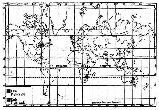
Proterozoic Geosynclines. — Schuchert recently plotted most of the known deposits of late Proterozoic time and then had his work confirmed by the leading geologists familiar with these formations. The result is the map, p. 159. From it will be seen that there were in Proterozoic time four seaways: (1) Appalachic, (2) Cordilleric, (3) Ontario, and (4) Arctic. Of the formations in the Appalachic geosyncline nothing is said in this chapter because they are too greatly altered to make certain their original nature. The deposits of the Ontario geosyncline are described at greatest length because they are the best known strata of the Proterozoic, while those of the Arctic sea are mentioned under the Animikian. The deposits of the Cordilleric geosyncline are also discussed on later pages. Of these seaways, the only one that is known to have been obliterated through mountain making toward the close of the Proterozoic is the Ontario geosynclme. This trough is an outgrowth of the previously described Quebec geosyncline (see p. 149).
Were there Proterozoic Epeiric Seas? — The coarse sediments, red oxidized color, and rarity of fossils other than algse, in Proterozoic formations, along with the abundance of feldspars, have long attracted the attention of geologists, and especially Walcott. After a study of these phenomena he concluded (1916) that the Proterozoic era “ was a time of continental elevation and largely terrigenous sedimentation in nonmarine bodies of water. . . . Marine sediments undoubtedly accumulated in the waters along the outer ocean shores of the continent, but they are unknown to us. . . . The known fossils … of the Cordilleran geosyncline lived in fresh or brackish waters that were rarely in connection with marine waters,” and the algae reefs of the Newland limestone grew in lakes “ several thousand square miles in area.”
Since siliceous sponge spicules have been seen in several places, since annelid tubes are also present, and since, further, the algal growths in the Cambrian and Champlainian are always found in connection with marine faunas, it appears more reasonable to assume that all of the recovered Proterozoic fossils are of marine origin. In regard to the fresh-water aspect of many of the formations, it should not be forgotten that the lands then had no vegetation and accordingly no soils. The granites broke down into an arkose which was quickly oxidized [ p. 159 ] [ p. 160 ] and in this condition were delivered into the shallow-water geosjmclines. Therefore the Proterozoic sediments should not always be like those of subsequent times when floras and soils were in existence, and yet those of the Sudburian series and other Proterozoic strata are much like those of .the Paleozoic. On the other hand, the aniTnala of the sea could not, or at least were not, obliged to cover themselves with an armor, and therefore as soft bodies they were not preservable as fossils.
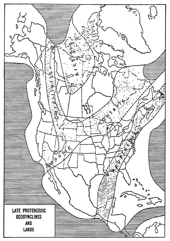
North America in Proterozoic Time. — From the geographic position of the earliest Paleozoic seas upon the continent of North America (see Fig., p. 139), and those of the late Proterozoic as well, it is plain that this land mass was not only outlined in much of its present form during the early Proterozoic, but that it was then even larger than it is now. How much larger is not known, but it is established that it was then and for a long time subsequently widely connected by dry land with Greenland and eastward across the sea with Scandinavia. Apparently about 2,000,000 square miles of greater North America has broken down into the oceanic basins in post-Proterozoic time (see Fig., p. 141).
The borderland Appalachis in the east and that of Caseadis in the west also came into existence during the Proterozoic (see Fig, p. 139). At the close of this era the Killarney mountains arose out of the Ontario geosyncline, dividing the vast interior of North America into a northern (Canadian Shield) and a southern (United States and Mexico) plain. Towards the blose of the Cambrian these mountains had in the main been reduced almost to sea-level, so that during the remainder of the Paleozoic, all of the Mesozoic, and most of the Cenozoic, the whole of the interior of the continent was one vast plain. During the Paleozoic this plain was often transgressed more or less widely by epeiric seas, and again late in the Mesozoic. In all of these statements we see that the basin-like form of the North American continent was established early in the Proterozoic, but that the vast medial plain was not a continuity until toward the close of the Champlainian.
Divisions of the Proterozoic. — The Proterozoic rocks may be grouped as follows:
Late Proterozoic time
- Epi-Proterozoic or Lipalian Interval of peneplanation
- Killamey Revolution and mountain making
- Keweenawan volcanic and continental formations Break in record (Beltian series)
Middle Proterozoic time
- Animikian-Whitewater sediments with great iron formations Break in record (Beltian series)
[ p. 161 ]
Huronian series
Cobalt marine and fresh-water deposits
- Oldest known tillite and glacial climate
- Break in record
Bruce (?Seine) marine series (all or part of the Grenville may be of this time)
Early Proterozoic time
- Ep-Algoman Interv’al of erosion
- Algoman Revolution and mountain making
- Sudburian (Dorean?) sediments and voleanics
¶ Early Proterozoic Events
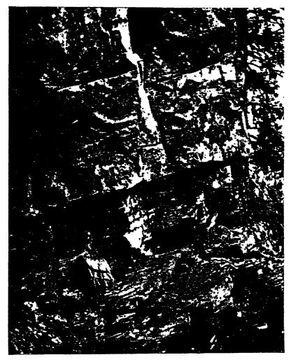
Sudburian Series. — Upon the Laurentian peneplain from Lake Huron north to beyond Sudbury, Ontario, there rests a 3’ounger series of essentially coarse marine deposits, as a rule conglomerates and sandstones, with from 2 to 13 per cent of shales, all of which are also deformed and metamorphosed, though less so than the Keewatin-Coutchiching and equivalent formations (Fig., p. 162). Carbonaceous material, however, is completely absent in the Sudburian, which is often a cleanly washed sand of fairly equal grain, coming apparently from the north and transported by long rivers to a wide delta built into the Ontario geosyncline.
The lower part of the Sudburian of Coleman, of variable thickness up to 5000 feet, is heterogeneous in composition. In places there are arkoses (Copper Cliff), the broken-up material of granite, as much as 1000 feet thick, and in others, regularlj’ and’ cross-bedded thin alternations of grits and muds with angular quartz grams. The arkoses and graywackes full of feldspars are found in close association with the Lamentian granites. These arkoses were probably made under either a desert climate or a cool-moist one, the latter being the more likely. As a rule, the Sudbiuian has a basal conglomerate, which at Sudbury has a thickness ranging in places up to 5000 feet.
Where the Sudburian is not intruded by the later eruptives, it is but little altered, so that the original bedding, cross-bedding, and even the ripple-marks may still be seen on weathered outcrops. Where intruded by the granites, however, the Sudburian is much metamorphosed. All of the Sudburian is deformed, tilted or sharply bent, with an average dip of 45°, the strata rising toward the granite bathyliths of later intrusion. For this reason, the Sudburian series is sharply marked off from the higher Huronian, which usually lies nearly flat or is but gently folded.
Similarity of Sudburian Formations to those of Later Eras. — As the Sudburian deposits are so very ancient geologically, we note [ p. 162 ] with Coleman that their apparently modern nature is the most surprising impression made on the observer while in the field. JYom this we conclude that the atmosphere in character and composition must have resembled that of later times; water did its work then as now, and the extremes of heat and cold seem to have been normal.
Near Lake Tuniskaming and at the greatest gold mine of the world, the Holliuger of the Porcupine district, there is a similar series of strata, though there is more conglomerate here. Seemingly of the same general time are the Pontiac series in Quebec, and the Dor4 conglomerate of the Lake Superior country. The latter is possibly of glacial origin. All of these formations are likewise penetrated by granites of later age. Perhaps most of the sediments are those of shallow seas.
“ The Hastings series in eastern Ontario, sometimes considered a less metamorphosed part of the Grenville, is believed by Miller and Knight to be the equivalent of the Timiskamiug series, since a conglomerate at its base includes pebbles derived from the Greaville. The Hastings series contains limestones, which are infrequent in the Sudbury and Tuniskaming series ” (Coleman and Parks 1922).
Rocks of Sudburiau time are as 3ret unknown in other parts of North America or elsewhere.
Algoman Granites. — Nearly all of the Sudburian formations are intruded, deformed, and metamorphosed by granites named Algoman by Lawson. They are so much like the Laurentian ones that it is often very difficult to distinguish the two sets of deepseated intmaves. In fact, the younger ones have been established for only a few localities and all were formerly called Laurentian. Both intrusions made bathylithic mountains.
[ p. 163 ]
¶ Middle Proterozoic Time
Huronian Series. — The original “ Huronian system ” of Logan has undergone much investigation since he studied it in the eighteensixties and -seventies, due to the great mining industries more recently developed in Canada. Collins divides the Huronian into a lower Bruce series and an upper Cobalt one.
The Bruce series is in the main water-laid, and begins with 1000 to 2000 feet of white conglomeratic quartzite, followed by limestone, graywacke, and more quartzite. The whole of the Bruce series is about 3000 feet thick, and finally the sea withdrew, to be followed by a long interval of land conditions and erosion.
The Cobalt series has as its lowest formation a bowlder conglomerate known as the Cobalt tillite, which is the oldest known glacial deposit; it will be discussed later in the chapter. This tillite is succeeded by 600 to 800 feet of white quartzite, about 3000 feet of “ slate conglomerate,” and thousands of feet of red or white quartzite with showy jasper conglomerate. Then come 200 feet of cherty limestone and 400 feet of white quartzite, the whole series measuring probably more than 12,000 feet in the region north of Lake Huron (Coleman and Parks).
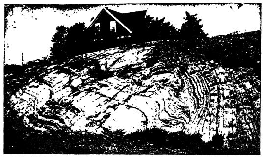
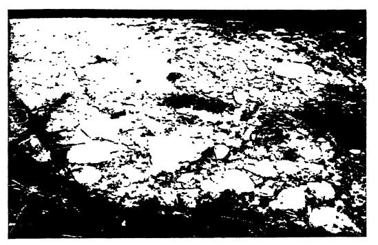
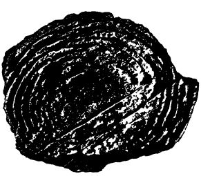
In the Rainy Lake area north of Minnesota there occurs in the Steeprock series a limestone blue and gray in color and up to 500 feet in thickness, with an abundance of globular masses that may be sponges. These fossils are shown in the figure above.
[ p. 164 ]
Animikian or Great Iron Series. — The formations of Animikian time have a wide distribution over the Canadian Shield, the Ontario and Arctic seas, it is thought, having transgressed far and wide over the older rocks. Most of the deposits are of marine origin, though some appear to be of a continental character. However, the Animikian formations are not now of universal distribution over the shield. On the contrary, the areas are widely isolated and appear in the main to be remnants preserved from erosion in the down-folded or gently down-warped basins in the older rocks.
The Animikian strata generally lie nearly horizontal and are very little metamorphosed, but in other areas are folded into large pitching anticlines and dsynclines. In the Penokee area of Michigan the formations that remain after their long exposure to the erosive forces are stiH 14,000 feet thick, but elsewhere they are usually reduced to a maximum of about 6000 feet.
The very thick carbonaceous deposits of the Animikian clearly mark the effective beginning of oxygen in the atmosphere, and the red color of much of the Keweenawan and some of the Animikian sediments may indicate an increase in free oxygen to the point where it became effective as an enormous stimulant to the spread and rapid evolution of the animal kingdom.
The deposits of the Animikian may begin with a basal conglomerate of pebbles of the Keewatm schist and Laurentian gneiss. This passes into chert or jasper that may be banded or oolitic, or into beds of impure limestone or dolomite with chert. Higher in the series there are great thicknesses of thinly laminated carbonaceous slate with large concretions of marcasite, and it has been calculated that if all of the carbon in these argillites (6 to 10 per cent) were concentrated, it would make a bed of anthracite 200 feet thick. There is also much sandstone. Near Port Arthur the Animikian is intruded by sills and dikes of diabase or trap of Keweenawan age, the sills varying from an inch up to 200 feet or more in thickness, and near Sudbury there are interbedded tuffs with a depth of 3800 feet. On the north of Lake Huron (Thessalon) the Animikian strata appear to be of continental origin.
“ The wide-spread shallow seas of the Animikie,” says Coleman, “had one feature scarcely repeated on the same scale in later times, the deposition of iron compoimds with associated silica. In nearly all of the Animikie areas there is an ‘ iron formation ’ [in places as much as 1000 feet thick], with cherty ferruginous carbonate or oolitic greenalite or jasper. . . as the initial stage, from which are formed by secondary causes small or large bodies of ore, culminating in the immense and rich deposits of the Mesabi to the southwest of the shield in Minnesota.” Other great fields occur in the Penokee-Gogebic region of Wisconsin and Michigan, [ p. 165 ] and in the Menominee area, which lies chiefly in the latter state.
The iron-ore mined in the United States in 1916 was about 75,000,000 tons. At the mines this ore was worth on the average about $2.34 per ton. The Lake Superior district furnished nearly 85 per cent of the iron mined in the United States and about 8 per cent came from Birmingham, Alabama. The Adirondack region is third in quantity of iron mined.
Lake Superior Iron Mines. — The hematite ores found along the south and west sides of Lake Superior in the Archeozoic and Proterozoic formations are in the main (70 per cent , from the Animikian series. Most of the richest ores occur near the surface and for 1000 feet downward. Originally the iron formation had a content of about 25 per cent of metallic iron, but in places it bas been concentrated and in these, which form the mining areas, the amount in the ores now mined is about 59 per cent. The Marquette, Michigan, field was opened in 1849, and that of the Alesabi in 1892. In 1920 Minnesota produced 40,000,000 long tons and Michigan about 19,000,000, making up about 85 per cent of all the iron-ores mined in that year in the Lnited States. On account of the enormous scale upon which these rich mines are now worked they will become exhausted during the present generation. Vast bodies of lower grade ores remain, however, which will gradually come into economic use, but their lower content of metal will mean, in so far as that factor is concerned, a higher price of iron. The rich ores utilized in the present generation have been no small factor in the present great industrial expansion of the United States and Canada.
In the southern portion of Hudson Bay, E. S. Moore (1918) has described in detail the iron-bearing series of the Belcher Islands, which is nearly 10,000 feet thick. The formations consist of sandstones (42 per cent), limestones and dolomites (34 per cent), banded slates (14 per cent), iron strata (5 per cent), and diabase-basalt (5 per cent). One of the more interesting features is a thick (428 feet) zone of concretionaiy limestone, the deposits of blue-green cllgce. These spherical and subspherical masses range in size up to 15 inches across and suggest similar Proterozoic fossils described as Newlandia and Collenia (Figs., pp. 176, 177). Much oolite is also associated, and apparently some of the microscopic single-celled algae preserved. Moore suggests “ that the algse and iron bacteria have been responsible for the precipitation of colloidal silica, hematite, and iron silicate in this granular form, in some places as a direct precipitate [in thin bands] on the floor of the basin and in others as a replacement of the calcite granules by the iron compounds.”
Llano Series of Texas. — In central Texas, the earth’s crust is domed, bringing to the surface through profound erosion an ancient series of formations. These are some thousands of feet thick, consisting of alternations of shale, sandy shale, sandstone, limestone, and schists. They strike east and west and the general dip is to the south. In places these strata are but little metamorphosed and in others changed into schists, marbles, and gneisses, due in the main to two series of granitic bathyliths. These intrusions were of great extent.
After the deposition of the Llano strata and the granitic intrusions, the entire central area of Texas was folded into mountains that had an east and west strike. Then followed a long time of erosion and complete peneplanation before [ p. 166 ] the sea of Upper Cambrian time crossed the roots of these mountains. This movement has been called the Uano orogeny, but the whole extent of the mountains is not yet known.
The Llano series is believed to be of about the same age as the Grand Canyon series of Arizona (see p. 167).
¶ Late Proterozoic of the Cordilleras
Beltian Series. — The best known and thickest sections of Proterozoic formations in western North America occur in western Montana, eastern Idaho, and British Columbia, north to at least 54° north latitude (see Mg., above). Upward of 37,000 feet of sediments, mainly sandstones and shales, are exposed in the combined sections. In the Cabinet Range, Montana, the thickness is about 35,000 feet (Calkins). A striking feature of these Beltian formations of the Cordilleras, Lindgren states, is the small amount of igneous materials. Diabase intrusions of sTnall areal extent are known, and it is probable that there are also some basalt flows. North of the International Boundary, however, extensive intruded sheets are referred to the Proterozoic.
The Cambrian overlies the Proterozoic strata in Montana and British Columbia with apparent conformity, and yet there may have been as much as 16,000 feet locally removed through erosion preceding the overlap mentioned Csee Fig., below). In the lower part of these sections occur three great limestones, pure and impure, that have thicknesses ranging between 2000 and 4S00 feet. It is in these calcareous zones that lime-secreting algae abound. The bulk of the sediment, however, is sandstone, and it is significant that above the basal portion much of it is red in color, ripple-marked, and sun-cracked. As the clastic portion thickens to the west at the expense of the limestone, we see that it is from this direction that the sediment was mostly derived. The inference seems to be that the earlier sediments are of marine origin, while the later formations are either delta deposits or are continental and of a semiarid climate.
In the Grarid Canyon, Arizona, occur the Chuar and Unkar formations with a thickness, remaining after an unknown amount of erosion, of nearly 12,000 feet, most of which is sandstone, while [ p. 168 ] of limestone there is onlj’ 435 feet, and that near the base. The sediments are at first of marine origin, but quickly pass upward into continental deposits (see figure below). These formations rest on the peneplained surface of the highly deformed Archeozoic (Vishnu) strata.
Grand Canyon Revolution. — After the deposition of the Grand Canyon series, and long before the Paleozoic, the strata were broken into many blocks, let down through faulting into the Archeozoic masses, and later on both were raised into a mountain system similar in aspect to the present Great Basin ranges. This orogeny may be known as the Grand Canyon Revolution. All were eroded to sea-level before the Paleozoic era began, for the horizontal Cambrian strata rest upon the peneplained older formations. In other words, after the deposition of these Proterozoic sediments, the rocks of the Colorado plateau region were profoundly block-faulted, tilted eastward, and elevated into a monoclinal attitude, and the resulting mountains were presumably high. How long it took to reduce this highland to sea-level is unknown, but the eroded peneplain is indicated by a marked rmconformity.
[ p. 169 ]
¶ Late Proterozoic of Lake Superior
Lower Keweenawan. — The Keweenawan division of rocks was introduced by T. B. Brooks in 1876, and includes the youngest of Proterozoic strata. They are all of continental origin, and of quick accumulation. Geologists are agreed that there is a distinct break in the record between the Animikian and the Keweenawan series of formations. Moreover, the sediments of the former are of marine origin, while those of the latter are held to be of continental deposition. Some geologists hold that the Keweenawan should be referred to the Paleozoic, but the trend of opinion since Walcott’s discussion of it is that it should be regarded as the closing period of the Proterozoic era, a belief that is followed in this book. The Keweenawan is characterized by enormously thick deposits, both of sediments and lavas, the igneous activity becoming greater in its middle and upper portions.
At the base, from Wisconsin eastward, there are conglomerates, well stratified, coarse, red and white sandstones interbedded with conglomerates, thin impure limestones of various colors, and shaly rocks, the whole having a thickness of from 300 to 1400 feet. These are also penetrated by dikes and sills of diabase or trap of Upper Keweenawan time. The sediments are largely derived from the Laurentian granites, but red jasper pebbles of the iron formations also occur. Ripple-marks are common, the sandstones are often feldspathic and might be called arkose, and the shales have mudcracks, all of which are indicative of continental origin. Further, the prevailing color is red, like the Triassic of the Connecticut valley, suggesting semiarid conditions and complete oxidation; the absence of carbonaceous beds is also strikingly different from the conditions found in the Animikian sediments.
Upper Keweenawan Volcanics. — The closing period of the Proterozoic record is marked in the region of Lake Superior and elsewhere by a tremendous outpouring of volcanic materials upon the dry land, probably not by volcanoes but rather through fissures. Most of the formation, according to Coleman, “ consists of basic lava flows, variously called trap or diabase or melaphjire, some being really basalts, but there are also more acid [feldspathic] flows, referred to as porphyries and felsites, really rhyolites. In sul> ordinate amounts ash rocks and lapilli are found between the lava sheets, and the [interbedded] conglomerates and sandstones [and shales of small amounts] are made of almost contemporary material, especially of fragments of the rhyolites and porphyries.”
[ p. 170 ]
One of the thickest series of lavas known on the Canadian side of Lake Superior occurs on Michipicoten Island where a section was measured with a thickness of 11,230 feet, only a small part of which consists of sediments. In northern Wisconsin and Michigan, Van Hise and Leith give the maximum thickness of their Middle Keweenawan (after allowing for initial dip during accumulation) as upward of 30,000 feet. Of this, from five eighths to eight ninths is igneous material, the rest being red conglomerates and red sandstones derived from the volcanics.
Over the “Middle Keweenawan” of Wisconsin and Michigan lies the local “ Upper Keweenawan,” made up of conglomerates (800 to 4000 feet), sandstones (15,000 feet), and shales (100 to 400 feet), attaining a total thickness of about 20,000 feet. All of this material is, however, detritus from the igneous Keweenawan, and does not signify a long interval of erosion, because of the soft nature of the volcanics and the high and rough topography of the lava field.
The volume of known igneous material extruded (estimated as 24,000 cubic miles) was accumulated in a sinking field, and in this way arose the Lake Superior geosyndinal basin, which is almost devoid of subordinate folds. In other words, the molten material as it rose to the surface permitted the upper formation to sink in. Elsewhere, however, the Keweenawan rocks still lie almost horizontal, and in graieral thdx appearance is not unlike similar Paleozoic formations, though block faulting is common.
Upper Keweenawan Metals. — From the human and economic point of view, the advent of the Keweenawan lavas was one of the most important events in the pre-Cambrian history of the Canadian Shield, since most of the valuable ore deposits of the region, so far as known, are connected with the igneous activity of this age. At Thunder Bay the silver ores of Silver Islet and other mines were supplied by the Keweenawan diabase dikes and sills, Ontario in 1913 yielding over $36,000,000 worth of silver. The unrivalled mines of native copper in Michigan belong to the amygdaloids and conglomerates of Keweenaw Peninsula, and similar ores of native copper, perhaps on a larger scale, exist in the extensive area of amygdaloids east of Great Bear Lake and near Coppeimine Biver in the extreme north of the shield.
The native “ low grade ” copper ore of Michigan was discovered by Douglas Houghton in 1830, though worked long before by the Indians. The area in which it occurs is 70 miles long by 3 to 6 miles wide. The famous Calumet and Hecla mines were opened in 1846, and in the following year Michigan produced 239 tons of copper. In 1916, when it reached its TnaxiTTnntr) output, the yield was [ p. 171 ] 135,000 tons, valued at $66,300,000. The total output to the end of 1922 was 3,500,000 tons of copper, and has been exceeded only bj’ that of Butte, Montana.
“ The Sudbury [Ontario] deposits of nickel and copper, including much the largest mines of nickel in the world, are connected with a sheet of norite-micropegmatite probablj’ of Keweenawan age; and Miller has concluded that the singularly rich silver veins of Cobalt have derived their ore from a great diabase sill which ascended into the Cobalt conglomerate at this time.
“ The Keweenawan eruptives seem to have brought with them copp)er, nickel, and silver in large amoimts, cobalt, gold, platinum, and palladium in much smaller amounts; and if the iron mines are left out of account, almost all the metalliferous deposits of the southern margin of the Canadian Shield have resulted from the coming of its dikes or sheets or lava streams." (Coleman.)
Gold and silver, Lindgren states, are obtained in the eastern part of North and South America mainly from the rocks of Archeozoic and Proterozoic age. Almost all primary gold and silver vein deposits have been formed during or shortly after epochs of volcanic or intrusive activity. Gold is the principal metal and is always accompanied by quartz gangue.
Killaraey Revolution. — Collins (1922) has shown that the whole area of the Ontarie geosyncline from at least Sudbmy, Ontario, into southern Wisconsin, was folded and injected by granite bathyliths, tnaking the Killarney, fountains. These have long been known as the “ Lost moimtains of Wisconsin,” and Lawrence Martin thinks they may originally have been as high as the present Alps. In a northeast direction the Killamey mountains are known to have extended at least 1000 miles, from southwestern Minnesota (Sioux Falls) to beyond Lake Huron (see map, p. 193).
¶ Climates of Proterozoic Time
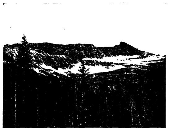
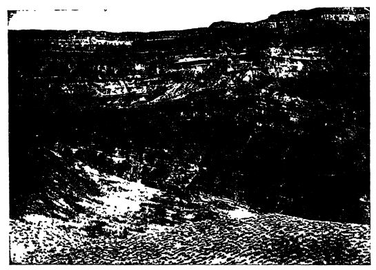
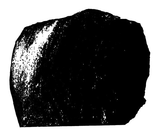
Tillites of the Huronian. — One of the most surprising of recent discoveries in Geology was the finding by Coleman of tillites (morainal deposits of glacial till or bowlder clay, hardened into stone, see Pt. I, p. 144, and Pt. II, Figs., p. 173) in the Huronian formations of Canada, and the consequent establishing of the occurrence of a glacial dimate thus early in the history of the earth. Over the wide laurentian peneplain previously described, there is found in the coimtry to the north of Lake Huron a basal conglomerate that often includes facetted and striated bowlders of various kinds of rocks. Over the tillites occur, locally, thick zones of banded (varved) slate [ p. 172 ] and water-formed conglomerates and quartzites. (See map below for distribution.)
The whole thickness of glacial beds is usually not more than 500 or 600 feet, somewhat in excess of the thickness of the recent Pleistocene glacial and interglacial beds at Toronto. This Huronian tillite is known to cover an area of 1000 miles from west to east and 200 miles north and south, down to 46° north latitude, and rests upon a nearly plane surface that still lies not far above sea-level. It is the material of a continental ice sheet which deposited its content of rocks and earth upon the land.
Bowlders of granite and greenstone with diameters up to 2 or 3 feet are common and larger ones measuring 5 feet through are occasionally met. . . . These bowlders may be well roimded, subangular, or angular. They may be crowded into a mass of large and small stones cemented together, or they may lie sparsely scattered in a fine-grained matrix, the red granites showing up sharply from square yards of dull greenish gray ground mass. Generally no marked stratification can be seen in the coarser conglomerates, though associated pebble conglomerates and slates may be well stratified. . . . The matrix and the bowlders enclosed vary greatly from point to point, roughly corresponding to the character of the rocks beneath, and the rock strongly suggests a glacial moraine in some cases and bowlder clay in others.” (Coleman.)
At the top of the Proterozoic series in the Wasatch Mountains, Utah, Hintze and Calkins (1920) report a tillite, bluish green in color, fine in grain, with scattering pebbles up to 6 inches across, some of which are facetted, and bowlders up to tons of weight, [ p. 173 ] [ p. 174 ] of quartzite, limestone, and granite. Apparently no striated stones have been seen.
Other Proterozoic Tillites. — Undoubted and probable tillites of Proterozoic age are now known in many lands: certainly in Norway, China, India, and Australia, and probably in Africa. They are of different ages, some occurring at the close of the Proterozoic and others older (see Fig., p. 172).
It has often been stated that the Cambrian began with a glacial climate, but in all places where tillites are known in connection with strata of this age, it has not yet been demonstrated that such are actually a part of the Cambrian. In some places, the tillites disconformably underlie fossiliferous Cambrian strata, and in others no strata with fossils occur with them. It is therefore not yet established that any of these tillites are of Cambrian time, and we prefer to hold that they are for the present better referred to the Proterozoic. These are the tillites of Australia, Norway, and China.
A series of unmistakable tillites followed by seasonally banded slates occurs in southern Australia, having a thickness, according to Howchin, of between 600 and 1500 feet. These lie just below fossiliferous Lower Cambrian strata, and the tillites are also referred to this period. Below the tillites, the section continues unbroken for tens of thousands of feet, and all are devoid of fossils. Since the section goes imbroken downward, and since the tillites have not been shown to continue into the Lower Cambrian, we hold that it is best to refer the tillites and all the coarse strata beneath them to the Proterozoic. Andrews has recently shown (1922) that at least those of the Broken Hill area are of early Proterozoic age.
Other tillites of northern Norway were made known by Reusch as long ago as 1891, and have recently been restudied by Holtedahl (1922). They occur below the Lower Cambrian sandstones having the Holmia fauna, and terminate the Sparagmite (feldspar-bearing) sandstones. The latter attain in places a thickness up to 6500 feet, and are often compared with the Torridonian sandstones of Scotland. The latter series occurs at the top of the Proterozoic and is also thought to have tillites, or is the material of a subtropical desert having icy storms. Below the Norwegian sparagmites occur the Trysil or Dala sandstones referred to the Proterozoic. Under date of April 21, 1921, Holtedahl writes: “ It is now proved that warping movements took place during and after the time of the tillite deposition and before Holmia time. The Norwegians think the tillites and the Sparagmites are of Lower Cambrian age and transitional to them.” This may be so, but until it is proved we prefer to think of them as late Proterozoic in age. The tillite is made up of bowlders, often of large size, of granite, diabase, gneiss, quartzite, sandstone, and limestone. As yet, no glacial striae have been found. The unmistakable tillites of arctic Norway, formerly referred either to the Cambrian or the Proterozoic, Holtedahl has recently shown to be of Champlainian or Silurian age.
Still other Proterozoic tillites are known in peninsvlar India. They also occur in the Himalayas in the upper part of the thick Vindhyan system. In the Simla area, also of the Himalayan region, is another thick series of Proterozoic [ p. 175 ] strata, and in the lower division, the Blaini series, occurs a bowlder bed with rounded and angular stones, some of them facetted and striated by ice action, bound together by a fine-grained slate. The bowlders suggest an origin in floating ice or from melting icebergs that drop them up>on the mud-gathering bottoms. Overhung the bowlder bed occurs a thick mass of carbonaceous slates, the Infra-Ivrol series (Wadia 1919). H. H. Hayden compares the Blaini bowlder bed with the tillites of the Talchir (Permian).
In China, in the provinces of the middle Yangtse River, Willis and Blackwelder have discovered unmistakable tillites the exact age of which has not yet been established.
Another occurrence of tillites is in the Griqua Towm series of South Africa, Here in the Hay district are found “ striated and flattened pebbles and bowlders.” These are accepted by Rogers as glacially striated. According to Du Toit, tillites of the same age (Proterozoic) occur in Namaqualand and in the Transvaal. Other tillites, but apparently of a different Proterozoic time, occur in the CJongo country.
Conclusions on Pre-Cambrian Climate. — The very thick limestone series of both the Archeozoic and Proterozoic suggest that at the time of their formation the climate was at least mild. Then, too, the many zones of algal concretions, some of which are actual reef-limestones, point also to warm waters. In the Proterozoic, the vast amount of iron deposited also is confirmation of mild climates. We may, therefore, conclude that at this very early time in the history of the earth the geologic climates were in general of the same nature as they have been ever since. In other words, the evidence indicates that during long stretches of time the temperature of air and water was mild and fairly uniform the world over, but that at somewhat irregular intervals cold climates developed that were geologically of short duration. The times of reduced temperatures appear to coincide with the beginning or close of the eras and periods, when the lands are largest and highest.
¶ Life of the Proterozoic
It is not so long since it was thought that the Proterozoic strata were devoid of recognizable fossils, but during the past twenty-five years Walcott has described such from various places and Cayeux has secured Radiolaria (Fig., p, 70), spicules of the four orders of siliceous sponges, and possibly Foraminifera (Fig., p. 68), from Brittany in France. Near the top of the Grand Canyon series, Walcott has also found in limestones (Chuar) an abundance of siliceous sponge spicules. A careful search among the Proterozoic flints would probably reveal more of these, and one through the limestones might yield undoubted Foraminifera and possibly other micro-organisms.
[ p. 176 ]
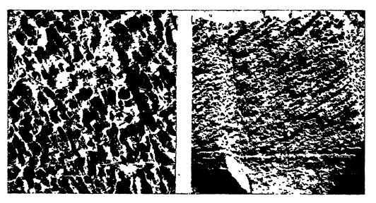
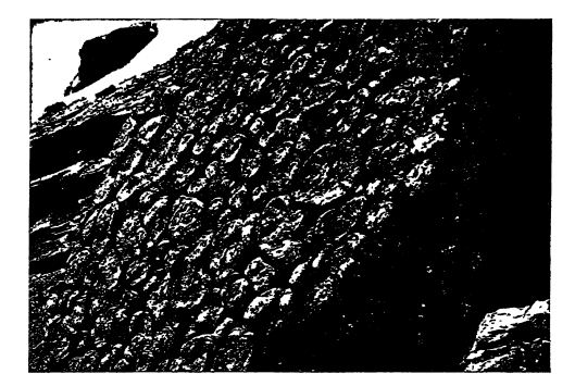
The most abundant fossils of the Proterozoic limestones are the secretions of calcareous algae commonly known as Cryptozoon (Figs., pp. 176-177). These coral-like plant masses make entire beds that repeat themselves time and again through thousands of feet of limestone. Moore (see p. 165) has described great quantities of these algae as common to the iron strata of Hudson Bay, and Grout and Twenhofel have done the same for the similar strata of Minnesota and Michigan.
Walcott has shown that certain of the Proterozoic (Beltian) limestone formations abound in a variety of layered secretions due to the physiological processes of algae (blue-green). He describes them imder six new genera and ten species. Most of them occur in abundance in the Newland limestone in Montana throughout a thickness of 2000 feet. Higher up come the Greyson shales, 3000 feet thick, with marine annelids, but without the algae. Still Mgher are the Spokane shales, 1500 feet thick, and here again in a thick zone the algae abound. We may, therefore, truthfully say that the Proterozoic strata abound in fossils, but not in such forms as would be expected from the evidence of the Paleozoic formations. It is rather a plant world of the lowest type, that has left inorganic structures from which but little of the original organisms that caused their formation can now be learned.
[ p. 177 ]
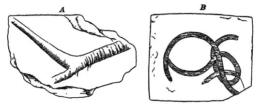
From the upper portion of the Proterozoic (Beltian series) of Montana, Walcott has described a number of worm tubes and trails, seemingly of segmented annelids, that were found 7700 feet beneath the top of the section (Fig., p. 178). They are among the youngest fossils known in the Proterozoic, and even though they are only tubes and trails they seem to indicate the presence here of free (errant) annelids, a class of marine invertebrates high in the line of organic evolution. It is also interesting to note here that Walcott has discovered in Montana Micrococcus, one of the “ immortal types,” a form related to Nitrosococcus living to-day. There are still other fossils, but their nature is too obscure to make out their relationship to known organisms.
This evidence shows that life was present in abundance early in the Proterozoic, and that it consisted mainly of marine algae. In the later Proterozoic occur Protozoa (Radiolaria), Annelida, and various types of siliceous sponge spicules, and from the nature of the Cambrian faunas we must infer that trilobites were also present. This means that most of the invertebrate classes of organisms were in existence in Proterozoic time.
The apparent absence of lime-secreting animals in the Proterozoic has been explained by Daly and Lane as possibly due to a lack in available form of lime salts in the oceans and seas of this early era. In other words, it is held that [ p. 178 ] even though vast limestones were formed, there was no lime available for organic skeletons and hence there could be no structures that were preservable as fossils. Daly has suggested that the small amount of lime then being delivered by the rivers to the seas was quickly precipitated through the continuous decay of organisms, since there were no bottom-feeding or scavenging animals to eat the dead organic matter. The massive deposits of calcareous algae of the Proterozoic are not skeletons but the involuntary secretions due to the metabolic processes of these plants. That the marine waters of this ancient time may have had a different salt content, and one devoid of the cyclic rotation of organic matter from animal to animal, as held by Daly and Lane, and that this difference led to different physiological processes among the organisms, preventing the invertebrates from using lime in their skeletal parts, appears more probably true.
¶ Collateral Reading
R. S. Dalt, The Limeless Ocean of Pre-Cambrian Time. American Journal of Science, 4th series, Vol. 23, 1907, pp. 93-115.