Public domain
[p. 289]
A few facts concerning the depth of the ocean and the distribution of its water have been given on a preceding page (p. 6), and some reference to the origin of the ocean basins and the ocean will be made later. We are concerned here chiefly with the geologic processes now going on in the sea; but a few facts concerning the seawater and its life, and the topography of the ocean’s bed,[1] may well precede the study of the processes now in operation.
Mineral matter in solution. Every 1,000 parts of sea-water contain about 34.40 parts by weight of mineral matter in solution. The principal solids are shown in the following table : [2]
| Chloride of sodium | 77.758 |
| Chloride of magnesium | 10.878 |
| Sulphate of magnesium | 4.737 |
| Sulphate of calcium | 3.600 |
| Sulphate of potassium | 2.465 |
| Bromide of magnesium | 0.217 |
| Carbonate of calcium | 0.345 |
The presence of many other mineral substances in sea-water has been proved, and oxygen, nitrogen, and carbon dioxide are present in quantity. The amount of carbonic acid is estimated to be 18 times as great as in the atmosphere.
The amount of sea-water is estimated by Murray at 323,722,150 cubic miles,[3] or about 15 times the volume of the land above sealevel. The volume and composition of the sea-water being known, [p. 290] the amount of mineral matter which it contains may be readily calculated. Assuming the average specific gravity of the mineral matter to be 2.5, the 3.5% (nearly) by weight becomes about 1.4% by volume, and 1.4% of 323,722,150 cubic miles is 4,532,110 cubic miles. This represents the aggregate volume of mineral matter in the sea if it were precipitated and compacted so as to have an average specific gravity of 2.5. This amount of mineral matter would cover the ocean bottom to a depth of about 175 feet. Its amount is equal to about 20% of that of all lands above sea-level.
A large part of the mineral matter of the sea has come from the land, having been extracted from it by ground-water, and carried by rivers to the sea. But the mineral matter of the sea gives no more than a hint of the importance of the solvent work of water in the general processes of rock decay, for most of the mineral matter carried from the land to the sea in solution is taken from the sea-water about as rapidly as it is supplied. Calcium carbonate, for example, is about twenty times as abundant as sodium chloride in river-water, but it is only 1/225 as abundant in sea-water. This is because the calcium carbonate is used by animals and plants to make shells, skeletons, etc., while the salt remains in solution.
Knowing, approximately, the amount of water discharged by rivers into the sea each year (about 6,500 cubic miles [4]), and knowing the amount of salt it carries, it is calculated that it would take about 370,000,000 years for the salt of the sea to have been contributed by the rivers, at the present rate. It is to be understood, however, that this figure cannot be taken as the age of the ocean, for (1) the salt is not all brought in by rivers, (2) it is not probable that the rivers have always contributed salt at the present rate, and (3) much salt once in the sea has been precipitated. Nevertheless the above figure gives some suggestion as to the order of magnitude of the figure which represents the age of the ocean. All of the calcium carbonate in the sea would be given to it by rivers in about 62,000 years at their present rate of contribution.
Topography of the ocean bed. The ocean basins are pronouncedly convex upward. It is only when we remember that a level surface (on the earth) is one which has the mean curvature [p. 291] of the earth, and that the deeper parts of the ocean basin are considerably below the mean sphere level, that the name basin seems appropriate.
The bed of the ocean, like the face of the land, is affected by elevations and depressions, and its deepest parts are about as far below its surface as the highest mountains are above it. If the water were drawn off, so that the bottoms of the ocean basins could be seen, three great features would appear: (1) Extensive tracts of low land, now covered by deep water; (2) other great, but less extensive tracts of higher land, now covered by shallow water; and (3) ridges and peaks of mountainous heights. These three principal divisions may be compared to the plains, plateaus, and mountains of the land, though mountain systems would be less numerous than on land. Furthermore, there would be found great depressions comparable to the great basins of the land.
Apart from these general features, there is little in common between the topography of the sea bottom and that of the land. If the water were drawn off from the ocean’s bed so that it could be seen as the land is, its most impressive feature would be its monotony. The familiar hills and valleys which, in all their multitudinous forms, give the land its most familiar features, are essentially absent. A large part of the ocean bottom is so nearly flat that the eye would not detect its departure from planeness, if the water were absent.
The reason for this profound difference is readily found. The dominant processes which shape the details of the surface of the land are degradation al, and though the final result of degradation is flatness (base-level), the immediate result is roughness. In the sea, the dominant processes are aggradational, and tend to monotonous planeness.
Distribution of marine life. Marine life has been of such importance in the history of the earth that the elementary facts concerning its distribution and the principles which control it are here recalled. The distribution of marine life is influenced by many factors, chief among which are temperature and depth of water. Life is more abundant in the warmer parts of the ocean than in the colder, the species inhabiting cold waters are different from those in [p. 292] warm, and few species range through great variations. Many forms of life are restricted to shallow water; many others, especially those which live near the surface, swim about freely without reference to the depth of the water beneath them; while a few are restricted to great depths. Some species are also influenced by (1) the salinity of the water, which varies notably along coasts where the fresh waters from the land are discharged; (2) the character of the sediment at the bottom, some species preferring mud, others sand, etc.; (3) the movement of the water, some species preferring still water and others rough ; (4) the abundance and nature of the food-supply; and (5) the presence or absence of rival and hostile species.
Subject to the exceptions determined by temperature, etc., plant life abounds in shallow water out to depths of 100 fathoms or so, and is found in abundance at the surface where the depth is much greater. Animal life abounds in shallow water, both at the bottom and above it, out to depths of 200 or 300 fathoms, and occurs in great profusion in the surface-waters of temperate and tropical regions without regard to the depth. The great body of the ocean-water lying below a depth of some few hundred fathoms is nearly tenantless, though life reappears sparingly at the bottom, even where the depth is great.
¶ Processes in Operation in the Sea
Diastrophism, vulcanism, and gradation are operative on the bottom of the sea as on the land.
Diastrophism. So far as the lithosphere is concerned, the sealevel is the critical level. At and above it, many processes are going on which are not operative below, and below sea-level, some which do not take place above. Warpings of the surface which do not involve the submergence of areas which were land, or the emergence of areas which were under water, are relatively unimportant compared with those which effect such changes. The rise of the bottom of the sea from a depth of 400 fathoms to a depth of 200 fathoms would not have important results, so far as the area itself is concerned, while an equal rise of the bottom beneath 100 fathoms of water, or an equal subsidence of land 500 feet high, [p. 293] would be attended by more striking consequences. It follows that the changes effected by diastrophism are much more obvious in shallow water than in deep. Emergence or submergence shifts the zone of contact of ocean and land, and so the areas of aggradation and degradation, and changes the region concerned from one appropriate for sea life to one appropriate for land life, or vice versa.
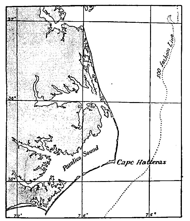
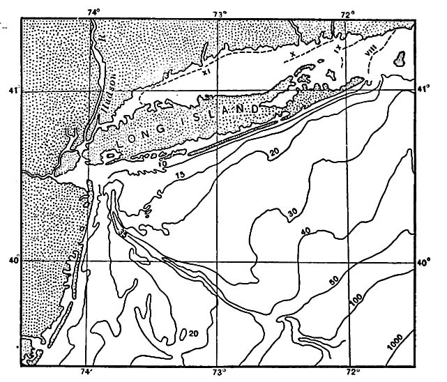
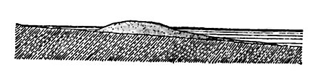
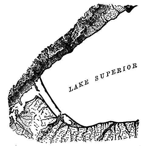
Over the continental shelves the water is shallow and the bottom relatively smooth. If the sea-level is drawn down, or if the continental shelf is elevated evenly, the new shore-line on the smooth surface of the former submerged shelf will be relatively regular, even though the coast was notably irregular before the change. This is illustrated by Fig. 240. . Subsidence of a coast-line (or rise [p. 294] of the sea-level) tends to the opposite results, for in this case the sea advances on a surface which has relief, and the water enters every depression brought to its level. Thus the numerous bays at the lower ends of the streams along the Atlantic coast from Long Island Sound to Carolina are the results of recent sinking. From the present configuration of coast-lines it has been inferred that the present is, on the whole, an era of continental depression.[5] River valleys, the lower ends of which are embayed, are sometimes found to be continuous with submerged valleys beyond the coast-line (Fig. 241). Submerged river valleys show that the surface in which they lie was once land.
The effects of diastrophism in the ocean and about its borders, may (1) make the water of any ocean, or of any part of it, shallower or deeper; (2) cause the emergence or submergence of land; (3) make coast-lines regular or irregular; (4) shift the habitat of many [p. 295] forms of life, and, through these changes, (5) influence the processes of gradation, especially at the contact of sea and land.
Vulcanism affects the sea-bottom much as it affects the land. At the volcanic centers, where the great body of extruded matter accumulates, mounds and mountains are built up, and most of the mountain peaks of the sea-bottom had a volcanic origin. Where volcanic cones are built up near the surface of the sea, they often furnish a home for shallow-water life, such as polyps. Wherever they are built up so as to be within the reach of waves, gradational processes are stimulated.
The number of acti 3 volcanoes on islands is about 200, but the number of active vents beneath the sea is unknown. A few submarine eruptions have been observed, but those observed are probably but a small percentage of those which have taken place in historic time, for slight eruptions in deep water might not be seen at the surfaee, even if observers were near.
Oceanic volcanoes affect both the temperature and the composition of the sea-water. Both the increase of temperature and the solution of volcanic gases increase the solvent power of water, and both the change in temperature and composition affect the life of the adjacent waters. The decay of organisms destroyed during eruptions generates gases, and these gases may lead to further chemical changes. Volcanoes in the sea have furnished much of the material now found on the bottom of the ocean. Some of this material is very fine, like volcanic dust, and some of it is much coarser. Both the very fine material and the pumice may be distributed far from the volcanoes which emit them. As a matter of fact, they are found nearly everywhere on the bottom of the deep sea, though not in uniform abundance. From these considerations it is apparent that the effects of oceanic volcanoes on the sea-water are considerable, when long periods of time are considered.
Gradation. The gradational processes of the land and the sea are in striking contrast. On the land, degradation predominates, and aggradation is subordinate; in the sea, aggradation predominates and degradation is subordinate. On the land, degradation is greatest, on the whole, where the land is highest, while aggradation is of consequence only where the land is low, or where steep [p. 296] slopes give place to gentle ones. In the sea, degradation is virtually confined to shallow water, or to what might be called the highlands of the sea, while aggradation is nearly universal, though most considerable in shallow water, or where shallow water gives place to deep. Both the degradational and aggradational work of the sea are greatest near its shores. Though the gradational work of the land and sea are in strong contrast, they tend to a common end — the leveling of the surface of the lithosphere.
The gradational processes of the sea-bottom are effected (1) by mechanical, (2) chemical, and (3) organic agencies. The mechanical work of gradation in the sea is effecte 1 chiefly by the movements of the water. These movements may be degradational where the water is shallow enough for the motion to affect the bottom, but elsewhere they are aggradational. The gradational work effected by chemical means is likewise partly degradational and partly aggradational. In lagoons and other small inclosures, the water may become super-saturated with some mineral substance; precipitation then takes place, the precipitate accumulating as sediment on the bottom. On the other hand, solution results in degradation. Organic agencies are, on the whole, aggradational. Accumulations of coral, coral debris, shells, etc., help to build up the sea-bottom, and most rapidly in shallow water where the forms of life which secrete calcium carbonate are most abundant. In the aggradation effected directly by organic agencies, the sea is passive. Its only part is to support the life which gives rise to the solid matter, and incidentally to float a part of it in its currents.
Movements of the sea-water. The movements of the sea-water fall into several categories. There is (1) a general circulation of sea-water, determined chiefly by (a) differences in density in the sea-water, (b) differences of level, and © movements of the atmosphere; (2) periodic tidal movements; and (3) aperiodic movements due to occasional causes, such as earthquakes, volcanic explosions, landslides, etc.
For present purposes, all movements of the sea-water may be grouped into two main classes — (1) waves, with the undertow and the littoral currents they generate, and (2) ocean-currents.
[p. 297]
Waves
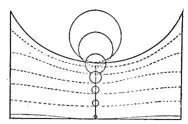
Wave-motion.[6] The most common waves are those generated by winds. During the passage of a wave, each particle affected by it rises and falls and moves forward and backward, describing an orbit in a vertical plane. If the passing wave is a swell, the orbit of the particle is closed and is either a circle or an ellipse; but in the case of a wind-wave the orbit is not closed, for in such a wave the water, as well as the undulation, moves forward. On the crest of the wind-wave each particle of water moves forward, and in the trough it moves less rapidly backward, and the excess of the forward movement over the backward gives the water a slight residual advance. This advance is the initiatory element of current. As a result of this advance, the upper layer of water is carried forward with reference to the layer below, in the direction toward which the wind blows. The waves of any considerable or long-continued wind, therefore, generate a current tending in the same direction as the wind.
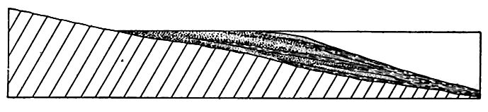
The wave motion is propagated indefinitely downward, but the amount of motion diminishes rapidly with increasing depth (Fig. 242.) Engineering operations have shown that submarine structures are little disturbed at depths of five meters in the Mediterranean,
and eight meters in the Atlantic. On the other hand, debris as coarse as gravel, which is transported by rolling on the bottom, is not infrequently carried out to depths of 50 feet, and sometimes even to 150 feet. Fine sediment, like silt, is disturbed at still greater depths, for ripple-marks, which indicate agitation of the water, are said to have been found at depths of 100 fathoms.
[p. 298]
When a wave approaches a shelving shore, its habit is changed. The velocity of the undulation is diminished, while the velocity of the advancing particle of water in the crest is increased; the wave-length, measured from trough to trough, is diminished, and the wave-height is increased; the crest becomes acute, with the front steeper than the back, and these changes culminate in the breaking of the crest, when the undulation proper ceases. Waves of a given height break in about the same depth of water, and the line along which incoming waves break is the line of breakers. The line of breakers is in deepest water and farthest from shore when the waves are strong. The return of the water thrown forward in the crests of waves is accomplished by a current along the bottom called the undertow. The undertow is sensibly normal to the coast when uninfluenced by oblique waves, and is efficient in removing the products of erosion.
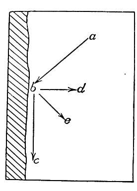
When waves advance on the shore obliquely, a shore-currenl is [p. 299] developed as illustrated by Fig. 244, where ab represents the direction of the incoming wave, be the direction of the shore (or littoral) current, and bd the direction of the undertow. Where they strike the borders of land, the wind-waves, therefore, generate two other movements, the undertow and the littoral current. Any particle of water near shore may be affected by any two or by all three of these movements at the same moment. The effect of littoral current and undertow is to give a particle of water on which both are working a direction between Xv the two, as. be. The effect of other combinations can be readily inferred. These various combinations are of consequence in the transportation of debris.
Work of the Waves
The general effects on shores of the waves and the other movements to which they give rise are (1) the wear of the shores; (2) the transportation of the products of wear; and (3) the deposition of the transported materials.
Erosion. In the dash of the waves against the shore, the wear is effected chiefly by the impact of the water and of the debris which the water carries, but lesser results are accomplished in other ways.
When the land at the margin of the water consists of unconsolidated material, or of fragment al material but slightly cemented, the dash of the water is sufficient to displace or erode it. If weak rock is associated with resistant rock within the zone of wave-work, the removal of the former may lead to the disruption and fall of the latter, especially when weak rock is washed out from beneath strong. The impact of the water is competent also to break up and remove rock which was once resistant, but which has been weakened by weathering. Rock affected by joints is likewise attacked with [p. 300] success, for the blocks bounded by joints may be loosened and literally quarried out. Waves of clear water, even when their force is many tons to the square foot, have little effect on rock which is thoroughly solid.
The impact of the waves is generally reinforced by the detritus they carry. The sand, the pebbles, and such stones as the waves can move are used as weapons of attack, both against the shore and against one another. Masses of rock too large for the waves to move (Fig. 245) are worn by the detritus driven back and forth over them, and in time reduced to movable dimensions. They then become the tools of the waves, and, in use. are reduced to smaller and smaller size. Thus bowlders are reduced to cobbles, cobbles to pebbles, pebbles to sand, and sand to silt. The silt, held in suspension in agitated water, is carried out beyond the range of breakers, and settles in water so deep as not to be effectively agitated to its bottom. Thus one generation of bowlders after another is worn out, and the comminuted products are carried out from the immediate shore and deposited in deeper water.
[p. 301]
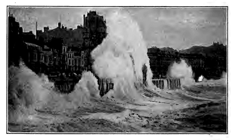
The effectiveness of waves depends on their strength and on the concentration of their blows.[7] The strength of waves is dependent on the strength of the winds (or other generating cause) and the depth and expanse of the water, and the concentration of their blows is determined by the slope against which they break. On exposed ocean-coasts the fetch of the waves is always great. The winds are variable. For a given coast they have an average strength, but the effectiveness of wave-erosion is determined less by the average strength of waves, than by the strength of the stormwaves. The average force of waves on the Atlantic coast of Britain has been found to be 611 lbs. per square foot in summer, and 2,086 lbs. in winter, but winter breakers which exert a pressure of three tons per square foot are not infrequent. Exceptional storm-waves are known to have moved blocks of rock exceeding 100 tons in weight. Waves are most efficient on bold coasts bordered by broad expanses of deep water, for here the force of the wave is almost wholly expended near the water line; where shallow water borders the land, the force of the waves is expended over a greater area.
The less familiar phases of wave-work are accomplished by hydraulic pressure, compressed air, shore ice, etc. When the water of a wave is driven into an open joint or a cave, the hydraulic pressure may be so great as to break the rock if it is weak. When water is driven with force into a cave, the compression of the air may be great if the wave is high enough to close the entrance. When the water runs out of a cave, the air within may be greatly rarefied, while that above exerts its normal pressure. In either case the roof of the cave, if it is weak, may be broken. At certain seasons of the year, especially during the spring, waves make destructive use of the ice which is then breaking up, but it is only in high latitudes that sea-ice is of importance in this way. In general, the effect of its presence in keeping down waves overbalances its effect as an agent of erosion.
[p. 302]
The direct effect of wave-erosion is restricted to a zone which is narrow both horizontally and vertically. There is no impact of breakers at levels lower than the troughs of the waves, though erosion may extend down to the limit of effective agitation. The upper limit of effective wave-action is the level of the wave-crests. The rise and fall of the water during the flow and ebb of the tides gives the waves a greater vertical range than wind-waves alone would have. The indirect work of waves is limited only by the height of the shore, for as the zone of excavation is carried landward, masses higher up the slope are undermined and fall. The fallen rock temporarily protects the shore against the waves (Fig. 245), but the fallen masses are themselves eventually broken up.
[p. 303]
The general result of wave-erosion is the advance of the sea on the land, the rate of advance being determined chiefly by the nature of the material attacked and the strength of the waves. Though examples of the retreat of coast-lines before the advance of the sea are numerous, it is not to be understood that the advance of the sea on the land is universal or uninterrupted. On the contrary, the land often encroaches on the sea, and the two things sometimes go on side by side. At Long Branch, N. J., the advance of the sea has been so rapid in recent years as to menace important buildings, while a few miles to the north and south, the land is advancing into the sea by the deposition of shore drift. The low coast of the Middle Netherlands has retreated two miles or more in historic times, but the opposite tendency is shown at other points in the same region. On the coast of England the sites of villages have disappeared by the advance of the sea within historic times[8], but the coast of the same island affords illustrations of land advance. On the south side of Nantucket Island, the sea-cliff has been known to retreat before the waves as much as six feet in a single year.[9] Almost every considerable stretch of coast affords illustrations both of the advance of the sea on the land and of land on the sea; but in the long run, the former exceeds the latter.
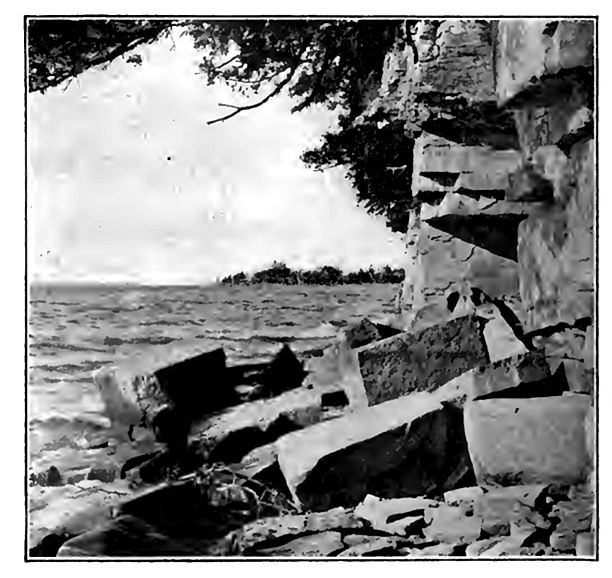
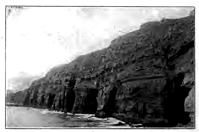
Topographic features developed by wave-erosion. As the waves cut into the shore at and near the water-level, they develop a steep slope above the line of cutting. This steep slope is the seacliff (Figs. 247 to 250). The term lake cliff is applied to the corresponding cliffs of lakes.
[p. 304]
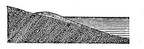
The height of the cliff depends on the height of the land on which the sea is advancing. Its slope may be steep or gentle (Figs. 247 and 248), according to the nature of the material of which it is composed and the rapidity of the cutting. Rapid cutting and resistant material tend to produce steep cliffs; but incoherent materials, such as sand and clay, may form steep cliffs if the cutting is rapid. The structure of the cliff-rock also influences the slope and configuration of the sea-cliff.
[p. 305]

[p. 306]
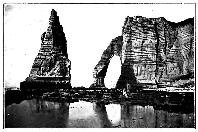
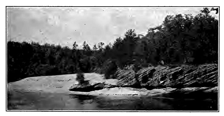
By working in along the joints of the rock, widening them and quarrying out the intervening blocks, pillars of rock (“chimney-rocks”, “pulpit-rocks”), or even considerable islets are sometimes isolated by the waves (Figs. 251 and 252).
Waves sometimes excavate caves at the bases of cliffs. The bottom and roof of a sea-cave usually have a pronounced inclination landward, and if the cliff is low, the cave may be extended landward until its roof is pierced. Through such an opening in the top of the cliff the water of the incoming waves may be forced in the form of spray. On the New England coast, such holes are sometimes known as “spouting horns.” Similar openings may be made, as already pointed out, by the compression or rarefaction of the air in the cave as the wave enters or retreats. The cave, the “spouting horn,” the “pulpit-rock,” and other isolated islets, are all closely associated with the sea-cliff in origin.
The bottom of the sea-cliff is bordered by a submerged platform over which the water is shallow. This platform, or at any rate its landward portion, represents the area over which the water has advanced as the result of wave-cutting, and is, therefore, known as the wave-cut terrace. Such a terrace is the necessary accompaniment of the cliff. Wave-cut terraces may become land by elevation, or by the lowering of the level of the sea (Fig. 253). Elevated sea-cliffs with wave-cut terraces at their bases are among the best evidences of change of relative level between water and land.
Wave-erosion and horizontal configuration. The structure of the rock along shore has much to do with the horizontal configuration of the wave-shaped coast. In general, waves develop re-entrant a in the weaker portions of the shore, leaving the more resistant parts as headlands (Fig. 1, PL XIX). It is to be noted that the resistance of rock to wave-erosion is not determined by its hardness alone. Every division plane, whether due to bedding, to jointing, or to irregular fracture, is a source of weakness to the rock, and rock of great hardness may be so broken as to offer relatively little resistance. A coast which is regular and of equal exposure, but of unequally resistant material, will be made irregular by the waves. A regular coast of uniform material, but unequal exposure, will be made irregular by greater cutting at the points of greater exposure. A coast of marked irregularity and homogeneous material will be made more regular by the cutting off of the projecting points, because they are most exposed. With a given set of conditions, waves tend to develop a certain sort of shore-line which, so far as its horizontal form is concerned, is relatively stable. Such a shoreline may be said to be mature[10] so far as wave-erosion is concerned.
[p. 307]
Since coastal lands are, in general, both heterogeneous and unequally exposed, a mature coast-line is somewhat irregular.
Since the conditions of erosion along coasts are constantly, even if slowly, changing, maturity is constantly being approached, but rarely reached. Other forces and processes, such as those of aggradation, vulcanism, and diastrophism, are in operation along coasts, and their results are sometimes antagonistic to those of the waves. The horizontal configuration of coasts is, therefore, the result of many co-operating forces, of which waves are but one. It is, nevertheless, important to note the end toward which the waves are working, even though they are continually defeated in their [p. 308] attempt to reach it. Their immediate goal is maturity of configuration; their final goal is the destruction of the land and the deposition of its substance in the sea.
Transportation. The material eroded from the shore by the waves is transported by the joint action of waves, undertow, and shore-currents.
The incoming wave begins to shift material where it begins to drag bottom. From the line where transportation begins, to the line of breakers, detritus at the bottom is shifted toward the shore by the waves, while the undertow tends to carry it back again. The result of these opposed tendencies is to keep sediment moving back and forth between the shore and the line of breakers. The advance and retreat of waves which come in at right angles to the shore do not move sediment along the shore; but oblique waves and littoral currents shift it along shore. The direction of movement is readily inferred from Fig. 244. The direction in which debris is shifted by waves and shore-current is modified by the undertow, and the direction which would result from undertow and current is modified by the wave. It is often the waves of storms, rather than those of the prevailing winds, which determine the direction of greatest shore transportation.
The waves, the undertow, and the littoral currents work together in assorting the detritus of the shore. If the coarsest parts are beyond the power of all but the strongest waves, they accumulate where agitation is great. Less coarse parts are carried farther from the site of greatest agitation, but no materials which are classed as coarse are carried beyond the depth of sensible movement. The coarse material which covers the bottom where the agitation of the water at the bottom is effective, constitutes shore drift, whether derived from the shore by the waves, or brought to the sea by streams.
The material which is fine enough to be held in suspension is measurably independent of depth. This is shown during storms when the water becomes turbid far beyond the line of breakers, and clears only after the waves have died away.
The sorting of shore drift, effected while it is in transportation, is often very perfect. The conditions favoring assortment are (1) [p. 309] vigorous wave-action, (2) prolonged transportation, and (3) a moderate volume of sediment.[11]
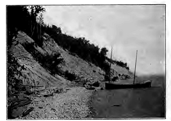
Deposition by waves, undertow, and shore-currents. The zone occupied by the shore drift in transit is the beach. Its lower margin is beneath the water, a little beyond the line where the great stormwaves break. Its upper margin is at the level reached by storm [p. 310] waves, and is usually a few feet above the level of still water. Material is brought to the beach from seaward by incoming waves, and from it detritus is carried out by the undertow. The crosssection of a beach is shown in Fig. 255. The beach follows the general boundary between water and land, though it does not conform to its minor irregularities (Figs. 240 and 254). The beach (or barrier) often causes the deflection of the lower courses of streams descending to it.
In its deposition, the shore drift assumes various forms. Where the bottom near shore has a very gentle inclination, the incoming waves break some distance from the shore-line, and it is here that the most violent agitation occurs when the waves are strong. To this line of breakers, material is shifted from both directions. Accumulating here, it builds up a low ridge, called the hairier (Fig. 256) . If it is built up above the surface of the water by storm-waves, it may shut in a lagoon behind it, and this may ultimately be filled by sediment washed down from the land. At one stage in the filling, the lagoon becomes a marsh (Fig. 258).
The disposition of shore deposits depends largely on the currents at and near shore. If the coast-line is deeply indented, the littonil current usually fails to follow the re-entrants. In holding its course across the mouth of a small bay, a shore-current usually passes into deeper water. Here its velocity is checked because its motion is communicated to the water beneath it, and, a larger amount of water being involved in the motion, the motion of each part is diminished. If sediment was being moved along its bottom before the current was checked, some part of it is dropped when and where the current is slackened. It follows that deposition commonly takes place beneath a littoral current as it crosses the mouth of a bay. The belt of deposition is often narrow, and the result is the construction of a ridge beneath the water in the direction of the current. The current would never build the embankment up to the water-level, but when its surface approaches the level of effective agitation, the waves may build it up to, and even above the surface of the water. So long as the end of such an embankment is free, it is a spit. The construction of a spit has been aptly compared to the construction of a railway embankment across a depression. The material is first carried out from the bordering upland (in this case the shallow water) and dumped where the slope to the depression (deep water) begins. The embankment thus begun is extended by the carrying out of new material, which is left at the end of the dump already made, as at the end of a railway grade.
[p. 311]
[p. 312]
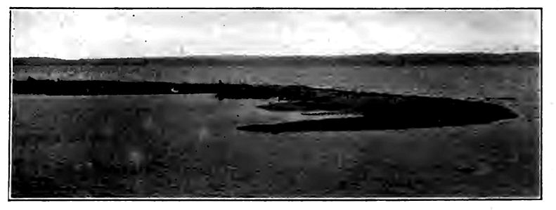
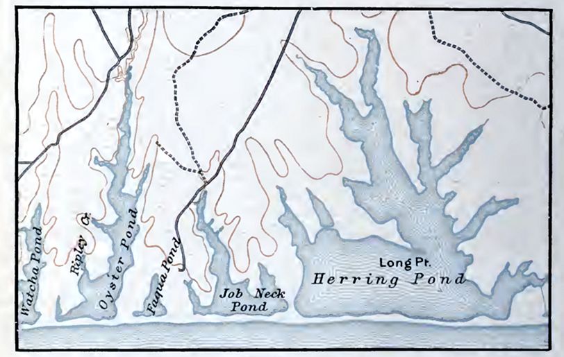
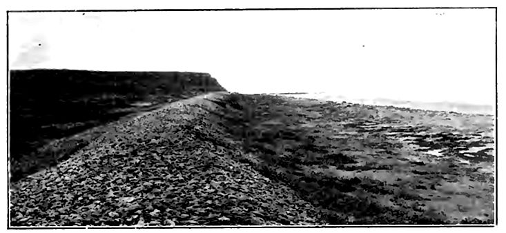
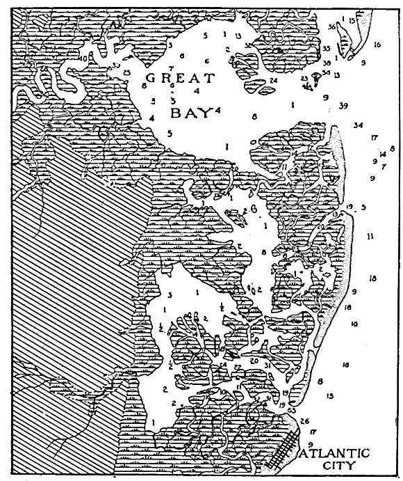
The spit is normally either straight or parallel with the general course of the shore-current, but since the littoral current is subject to change with the shifting of the winds, the spit may depart from straightness. Winds which simply reverse the direction of the littoral current retard its construction; but if a strong current [p. 313] flows past the end of a spit, it may cut away its extremity and rebuild the materials into a smaller spit, joining the main one at an angle. This gives rise to a hook (Fig. 259). Successive storms may develop successive hooks along the side of a growing spit. The end of a hook may be so extended as to join the mainland, when it becomes a loop. If the spit is lengthened until it crosses, or nearly crosses, the bay, shutting it off from the open water, it becomes a bar. Bars have shut in lakes (ponds) on the coast of Martha’s Vineyard, Mass. (PI. XX), and lakes, ponds, and lagoons at numerous points both on the Atlantic and the Pacific coasts. The same phenomena are to be seen along many lake shores (Fig. 260). Bars sometimes tie islands to the mainland (PI. XIX,Fig. 2).
If the bay across which the bar is built receives abundant drainage from the land, the outflow from the bay may be sufficient to prevent the completion of the bar, for when the growth of the bar has sufficiently narrowed the outlet of the bay, the sediment brought to the end of the spit by the littoral current will be swept out beyond the spit by the current setting out from the bay. The completion of a bar may be interfered with also by tidal currents, [p. 314] even without land-drainage. The scour of the tides often preserves deep entrances (inlets) to bays, and maintains definite channels or “thorofares” in the lagoon marshes behind barriers and spits. The sediment brought down from the land, as well as that washed in by tidal currents and waves, tends to fill up the lagoon behind a barrier, a spit, or a bar, converting it into land (Fig. 258).
Since spits and bars are built only where there is shore-drift in transit, they are always built out from a beach or barrier. The distal end of the bar may also join a beach or barrier. Traced back to its source, the beach from which a spit leads out is often found to terminate in the cliff from which the material of the beach and the spit were derived. In such cases the sediment of the beach has been shifted but a short distance; but in other cases it has traveled far.
The off-shore movements of shore-waters may leave the sediment of the shore in the form of a wave-built terrace, which is really a seaward extension of the beach. The wave-built terrace often borders the wave-cut terrace along its seaward margin (Fig. 247). Terrace-cutting and terrace-building are both involved in the development of the continental shelves.
Beach ridges, spits, bars, etc., like sea-cliffs and wave-cut terraces, are often preserved after the relative level of sea and land has changed. If the shore has risen, relatively or absolutely, these features are evidence of the change. If shore features are submerged instead of elevated, they furnish less accessible though not less real evidence of the change of level. Similar features about lakes have a like significance, but in this case it is often demonstrable that it is the water rather than the land which has changed its level.
Effect of shore-deposition on coastal configuration.[12] The tendency of shore-deposition is to cut off bays and to straighten and simplify the shore-lines. This is abundantly illustrated along the Atlantic and Gulf coasts of the United States (Figs. 240, 254, and PL XX). It is to be noted, however, that in the simplification of the shore-line through deposition, the initial stages often result in great irregularity (Fig. 254 and PI. XIX,Fig. 2).
[p. 315]
The Work of Ocean-currents
As agents of erosion, ocean-currents are not of great importance. Currents which reach the bottom are comparable, in their effects, to rivers of the same velocity and volume; but most ocean -currents do not touch bottom, and therefore do not erode it. Only where they flow through narrow and shallow passageways is their abrasive work considerable. Thus the Gulf Stream has a velocity of four or five miles per hour where it issues from the Gulf, and its shallow and narrow channel is current-swept. The abrasive power of the Gulf Stream is known to continue somewhat beyond its narrow channel, for on the Blake Plateau (between the Bahamas and Cape Hatteras). where the water is 600 fathoms and less in depth, “the bottom of the Gulf Stream … is swept clean of lime and ooze and is nearly barren of animal life.” [13] Other illustrations of the erosive power of currents have been noted near Gibraltar in water 500 fathoms deep, and between the Canary Islands at depths of 1000 fathoms.[14] In spite of these examples, and of many others which probably exist in similar situations, it yet remains true that ocean-currents are on the whole but feeble agents of erosion.
Ocean-currents are scarcely more important in transporting than in eroding, for they carry little except that which they erode, if the life which inhabits them is left out of consideration. Currents which do not touch bottom roll no sediment, and carry only what may be held in suspension. A river’s power of transporting sediment in suspension is due largely to cross-currents occasioned by the unevenness of its resistant bottom. If a particle of mud in suspension in a river drops to the bottom, as it frequently does, it may be picked up again and carried forward. If, on the other hand, a particle in suspension in an ocean-current once escapes the moving water by settling through it, the current which does not drag bottom has no chance to pick it up again. Very fine sediment may be carried by an ocean-current far beyond the point where it was acquired, but currents which do not touch bottom [p. 316] are rarely strong enough to hold any but the finest material for any considerable length of time. As transporters of sediment, therefore, ocean-currents are at a great disadvantage as compared with rivers.
How readily particles of extreme fineness may be kept in suspension, and how little agitation is necessary to keep them from sinking, is shown both by experiment and observation. Experiment has shown that fine particles of clay require days to settle a foot in still water, and the Challenger found fine sediment derived from the land 400 miles from the coast of Africa. Sediment settles more readily in salt water than in fresh, despite the fact that the former is heavier. This is presumably because the salt diminishes the cohesion of the water.[15]
Deposition by ocean-currents is limited by their transportation. Only where they erode their bottoms do they gather coarse materials, and only in the lee of such places are their deposits coarse. Since the material which they carry is generally fine, it is widely distributed before deposition.
¶ Deposits on the Ocean-bed
The deposits on the bed of the ocean may be divided into two classes according to the depth of water in which they are made.[16] Shallow-water deposits are made in water less than about 100 fathoms deep, and deep-sea deposits are laid down in water of greater depth. The selection of the 100-fathom line as the dividing depth is less arbitrary than it seems, for passing outward from the shore, it is at about this depth that the bottom ceases to be commonly disturbed by the action of currents and waves; that sunlight and vegetable life cease to be important at the bottom; and that the coarser sediments which predominate along shore give place, as a rule, to muds and oozes. Furthermore, the 100-fathom line (or some line very near it) is an important one in the physical relief of the globe, for it appears to mark, approximately, the junction [p. 317] of continental plateaus and ocean-basins. Because the latter are a little- overfull, the water runs over their rims, covering about 10,000,000 square miles of the borders of the continental protuberances.
Aside from the deposits made by organisms, shallow-water deposits are divisible into two groups — (1) those immediately along the shore, the littoral deposits, and (2) those made between the littoral zone and the 100-fathom line. Both are terrigenous chiefly, though chemical and organic deposits occur in both zones. The deep-sea deposits likewise are divisible into two principal groups, (1) the terrigenous deposits near the land, and (2) the pelagic deposits, made up chiefly of the remains of pelagic organisms, and the ultimate products arising from the decomposition of rocks and minerals. The former predominate in the less deep waters relatively near shore; the latter in the deeper water far from land. The shallow- and deep-water deposits grade into each other in a belt along the 100-fathom line.
Shallow-water Deposits
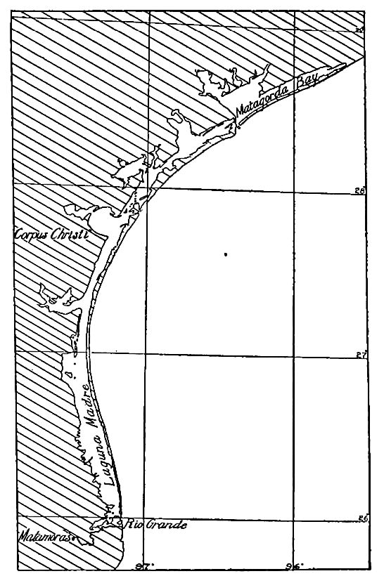
Littoral deposits. The littoral zone is often defined as the zone between high- and low-water marks, but in common speech, the very shallow water a little farther from the coast-line is often included. It is the zone in which bowlders, gravels, sands, and all coarser materials accumulate, though muds are occasionally met with in sheltered estuaries. Generally speaking, the nature of these deposits is determined by the character of the adjoining lands and the nature of the local organisms. The heavier materials brought down by rivers or worn from the shore by waves are here spread out by waves and shore-currents. Twice in the twentyfours hours the littoral zone is covered by water, and twice parts of it are exposed to the direct rays of the sun or the cooling effects of the night. Physical conditions in general are here most varied. Still greater diversity is introduced by the fact that the zone is inhabited by both marine and terrestrial organisms, while the evaporation of the sea-water which flows over tidal marshes and lagoons leads to the formation of saline deposits. The length of the coast-lines of the world is some 125,000 miles (about 200,000 [p. 318] kilometers), so that the zone of littoral deposits, though narrow, covers a very considerable area.
Mechanical deposits in shallow water beyond the littoral zone. These deposits are made between the littoral zone and the 100fathom line, and cover an area of about 10,000,000 square miles.[17] Their composition is much the same as that of the littoral deposits with which they are continuous, except that they are finer. At their lower limit they pass insensibly into the fine deposits of the deep sea. Coarse materials, such as gravel and sand, prevail, though in depressions and inclosed basins, and out toward the oceanward edge of the zone, muddy deposits are found. Some of the deposits are composed wholly of inorganic debris, but organic remains are freely mingled with others. The mechanical effects of tides, currents, and waves are everywhere present, but become less and less well marked as the 100-fathom line is approached. The forms of vegetable and animal life are numerous, though the former decrease as depths which make the sunlight feeble are approached.
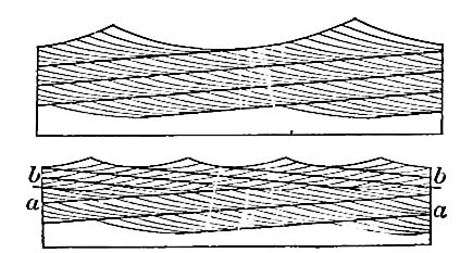
As a rule, no definite line marks the seaward terminus of the coarse detritus, since coarse material is carried farther out when the waves run high (and the undertow is strong) than when they are feeble. In calm weather, therefore, fine sediment may be deposited where coarse had been laid down in the preceding storm, only to be covered in turn by other deposits of a different character. Thus gravel grades off into sand, with more or less overlapping or interwedging, and sand grades off into silt in the same way. This is diagrammatically illustrated by Fig. 261.
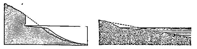
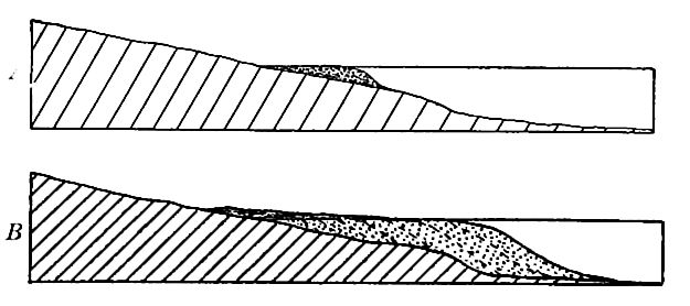
Since coarse deposits may extend far out from land where the waves are strong and the water shallow, and since the zone of [p. 319] shallow water may be extended seaward by the aggradation of the bottom, shallow-water deposits may cover extensive areas. They may become deep at the same time, for as the outer border of the shallow-water zone is shifted seaward by aggradation, the vertical space to be filled becomes greater (compare A and B,Fig. 262). Again, if the coast is sinking, new deposits of coarse material may be made on older ones. In this way, also, great thicknesses of sediment may be accumulated, all parts of which were deposited in shallow water. The great thicknesses of some of the conglomerate beds of the past show how far this process may go.
[p. 320]
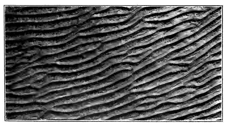
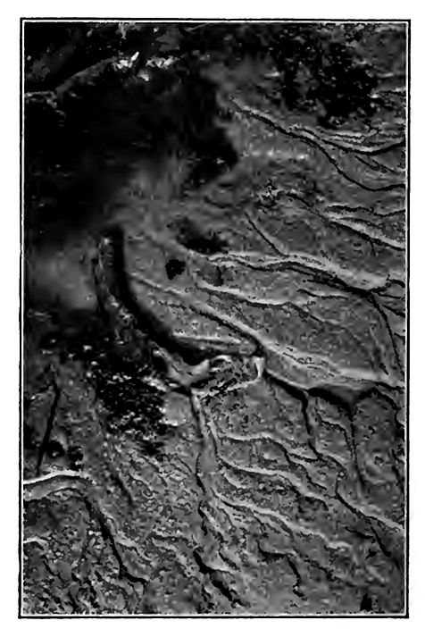
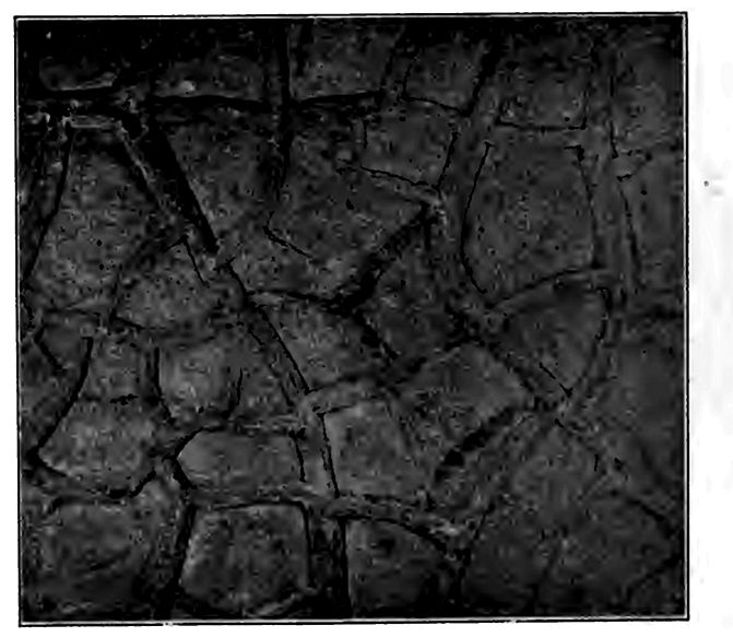
Characteristics of shallow-water deposits. Clastic sediments laid down in shallow water have several distinctive characteristics. While they are, in the aggregate, coarse, they are characterized by frequent variations in coarseness. The surfaces of successive beds are likely to be ripple- and rill-marked (Figs. 263 and 264),and cross-bedding (Figs. 265 and 266) is common. Clayey sediments accumulated between high and low water are often suncracked (Figs. 267 and 268), and the tracks of land animals are sometimes preserved on their surfaces. Shallow-water deposits often contain fossils of organisms which live in waters of slight depth. These characteristics are sufficient to differentiate sedimentary formations made in shallow water from those made in deep water, even after they have been converted into solid rock, and after the rock has emerged from the sea. Many of these characteristics are, however, shared by deposits made by streams on land. Subaerial and lacustrine sediments are usually distinguishable from those made in the sea by their fossils, and sometimes by their distribution.
[p. 321]
Topography of shallow-water deposits. The shallow-water deposits have, on the whole, a rather plane surface, though there are some notable departures from flatness. The steep slopes of the delta fronts and of wave-built terraces have already been spoken of. Barriers often shut in depressions, and the disposition of the material deposited is sometimes uneven, owing to shore and tidal currents. The result is that the surface of the shallow-water deposits is often affected by low elevations and shallow depressions. The elevations and depressions may be elongate, circular, or irregular in form. This topography is sometimes preserved on newly emerged lands.
[p. 322]
[p. 323]
Chemical and organic deposits in shallow water. There is no sharp line of distinction between the deposits usually classed as chemical and those classed as organic. The latter are chemical in the broader sense of the term, but as they are immediately associated with life and are dependent upon it, it is a matter of practical convenience to separate them. Aside from the organic deposits, the chemical deposits made in shallow sea-water embrace (1) those due to evaporation, and (2) those due to chemical reactions between constituents so brought together that new and insoluble compounds are formed and precipitated.
The chemical deposits made in the shallow water of the sea, or in bodies of shallow water isolated from the sea, are chiefly simple precipitates resulting from evaporation. All substances in solution are necessarily precipitated on complete evaporation; but since the sea-water is in general far from saturation, so far as all its leading salts are concerned, only a few are thrown down in quantity sufficient to be of geological importance where evaporation is incomplete. The principal deposits of this sort are calcium carbonate (limestone, CaC03) and sulphate (gypsum, CaS04, 2H20), common salt (rock salt, NaCl), and the magnesium salts, usually the chlorides or sulphates.
While there is more than ten times as much lime sulphate as lime carbonate in the ocean (p. 289), deposits of the carbonate (including shells, coral, etc.,) have been very much greater than those of the sulphate. This is due to the following facts: (1) The sulphate is much more soluble in natural waters than the carbonate, (2) rivers bring much more carbonate than sulphate to the sea, and (3) marine plants and animals extract lime carbonate from the water for their skeletons, shells, etc. The secretion of lime carbonate by organisms is not dependent on the saturation of the water, but may be carried on when the amount in solution is very small, [p. 324] The chief deposits of lime carbonate have been made through the agency of plants and animals, in the form of shells, coral, bones, teeth, and other devices for supporting, housing, protecting, and arming themselves; but while it is agreed that the larger part of the lime carbonate deposited in the open sea is of organic origin, it is equally clear that in closed seas subject to concentration from evaporation, simple precipitation may take place. There is difference of opinion as to the quantitative importance of this last class of deposits.
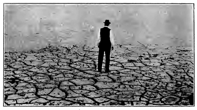
Gypsum appears to be deposited in quantity only in the basins of arid regions where concentration reaches an advanced state. Since normal sea-water is far from saturation with common salt, the latter is precipitated only in lagoons, in closed seas, or other situations favorable to great concentration. This is, as a rule, only in regions which are notably arid. It follows that deposits of salt usually signify highly arid conditions, and where they occur over wide ranges in latitude and longitude, as in certain periods of the past, general aridity of climate is inferred. Where confined to limited areas, their climatic significance is less, for topographic conditions may determine local aridity. The total area where salt is now being precipitated is small, though on the whole the present is probably a rather arid period of the earth’s history. On the other hand, ancient deposits of salt preserved in the sedimentary strata show that the area of salt deposition has been much more considerable than now at one time and another in the earth’s history. The salt and gypsum deposits of the past seem, therefore, to tell an interesting tale of the climates of the past.
The magnesium salts are among the last to be thrown down as the sea-water is evaporated, and they most commonly take the form of sulphates and chlorides. They often form double salts with potassium, a relatively small and soluble constituent of sea-water. In the artificial evaporation of salt water to obtain common salt, the process is usually stopped before the saturation point for the magnesium salts is reached, and the residue, the “mother-liquor,” or “bittern,” is drawn off to prevent these “bitter” salts from mixing with the common salt. The magnesium salts are among the last to be precipitated, not only because they are readily soluble, [p. 325] but because their quantity is small; yet in the original rock from which the sea-salts came, there is at least as much magnesium as sodium, while in the sea there is about five times as much sodium as magnesium. Just what becomes of all the magnesium in the sea-water is not well understood. In the earlier marine strata, u_, composed partly or wholly of the double carbonate of lime and magnesia (CaMg)CO3, abounds. This appears to have been formed by a gradual substitution of magnesium for calcium, in calcium carbonate, but just how and when and why the substitution was effected is not fully understood.
The plants and animals of the sea secrete notable quantities of silica. Deposits of this sort are relatively more important in the deep sea than in shallow water, and will be mentioned in that connection.
Limestone. Something concerning the origin of limestone has already been given in the preceding paragraphs; but because of the importance of this formation, it may be added, by way of summary, that shallow seas free or nearly free from terrigenous sediment, and abounding in lime-secreting life, furnish the conditions for nearly pure deposits of limestone, and that most of the limestone within the areas of the present continents appears to have originated under such conditions. The common notion that limestone is normally a deep-water formation is a serious error. Although limestones are formed in deep as well as in shallow waters, the more important classes of lime-secreting organisms are limited to the depths to which light penetrates. In the shallow waters, these plants and animals are in part free and in part attached. Within the areas of deep water, they are free and at the surface- and their remains drop to the bottom if not sooner dissolved. But few forms live on the deep, dark, cold bottoms of the abysmal depths. Clear waters, free from abundant terrigenous sediments and abounding in lime-secreting life, rather than deep waters, are, therefore, the most favorable conditions for the origin of limestone.
The purely chemical deposits of limestone are probably all of shallow-water origin. Once made, they are subject to solution, re-deposition, and other mutations like other deposits. As a result, [p. 326] they often lose many of their original characteristics, but enough usually remain to tell the story of their origin.
Deep-sea Deposits
Contrasted with shallow-water deposits. The deep-sea deposits cover the ocean-bottom below the 100-fathom line. Their area is considerably more than half the earth’s surface. The characteristic deposits are muds, organic oozes, and clays, which, in their physical characteristics, are remarkably uniform. Gravels and sands are rarely found. In regions of floating ice, some diversity is introduced from the varied nature of the materials which it transports. Vegetable life is limited to the surface waters, while animal life is present in them and on the bottom, but absent or nearly so in the great middle zone between. The temperature of the bottom is below 40° Fahr. throughout the larger part of the ocean, and subject to little variation. The conditions over the sea-bottom are therefore very uniform.
In consequence of the slow accumulation of sediment on the deep-sea bottom, the absence of transportation there, and the nature and small size of the particles, many evident chemical reactions take place, resulting in the formation of many secondary products, such as glauconite, phosphatic and manganic nodules, zeolites, etc. The amount of matter arising from the decomposition and alteration of minerals and rocks increases, relatively, with increase of distance from the land. At the same time there is an increase (relative), in all moderate depths, of the remains of pelagic organisms. We thus pass insensibly from deep-sea deposits of a terrestrial origin (terrigenous deposits) near the land, to pelagic deposits, “in which the remains of calcareous and silicious organisms, clays, and other substances of secondary origin play the principal role.”[18]
The following table [19] shows the relations of the various groups of marine deposits.
[p. 327]
| 1. Deep-sea deposits beyond 100 fathoms |
Red clay Radiolarian ooze Diatom ooze Globigerina ooze Pteropod ooze Blue mud Red mud Green mud Volcanic mud Coral mud |
I. Pelagic deposits formed in deep water , removed from land II. Terrigenous deposits formed in deep and shallow water, mostly close to land |
| 2. Shallow-water deposits between low- water mark and 100 fathoms |
Sands, gravels, muds, etc. |
II. Terrigenous deposits formed in deep and shallow water, mostly close to land |
| 3. Littoral deposits between high- and low- water marks |
Sands, gravels, muds, etc. |
In spite of this classification of Murray, the coral and volcanic muds cannot be regarded as terrigenous, and shells, coral, etc., are found abundantly in shallow-water deposits. It is to be noted that the pelagic deposits are partly inorganic and partly organic in origin. The inorganic materials may be of mechanical or chemical origin.
Mechanical inorganic deposits. The mechanical deposits of the deep sea come (1) from the land by the ordinary processes of gradation, (2) from volcanic vents, and (3) from extra-terrestrial sources. The terrigenous materials which reach the deep sea are, as a rule, only the finest products of land decay, and are carried out by movements of water and by winds. They are not commonly recognized in the dredgings more than 200 miles from shore, but opposite the mouths of great rivers they extend much farther, — 1,000 miles in the case of the Amazon. They are especially abundant on the slopes of the continental shelves, where the blue, green, and red muds are associated with volcanic and coral muds. The color of these various muds depends in part on the changes they have undergone since their deposition. The green muds usually contain enough glauconite to give them their color, and are most commonly found off bold coasts where sedimentation is not rapid. The blue muds indicate lack of oxidation, or perhaps deoxidation. Red muds are not common, though found in some situations. These deposits are analogous, in a general way, to certain shales, marls, etc., found on the continents.
[p. 328]
The occasional presence of coarse materials derived from the land in the deep-sea deposits must be looked upon as in some sense accidental. ’ Pebbles, or even bowlders, entangled in the roots of floating trees, may be carried out into the ocean, and icebergs carry out bowlders and smaller fragments of rock. The amount which icebergs might carry, if fully loaded, is far greater than the amount which they do carry.
Of the identifiable inorganic materials among the pelagic deposits, those of volcanic origin are most abundant, and among these the most common is pumice, which often floats readily until it becomes waterlogged. Pieces of pumice brought up from the bottom and thoroughly dried, will float for months in sea-water. The next most abundant substance of volcanic origin in pelagic deposits is volcanic glass. This ranges from pieces of the size of a walnut down to the smallest fragments, which often serve as centers for concretions. Lapilli (cinders) and volcanic ash also abound in parts of the deep sea. The distribution of these volcanic products is essentially universal, though by no means uniform. Some of them are probably from submarine volcanoes.
The deep-sea deposits contain many nodules and grains which are believed to be of extra-terrestrial origin. Many of them are magnetic.[20] The dust of the countless meteors which enter the atmosphere daily settles on land and sea alike, and must enter into the sediment at the bottom of the latter. It is probably no more abundant in deep water than in shallow, but it is relatively more important, since other sedimentation is meager. The number of meteorites which enter the atmosphere daily has been estimated at from 15,000,000 to 20,000,000.[21] If, on the average, the meteorites weigh ten grains each, probably a rather high estimate, the total amount of extra-terrestrial matter reaching the earth yearly would be 5,000 to 7,000 tons, and something like three-fourths of this must, on the average, fall into the sea. But even at this rate it would take some fifty billion years to cover the sea-bottom with a layer one foot in thickness.
[p. 329]
Organic constituents of pelagic deposits. With increasing distance from shore, and especially with increasing depth of water, terrigenous deposits become less and less abundant, and sediments derived from pelagic life increase in relative importance. Beyond the upper part of the outer slopes of the continental shelves, the deep-sea deposits are made up largely of the secretions of marine organisms which live in the surface-waters. Pelagic molluscs, foraminifera, and algae secrete lime carbonate, while diatoms and racliolarians secrete silica. When the organisms die, they sink to the bottom and their secretions are mingled with the volcanic and other materials which are universal over the sea-floor.
Pelagic deposits of organic origin are named according to their characteristic constituents. Thus there are pteropod oozes, globigerina oozes, diatom oozes, radiolariari oozes, etc. It is not to be understood that these oozes are made up exclusively of the shells which give them their names. Diatom ooze is an ooze in which the secretions of diatoms are abundant, not an ooze made up wholly of these secretions; and globigerina ooze is an ooze in which globigerina shells are abundant, though in many cases they do not make up even the bulk of the matter. While samples of these various oozes might be selected which are thoroughly distinct from one another, there are all gradations between them, since pelagic life does not recognize boundary lines.
It is a significant fact that with increasing depth the proportion of lime carbonate in the ooze decreases. Thus in tropical regions remote from land, where the depths are less than 600 fathoms, the carbonate of lime of the shells of pelagic organisms may constitute 80% or 90% of the deposit. With the same surface conditions, but with increasing depth, the percentage of lime carbonate decreases, until at 2,000 fathoms it is less than 60%; at 2,400 fathoms, 30%, and at 2,600 fathoms, 10%. Beyond this depth there are usually no more than traces of carbonate of lime. The data at hand show that the percentage of lime carbonate falls off below 2,200 fathoms more rapidly than at lesser depths. When the percentage of lime carbonate becomes very low, the calcareous oozes grade off into the red clay with which the sea-floor below 2,400 to 2,600 fathoms is covered.
[p. 330]
Chemical deposits. The chemical deposits of the deep sea are chiefly the alteration products of sediments which reach the seabottom by mechanical means. All sediment deposited in the sea undergoes more or less chemical change, but it is only when the change is very considerable that the product is referred to this class. Where sedimentation is rapid and the sediment coarse, the chemical change is relatively slight; but where the sedimentation is slow and the sediment fine, the chemical change is relatively great; for both the longer exposure to the sea-water and the greater proportion of surface exposed to attack, favor change.
The red clay already referred to belongs to this class of deposits. Its origin has been the subject of much discussion. It contains much volcanic debris, various concretions, bones of mammals, zeolitic crystals, and extra-terrestrial spherules, and doubtless the insoluble parts of the shells of pelagic life; but it is still a mooted question how far the clay itself is the product of decomposed shells, and how far the altered product of pulverized pumice, volcanic ash, dust, etc. Pelagic life does not seem to be less abundant at the surface where the water is deep than where it is shallow, and it would appear that the shells must sink in such situations as elsewhere. If the lime carbonate of globigerina ooze is removed by dilute acid, the inorganic residue is similar to the red clay in the ocean-bottom. This suggests that owing to the more complete solution in the very deep water, the lime carbonate of the shells has been dissolved, leaving as a residuum material which makes up a part of the red clay. The more complete solution at the bottom might be the result either of the greater pressure, or of a greater percentage of C02 in the water due to emanations from the seafloor, or to both; but the rather sudden transition from oozes to red clay, with increasing depth, does not seem to be fully explained by these assumptions. The study of the dredgings has inclined the students of these materials to the conclusion that volcanic materials, rather than shells, are the principal source of the red clay.[22] The volcanic materials are thought to have accumulated slowly, and to have been long exposed to the action of sea-water.
[p. 331]
The various nodules and crystals in the clay are believed to be secondary products, the materials for which were derived from the decomposition of the sea sediments. Eolian dust, or the materials derived from it by chemical alteration, is doubtless a constituent of the red clay.
It is a significant fact that deposits corresponding to those of the deep sea have not been identified with certainty among the rock formations of the land. If such deposits are really absent from the land, as they seem to be, their absence must mean that the continents have never been beneath deep seas. That large parts of them have been beneath shallow sea-water is abundantly attested.
Map work. The topographic features of shores find ample illustration on maps. The Topographic Sheets of the U. S. Geological Survey listed on page 335 of the junior author’s Physiography afford good illustrations. So also do Plates CXXX to CLIV of Professional Paper 60, U. S. Geological Survey.
¶ Notes
Much information on these and other points is to be found in the following books: Wild’s Thalassa; Thompson’s Depths of the Sea; Barker’s Deep Sea Soundings, and Maury’s Physical Geography. Agassiz’s The Three Cruises of the Blake, and the Challenger Reports give much more detailed information for certain regions. ↩︎
Dittmar, Challenger Reports, Physics and Chemistry, Vol. I, p. 204. ↩︎
Murray, Scot. Geog. Mag., Vol. IV, p. 39. ↩︎
Murray, Scot. Geog. Mag., Vol. Ill, p. 70. ↩︎
J. Geikie, Earth Sculpture, p. 329. ↩︎
In the following pages concerning the waves and their work, Gilbert’s discussion of shore features, in the Fifth Annual Report of the U. S. Geol. Survey, pp. 80-100, is freely drawn on. Another incisive discussion of certain shore phenomena is that of Fenneman, Jour, of Geol., Vol. X, pp. 1-32. ↩︎
Willis, Jour, of Geol., Vol. I, p. 481. ↩︎
Dana, Manual of Geology, 4th. ed., p. 219. ↩︎
Shaler, Sea and Land, p. 29. ↩︎
Gulliver, Shore Line Topography; Proc. Am. Acad. Arts and Sci., Vol. XXXIV, 1899, pp. 151-258. A valuable study of shore-line topography. ↩︎
Willis, Jour, of Geol., Vol. I, p. 481. ↩︎
For map work on topographic features of shores, see end of Chapter. ↩︎
Agassiz, Three Cruises of Ike Blake, Vol. I, p. 259. Agassiz would ascribe the Blake Plateau itself to the Gulf Stream, p. 138. See also Am. Jour. Sci., Vol. XXXV, 1888, p. 498. ↩︎
Reade, Phil. Mag., Vol. XXV (1888), p. 342. ↩︎
The reason usually assigned is the “flocculation” of the fine sediment, but there is reason to doubt this explanation. ↩︎
Murray, Challenger Report, Deep Sea Deposits, pp. 184, 185. ↩︎
Murray, loc. cit., pp. 187-188. ↩︎
Murray, Challenger Rept., Deep Sea Deposits. ↩︎
Ibid., p. 186. ↩︎
Challenger Report, Deep Sea Deposits, p. 327. ↩︎
Young’s Astronomy, p. 472. ↩︎
Murray, Challenger Report on Deep Sea Deposits, p. 337 et seq., and Buchanan, Proc. Roy. Soc. Edin., Vol. XVIII, pp. 17-39. ↩︎