Public domain
[p. 110]
The average amount of precipitation on the land is estimated at about 40 inches per year. A part of this water sinks beneath the surface, a part forms pools or lakes on the surface, a part runs off over the surface at once, and a part of it is evaporated. The proportion of the rainfall in any given place which follows each of these courses depends on several conditions, among which are (1) the topography of the surface, (2) the rate of rainfall (or the rate at which the snow melts), (3) the porosity of the soil or rock, (4) the amount of water which the soil contains when the rain falls or the snow melts, (5) the amount of vegetation on the surface, and (6) the dryness of the atmosphere. The steeper the slopes, the more rapid the rainfall, the less porous the soil, the wetter it is, and the less the vegetation, the more water will run off without sinking beneath the surface.
The water which sinks into the ground becomes ground-water, while that which flows off over the surface without sinking is the immediate run-off. Much of the ground-water ultimately reaches the surface again, and some of it joins the immediate run-off in the streams. All the water which the streams carry, whether it has been beneath the surface or not, is the run-off. Whether the water which falls as rain stands on the land in lakes, runs off as rivers, or sinks beneath the surface, it is more or less active, and the results of its activity are seen on every hand.
¶ The Work of Running Water
Rivers are estimated to carry about 6,500 cubic miles of water to the ocean annually. The average height of land is nearly half a mile, and the waters which flow from the land to the sea therefore [p. 111] fall, on the average, nearly half a mile in their flow. Their energy is therefore great, and they are the great carriers of sediment from land to sea. The sediment which they carry is composed largely of decayed rock, but undecayed rock is sometimes worn away, especially where streams are very swift.
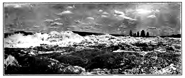
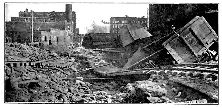
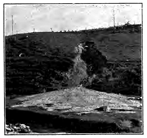
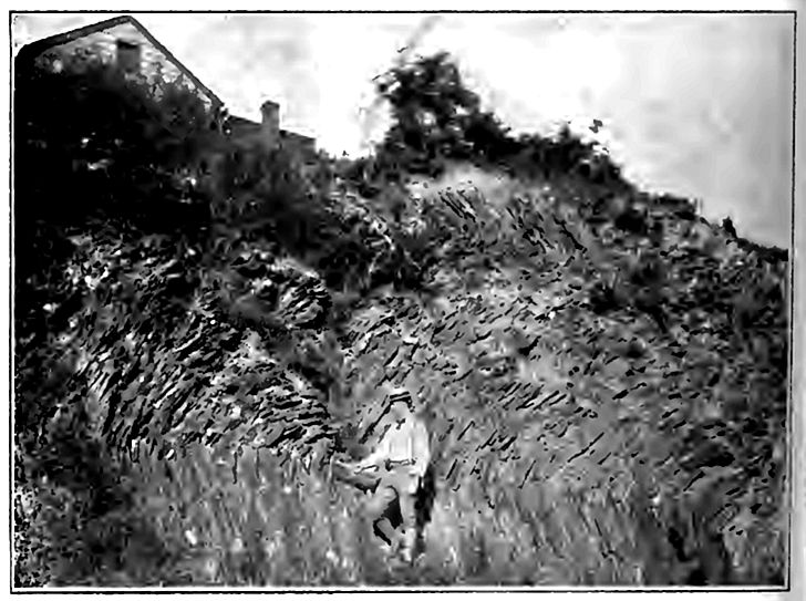
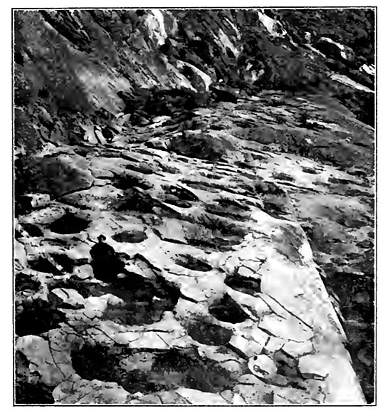
Though the flow of some streams is so gentle that they do not appear to work great changes in their valleys, others wear away their banks so rapidly that the changes they produce may be seen [p. 112] from year to year, or, sometimes, when the stream is in flood, from day to day. The force of streams at such times is often disastrous (Fig. 68). Occasionally they sweep away dams, bridges, and even buildings on their banks. The strong rods and beams of the bridges, and the steel rails of railways are bent almost as if they were twigs by the force of the occasional torrent which follows an exceptional rain, such as a cloudburst (Fig. 69) .
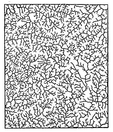
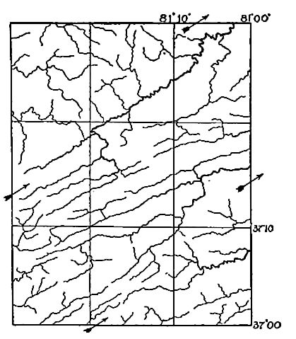
The source of river water is the rain and snow which fall from the atmosphere. This may be inferred from various familiar phenomena. Thus (1) streams are more numerous in regions where the rainfall is abundant than in those where it is scarce (Figs. 70-71); (2) multitudes of small streams spring into being with each heavy fall of rain and with each period of rapidly melting snow; (3) streams are notably swollen after rains, and most after heavy ones; and (4) many small streams which flow during wet weather dry up in times of drought, while others shrink. It is true that lakes, glaciers, and springs feed the rivers, but the lakes, glaciers, and springs derive their supply of water from precipitation.
[p. 113]
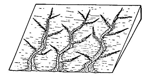
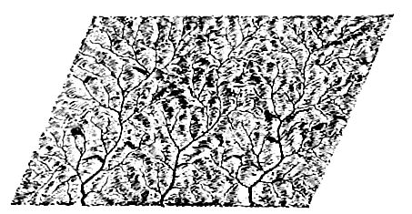
If the slope of a surface were perfectly even, the immediate run-off at any given time would flow in a sheet. There are slopes so smooth that water runs off them in this way; but on most slopes, even those which appear to be regular, there are small unevennesses, so that, although the run-off may start as a sheet, it is soon concentrated into rills and streamlets which follow the depressions. The smallest streamlets unite to form larger ones, and the little rills, after many unions with one another, reach valleys which have permanent streams. These may be small (creeks or brooks) or large (rivers) . Streams which flow but part of the time, as after a rain-storm, during wet weather, or during but a part of the year, are temporary or intermittent streams.
Every permanent stream and many temporary ones flow in depressions called valleys. Valleys are therefore about as numerous as streams. The very small depressions in which water runs only after showers are called gullies if they are very small (Fig. 72), or ravines if somewhat larger. Gullies and ravines are but small valleys, and just as the tiny streamlets unite to form creeks and these to form rivers, so the little gullies in which the smallest temporary [p. 114] streams flow, generally unite to form wider and deeper ones (Fig. 73). These, in turn, join one another and become ravines, which are but larger depressions of the same sort, and ravines lead to valleys, just as gullies lead to ravines. Valleys, like streams, usually end at the ocean or a lake; but in some cases, especially in arid regions, they end on dry land.
There is as a rule, some relation between the size of a valley and the stream which follows it, though this relation is not one which can be stated in mathematical terms. The large stream and the large valley go together so often, however, that the combination cannot be accidental.
¶ Erosive Work of Running Water
Wherever water flows over the land, it wears the surface on which it flows, and the faster it flows, the greater its power of [p. 115] erosion. The rate of flow is determined by several conditions, especially (1) the gradient (slope), (2) the amount and especially the depth of the water, and (3) the amount of sediment (load) it is carrying. The higher the gradient, the deeper the water, and the less the load it is carrying, the faster it flows. If it flows off in a sheet, as on a smooth surface, the depth of the water is slight, and the flow is not very swift (unless the slope is very steep), and the wear is correspondingly slight. Such wear is sometimes called sheet erosion.
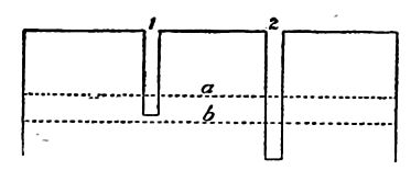
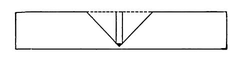
Beginning of a valley. 1 . If the slope of the surface is not uniform, the effect is very different. If there is, for example, a slight depression near the base of the slope (Fig. 75), more of the descending water flows through it than over other parts of the surface, and the greater volume of water following the depression would give it greater velocity. Greater velocity would cause greater erosion, and greater erosion would deepen the depression. The immediate result would be a gully or wash (Fig. 72) . So soon as the gully is started, it tends to concentrate drainage in itself still more, and it is thereby enlarged. The water which enters it from the sides widens it; that which enters at its head lengthens it by causing its upper end to advance up the slope ; and all which flows through it, deepens it. The enlarged gully will gather more water to itself, and, as before, increased volume means increased velocity, and increased velocity, increased erosion. As the gully grows, therefore, its increased size becomes the occasion of still further growth. Continued growth transforms the gully into a ravine, though there is no distinct line of demarkation between the two. But growth does not stop with ravine-hood. Water from every shower gathers in the ravine, and, flowing through it, increases its length, width, and depth, until it becomes a valley.
[p. 116]
It was assumed in the preceding paragraphs that the single depression in the slope was meridional and low on the slope; but almost any sort of depression in almost any position would bring about a similar result, since it would lead to concentration of the run-off. Had the original surface been marked by a ridge instead of a depression, the effect on valley development would have been much the same, for a ridge, like a depression, would cause the concentration of the run-off along certain lines, and therefore lead to the development of valleys.
Under the conditions represented in Fig. 75 the lengthening of the drainage depression is effected chiefly at its upper end, the head of the valley working its way farther and farther back into the land. This method of lengthening is known as head erosion. But the lengthening of the valley is not always wholly by head erosion. The gully begins normally where concentration of runoff begins, and if this is not at sea-level, the gully may be lengthening at both ends at the same time. This would have been the case, for example, had the original depression of Fig. 75 been halfway up the slope of the island. Valleys developed under the control of surface slope are consequent valleys, and their streams are consequent streams.
2. If the surface material of a slope is of unequal resistance, the water flowing over it may develop irregularities of slope, even if the slope was uniform at the outset. Thus if the material of a certain part of the slope is less resistant than that elsewhere, the run-off will erode most where the material is least resistant. The [p. 117] depression thus started will be a cause of its own growth, and, as before, the gully might develop into a valley.
In the presence of sufficient rainfall, therefore, either heterogeneity of" slope or of material will occasion the development of valleys. If lack of uniformity appears at but few points, there will be but few valleys; if at many points, the number of valleys will be large. Since it is unlikely that any great area of land ever had perfectly homogeneous material and absolutely uniform slopes, every considerable land area, affected for any considerable length of time by abundant rain, has had valleys developed in it; and the heterogeneity of material and slope is usually such that valleys are developed at short intervals.
The permanent stream. It appears from the foregoing discussion that a valley may be developed by the run-off of successive showers. If supplied from this source only, surface streams would cease to flow soon after the rain ceased to fall, and a valley might attain considerable size without possessing a permanent stream. How does the valley developed by the run-off of successive showers come to have a permanent stream? The answer to this question involves a brief consideration of that part of the rainfall which sinks beneath the surface.
If wells are sunk in a flat region of uniform structure and composition, the water in them is generally found to stand at a nearly common level. If a hole 60 feet deep fills with water up to a point 20 feet below the surface, it is because the material in which the well is sunk is full of water up to that level. When the well is dug, the water leaks into it, filling the hole up to the level to which the rock (or subsoil) is itself full. This level, below which the rock and subsoil (down to unknown depths) are full of water, is known as the ground-water level, or better, the ground-water surface, or water-table.
The ground-water surface fluctuates. It rises during wet weather, because more water sinks then; but several processes conspire to bring it down again. (1) Where there is growing vegetation, its roots draw up water from beneath; (2) evaporation goes on independently of vegetation; (3) the water is drawn out through wells, mines, etc., and runs out as springs; and (4) it flows underground from places where the water-table is higher to those where it is lower. In these and other minor ways the groundwater surface is depressed.
[p. 118]
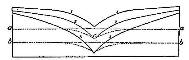
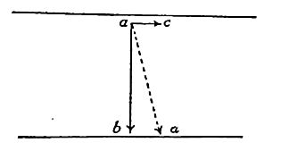
A well sunk to such a level as to be supplied with abundant water in a wet season may go dry during a period of drought because the ground-water level is depressed below its bottom. Thus either well shown in Fig. 76 will have water during a wet season when the waterlevel is at a; but well No. 1 will go dry when the water surface is depressed to b.
These principles are as applicable to valleys as to wells. When a valley has been deepened until its bottom is below the ground-water surface, water seeps or flows into it from the sides. The valley is then no longer dependent of the run-off of showers for a stream. When the bottom of a valley is below the ground-water level of a wet season, without being below that of a dry one, it will have an intermittent stream. If the rainfall of the year were concentrated in a single wet season, the intermittent stream would flow not only during that season, but for so long a time afterward as the ground-water level remained well above the valley bottom. In regions subject to frequent and short periods of precipitation alternating with droughts, the periods of intermittent flow may be many and short. Many valleys are now in the stage of development where their streams are intermittent.
As a valley containing an intermittent stream becomes deeper, the periods when it is dry become shorter, and when it has been sunk below the lowest ground-water level, it will have a permanent stream (3,Fig. 77). Since a valley normally develops head ward, its lower and older portion is likely to acquire a permanent stream while its upper and younger part has only an intermittent one. So soon as a valley gets a permanent stream, the process of valley [p. 119] enlargement goes on without the interruption to which it was subject when the supply of water was intermittent.
In general a permanent stream at one point in a valley means a continuous stream from that point to the sea or lake which the valley joins; but to this rule there are many exceptions. They are likely to arise where a stream heads in a region of abundant precipitation, and flows thence through an arid tract where the ground-water level is low, and evaporation great. In such cases, evaporation and absorption may dissipate the water gathered above, and the stream disappears (PL II).
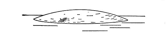
Other modes of valley development. Valleys are not always developed from gullies in the manner outlined above. The outflow of a lake would develop a valley, but the valley might be in process of excavation all the way from the lake basin to the sea at the same time (Fig. 78). A valley developed in this manner is not simply [p. 120] a gully grown big by head erosion, and the valley would not precede the stream.
If a narrow coastal plain is limited landward by a steeper slope, valleys might develop as shown in Figs. 79 and 80. Again, in mountain regions valleys are sometimes formed by the uplift of parallel mountain folds, leaving a depression between (Fig. 81). Drainage will appropriate such a valley so that it becomes in some sense a river valley. But it is not a river valley in the sense in which the term has been used in the preceding pages. It is rather a structural valley. A river valley may be developed in its bottom (a,Fig. 81) and it may be in process of development throughout the structural valley at the same time.
These illustrations do not exhaust the list of conditions under which valleys develop, but they suffice to show that valleys originate and develop in different ways.
[p. 121]
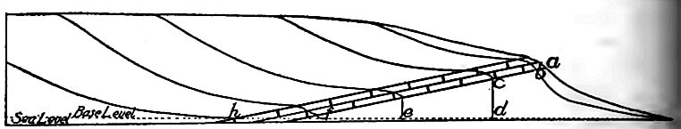
Limits of growth. In all cases there are limits in depth, length, and width, beyond which a valley may not grow. A stream flowing to the sea tends to erode its valley to sea-level, [1] but actually reaches the sea-level only at the coast. The lowest level to whichrunning water can wear a land surface is a base-level. In length, the valley will grow as long as its head continues to work inland. If but a single valley affected a land area, the limit toward which it would tend would be the length of the land area in the direction of the valley’s axis. In general, valleys are limited in length by other valleys. The head of a valley works back until it reaches a point where erosion toward the valley in question is equal to erosion in the opposite direction. Here the divide becomes permanent (Fig. 82.) In width, a valley is increased chiefly by the side cutting of the stream, by the wash of the rain which falls on its slopes, and by the action of gravity which tends to carry down to the bottom of the slope the material which is loosened above by any process whatsoever. The widening of valleys is limited much as their lengthening is. Adjacent valleys grow wider until the tops of the intervening divides are reduced to lines. Then, if erosion is equal on the two sides, the divide is lowered without shifting, so far as slope wash is concerned.
The development of tributaries. Most considerable valleys have numerous tributaries. So soon as a gully is started, the water flowing into it from either side wears back the slopes. A slight inequality of slope, or a slight variation in the character of the material, is sufficient to make the erosion of the slopes unequal at different points, and unequal erosion in the slopes results in the development of tributary gullies. Tributary gullies develop into ravines and valleys, the same as their mains. Every new [p. 122] valley facilitates the run-off of the water which falls on the land, and so helps along erosion.
The struggle for existence among valleys and streams. It is not to be inferred that every gully becomes a valley, nor that every small valley becomes a large one. The number of miniature gullies which develop on a slope may be very large (Fig. 73) ; but the history of many of them is ephemeral. If two adjacent ones are of unequal depth, the widening of the deeper narrows and finally eliminates the divide between them, and the two become one (Fig. 83).
Any good map of the north shore of Lake Superior, or the west shore of Lake Michigan shows a large number of small streams and gullies (PL III). No equal stretch of coast has a number of large valleys comparable to that of the small ones along such shores. It therefore seems evident that of these many small valleys a few only will attain considerable size.
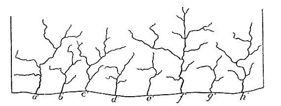
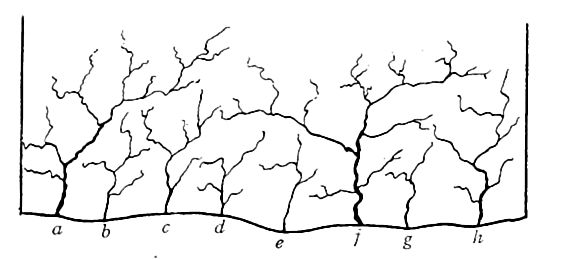
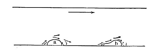
Some of the young valleys work their heads back into the land faster than others, because of inequalities of slope and material. If valleys develop in ways other than by head erosion, the chances are also against their equal growth. If two streams, such as a and c,Fig. 84, develop faster than the intermediate stream b, it is clear that their tributaries may work back into the territory which at the outset drained into 6, so as to cut off the supply of water from the latter stream (compare a’b’c,‘Fig. 85). As a result . the growth of b will be checked, and ultimately stopped. Similarly other valleys, such as f (Fig. 84), will get the better of their neighbors, and many of the competitiors, as b’ , d’, e’, and g’ (Fig. 85), will soon drop out of the race. Between the stronger streams [p. 123] competition still goes on. If a’ and /fwill be pre-empted by its rivals (compare Figs. 85 and 86). Thus as the result of the unequal rate at which valleys are lengthened, the larger number of those which come into existence are arrested in their development.
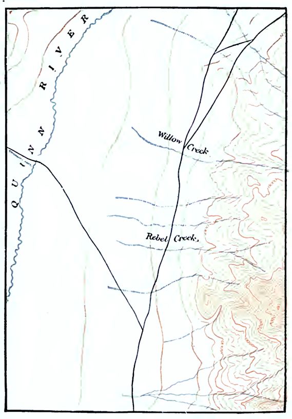
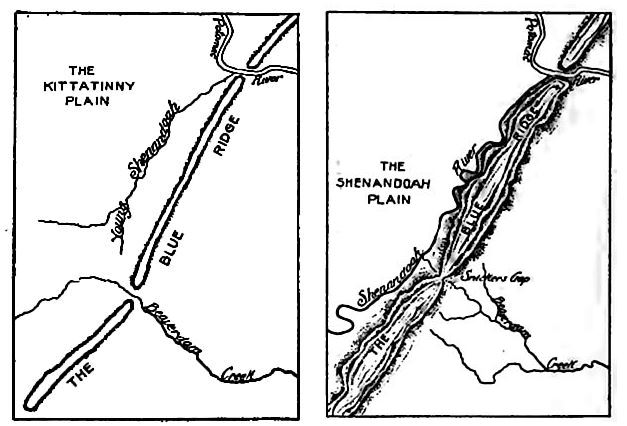
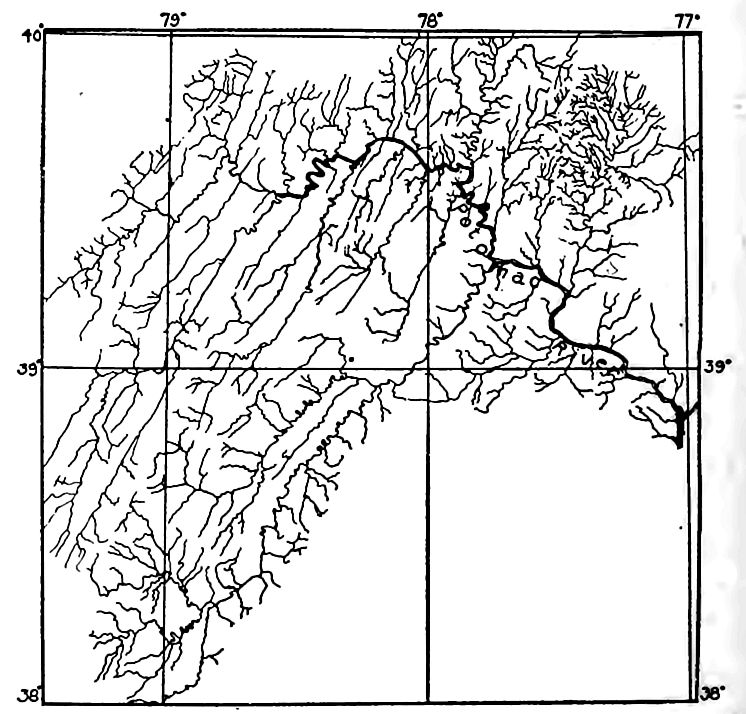
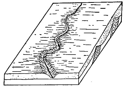
Piracy. Streams do not always hold the courses which they establish for themselves in youth. Thus the valley of the Potomac River across the Blue Ridge (Fig. 87) was deepened faster than that of Beaverdam Creek. The head of the young Shenan [p. 124] doah River then worked back and tapped Beaverdam Creek, diverting its head waters to the Potomac (Fig. 88). The young Shenandoah was a pirate, and Beaverdam Creek was beheaded. The stream to which waters are diverted is increased in size, and the beheaded stream is correspondingly diminished ; or if its total supply of water came in above the point of tapping it would disappear altogether.
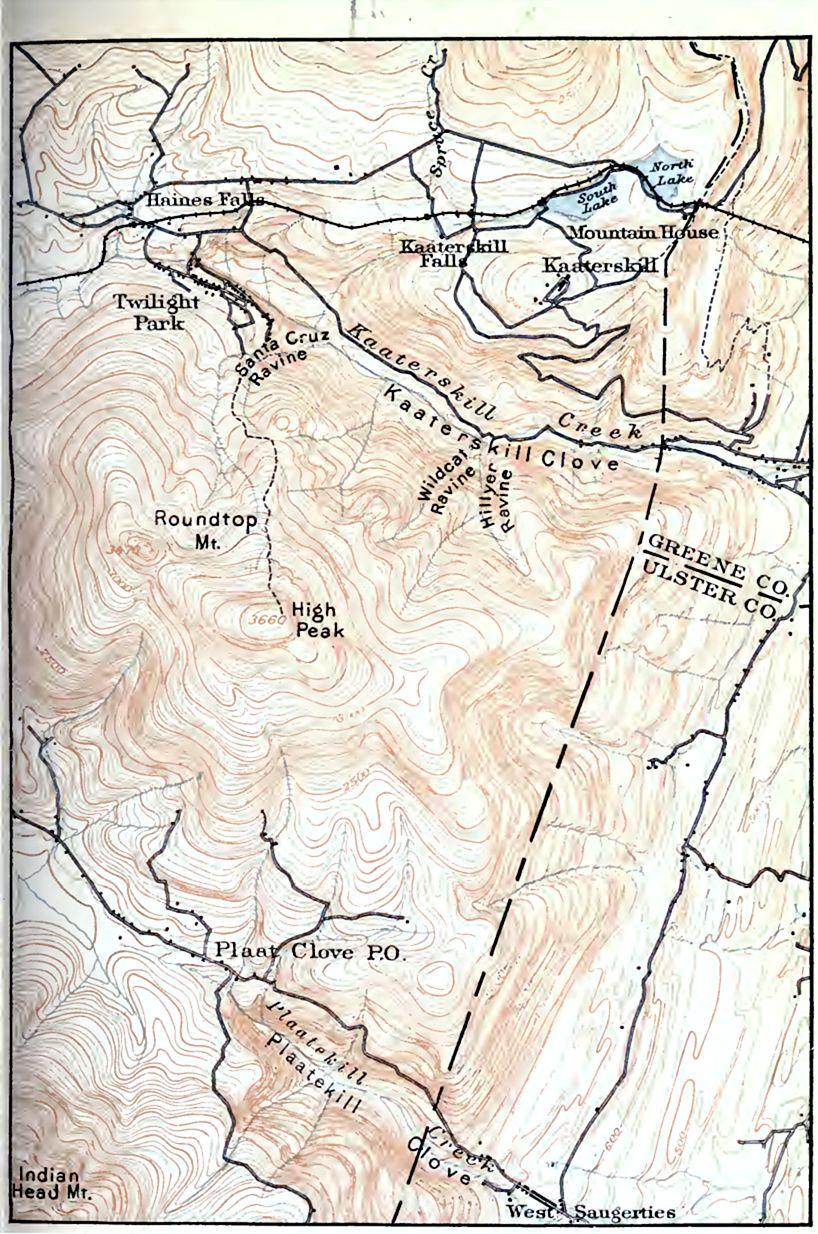
An actual case of piracy is shown on Plate IV. North and South Lakes formerly drained westward to the Schoharie Creek, the present head of which is in the extreme northwest corner of the map. The head of Kaaterskill Creek, which had a much higher gradient, worked back and captured the head of the westward-flowing stream, diverting the drainage from North and South Lakes to itself. Schoharie Creek was thus beheaded.
Plaatekill Creek, near the south limit of the map, appeal’s to have beheaded the creek flowing west and northwest, similarly diverting its head waters.
A Cycle of Erosion
From what has preceded it is clear that the topography of a region undergoing erosion will change greatly from time to time.
[p. 125]
The first effect of erosion by running water is to roughen the surface by cutting out valleys, leaving ridges and hills. The final effect is to make it smooth again by cutting the ridges and hills down to the level of the valley bottoms.
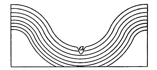
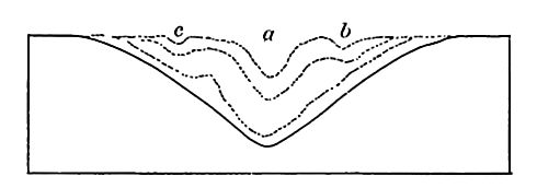
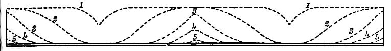
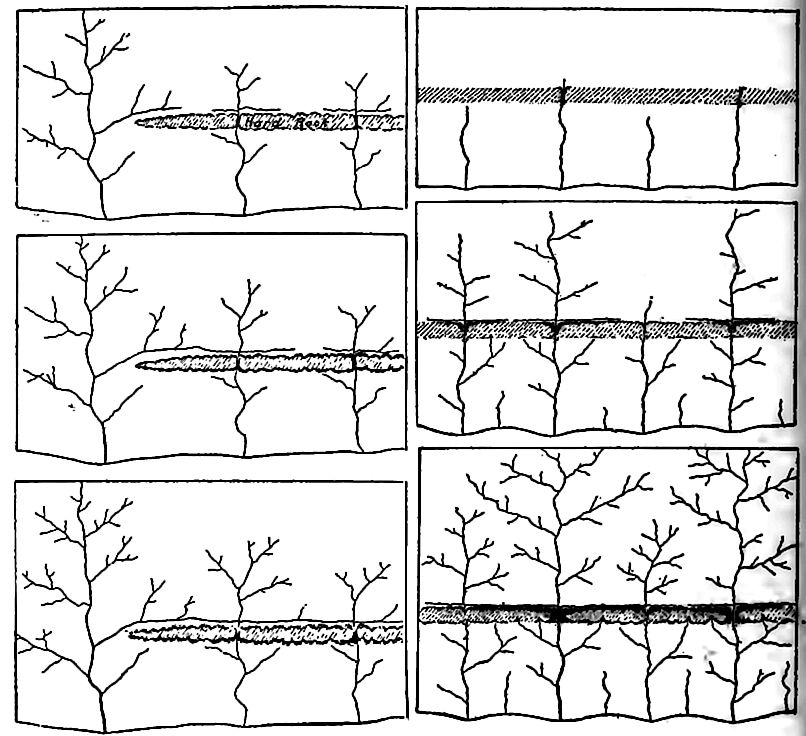
Base-level, peneplain, grade. A base-level of erosion has already been defined; but the mode of its development may now be illustrated in the light of the preceding discussion. Suppose a land surface affected by a series of parallel young valleys without tributaries (Fig. 89). Between them there is a series of upland plains or plateaus. The profile of the surface between two adjacent valleys is represented in section by the uppermost line in Fig. 89. As the valleys are widened from 1 and 1 to 2 and 2, the intervening upland is correspondingly narrowed. When the valleys have attained the form represented by 3 and 3, the intervening upland has been narrowed to a ridge, and the valley flats have become wide. With continued erosion the ridge will be lowered still more, and in time the surface will approach a plain. In this condition it is known as a peneplain. The ridges will be obliterated finally, and a base-leveled plain results.
[p. 126]
Tributaries are almost sure to develop along each main valley and their heads work back across the uplands between the main valleys, dissecting them into secondary ridges (Fig. 90). Tributaries will develop on the tributaries, and these tertiary valleys dissect the secondary ridges into ridges of a lower order. This process of tributary development goes on until drainage lines of the fourth, fifth, sixth, and higher orders are formed (Fig. 93). Since the process of valley development under such circumstances is also the process of ridge dissection, a stage is presently reached where the ridges are cut into such short sections that they cease to be ridges, and becomes hills instead. Even then the processes of erosion do not stop, for rain-water falling on the hills washes the loose material from their surfaces, and starts it on its seaward journey. Thus the “everlasting hills” are lowered, and, given time enough, they will be carried to the sea.
[p. 127]
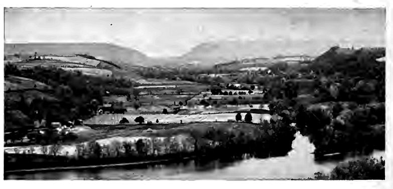
The base-leveled surface is not absolutely flat. The area reduced by each stream will have a slight slope down-stream, and from its sides toward its axis. The low divides between streams [p. 128] flowing in the same direction may, however, disappear altogethe for when valleys have reached their limits in depth, their strea do not cease to cut laterally. Meandering in their flat-bottom valleys, they often reach and undercut their divides (PL V, and Fig. 94). By lateral planation, therefore, the divides between streams may be entirely eaten away. The time involved in the reduction of a land area to base-level is a cycle of erosion.
The terms “grade,” “graded plain,” and “base-level” and “base-leveled plain,” are somewhat variously, and therefore somewhat confusingly used. “A graded valley is one in which there is a condition of essential balance between corrosion and deposition.” [2] Its angle of slope is variable and is dependent on the capacity of the stream for work, and on the work it has to do. A weak river must have a higher gradient than a strong one; a stream with much sediment must have a higher gradient than one with little, and a stream with a load of coarse material must have I higher gradient than one with a load of fine. Thus the graded valley of the lower Mississippi has an inappreciable angle of slope; but the graded valleys of some of its small tributaries have slopes of hundreds of feet per mile. Since both the size ofl the stream and the amount and coarseness of its load at a giveni place vary from time to time in the course of a cycle of erosion, it is clear that the inclination of a graded valley must vary. With the changing conditions of advancing years, the slope of a graded valley normally decreases. The same principles apply to grades surfaces outside of valleys.
In the continual readjustment of grades incident to a river’s normal history, the land is brought nearer and nearer to sea-level When the inclination of a graded surface becomes so low that it | sensibly flat, the surface may be said to be at base-level, althougl this does not mean that the surface can never be degraded mofl If the term be used in this way, it is clear that there is no shall line of distinction between a graded surface and a base-leveled sur face. A base-leveled surface is necessarily a graded surface and all graded surfaces of low gradients are base-levels.
The ocean may be looked upon as a barrier which in a general [p. 129] way limits the down-cutting of running water. Other barriers, such as lakes, and the outcrops of hard rock in a stream’s bed, have a comparable, though more temporary, effect on the development of valley plains above themselves. Plains thus developed have been called temporary base-levels.
Stages in a cycle of erosion. Since river valleys have a beginning and pass through various stages of- development before the country they drain is base-leveled, it is important to recognize their various stages of advancement. Nor is this difficult. An old valley and a young one have different characteristics, and the one would no more be mistaken for the other by those who have learned to interpret them, than the face of an aged man would be mistaken for that of a child.
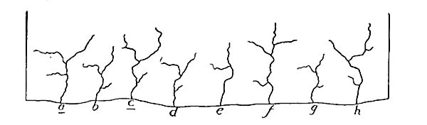
The cycle begins with the beginning of valley development, and at that stage drainage is in its infancy. The type of the infant valley is the gully or ravine (Fig. 72). It has steep slopes and a narrow bottom. Plate III represents somewhat older ravines in contour. The valley is widened, lengthened, and deepened, and passes from infancy to youth. In this stage also the valleys are relatively narrow, and the divides between them broad. They may be deep or shallow, according to the height of the land in which they are cut, and the fall of the water flowing through them; but in any case the streams flowing through them have done but a small part of the work they are to do before the country they [p. 130] drain is base-leveled. Figs. 95 and 96, respectively, represent youthful valleys in regions of moderate and great relief. Fig. 1, PL VI shows youthful valleys in a region of slight relief, and Fig. 2, PL VI, in a region of great relief. The uppermost line in Fig. 89j likewise represents topographic youth, as shown in cross-profile.
Not only are narrow valleys said to be young, but the territory affected by them is said to be in its topographic youth, since but I small part of the time necessary to reduce it to base-level has elapsed. An area is in its topographic youth when considerable portions of it are still unaffected by valleys. Thus the areas (as [p. 131] a whole), as well as the valleys, represented on Plate VI, are in ‘their topographic youth. It is often convenient to recognize various sub-stages, such as early youth, middle youth, and late youth, within’ the youthful stage of valleys or topographies.
Youthful streams, as well as youthful topographies, have their distinctive characteristics. They are usually swift; their cutting is mainly at the bottom rather than at the sides, and their courses are often marked by rapids and falls.
As valleys approach base-level, they develop flats. As the valleys and their flats widen, and as their tributaries increase in numbers and size, a stage of erosion is presently reached where but little of the original upland surface remains. The country is largely reduced to slopes, and in this condition the drainage and the topography which it has determined are said to be mature. Mature topography is shown in contours in PL VII, where slopes, rather than upland or valley flats, predominate. Mature topography is also shown in Fig. 97, wThich illustrates the universal tendency of rivers in regions of notable relief to develop new flats well below the former surface of the region.
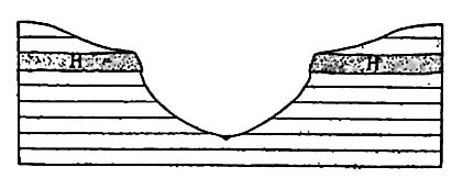
The same processes which have made young valleys mature will in time work further changes. When the gradients of the valleys [p. 132] have become low and their bottoms wide, and when the intervening ridges and hills have become narrow and small, the drainage and the drainage topography have reached old age. This is illustrated by PL VIII, and in section by the third and lower lines in Fig. 89. Topographic old age sometimes has a different expression; this is shown in Fig. 98, where most of the surface has been brought low. The elevations which rise above the general plain are small in area, but have abrupt slopes. This phase of old-age topography is usually the result of the unequal resistance of the rock degraded.
The marks of old streams are as characteristic as those of young ones. They have low gradients and are sluggish. Instead of lowering their channels steadily, they cut them down in flood, and fill them up when their currents are not swollen. They meander widely in their flat-bottomed valleys (PI. VIII) and their erosion, except in time of flood, is largely lateral.
The preceding discussion, and the illustrations which accompany it, give some idea of the topography which characterizes an area in various stages of its erosion history. Whether the valleys are deep or shallow in youth and maturity, and whether the intervening ridges are high or low, depends on the original height of the land and its distance from the sea. The higher the land, and the nearer it is to the sea, the greater the relief developed by erosion.
[p. 133]
A plateau near the sea may become mountainous in the mature stage of its erosion history, while a plain in the same situation would only become hilly. A plateau in the heart of a continent would have less relief in its maturity than one of equal elevation near the sea, since the grade-plain in the former position is higher than in the latter.
General Characteristics of Topographies Developed by River Erosion
With the characteristics of river valleys and the methods by which they grow clearly in mind, it is easy to say whether rivers have been the chief agents in the development of a given topography. River valleys are distinguished from other depressions on land surfaces by their linear form, and, leaving out of consideration the relatively insignificant inequalities in streams’ channels, by the fact that any point in the bottom is lower than any other point farther up stream in the same valley, and higher than any point farther down stream. The second point might be otherwise stated by saying that every valley excavated by erosion leads to a lower valley, to the sea, or to an island basin. Streams which dry up, or otherwise disappear as they flow, constitute partial exceptions. If, therefore, the depressions on a land surface are linear, lead to other and deeper valleys, and finally to an inland basin, or the sea, and if the elevations between these valleys are such as might have been left by the excavation of the valleys, it is generally clear that rain and rivers have been the chief factors in the development of the topography. If, on the other hand, a surface is characterized by topographic features which streams cannot develop, such as enclosed depressions, or hills and ridges whose arrangement is independent of drainage lines, other agents besides rain and surface streams have been concerned in its development.
Special Features Resulting from Special Conditions of Erosion
Many striking topographic and scenic features result from rain and river erosion. Some of them depend primarily on the conditions of erosion, such as climate, altitude, etc., while others depend largely on the structure and resistance of the rock.
[p. 134]
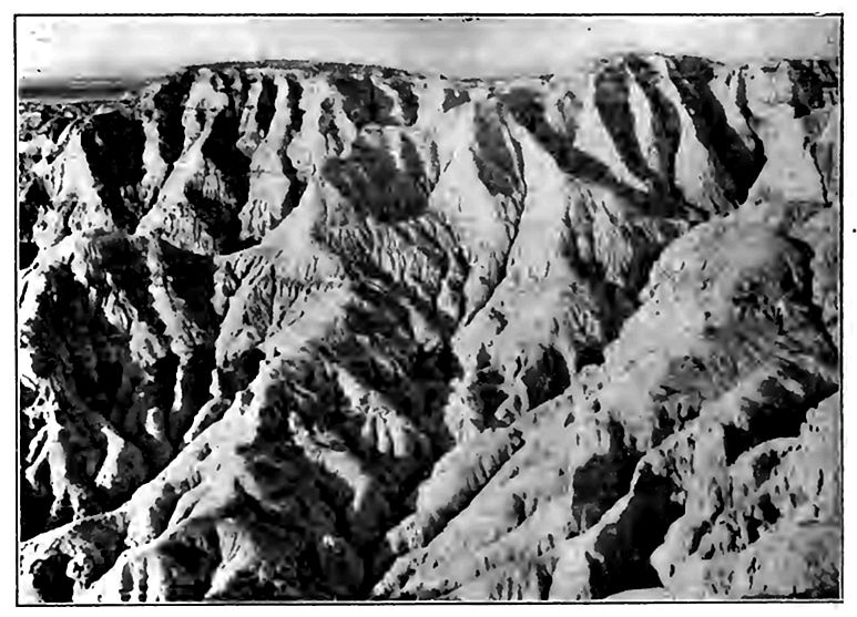
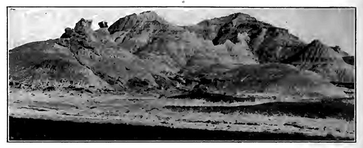
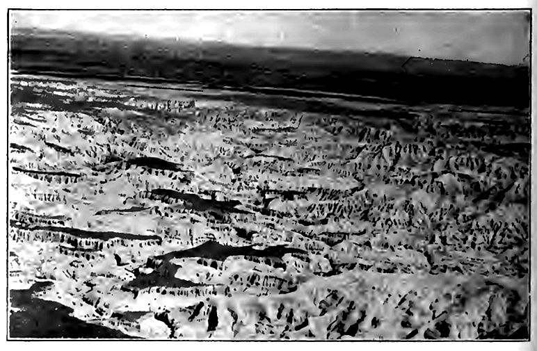
Bad-land topography. A type of topography developed in early maturity in certain high regions where the rock is but slightly though unequally, resistant, is termed bad-land topography. Some idea of bad-land topography is gained from Figs. 99 and 100. Bad-land topography is found in various localities in the AY est. but especially in western Nebraska and Wyoming, and the western parts of the Dakotas. The formations here are often beds of sane stone or shale, alternating with beds of clay. Climatic factoi are also concerned in the development of bad-land topographs A semi-arid climate, where the precipitation is much concentrate seems to be most favorable for its development. The bad-lai topography is most striking in early maturity.
[p. 135]
[p. 136]
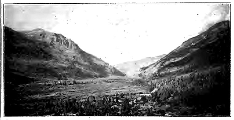
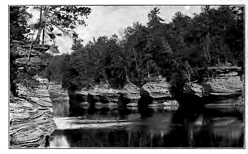
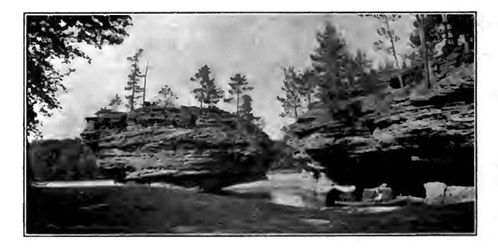
Special forms of valleys; canyons. Various conditions influenc the size and shape of valleys, especially in the early stage of their development. High altitude of land favors swift flowing streams. and the development of deep valleys. Such valleys will be narrow if the conditions which determine widening are absent or unfavorable. An arid climate favors the development of narrow valleys if there is sufficient water to maintain a vigorous stream, because there is little slope wash. Narrow valleys with steep slopes will also be favored if the valley is cut in rock which is capable <>t standing with steep faces. Thus a stream may develop a narrow \ -alley in firm rock where it would not do so in loose gravel. Aridity, high altitude, and the proper sort of rock structure therefore favor the development of canyons, and many of the young valleys in the western part of the United States where these conditions prevail, belong to this class.
[p. 137]
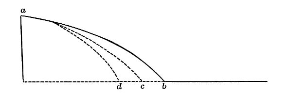
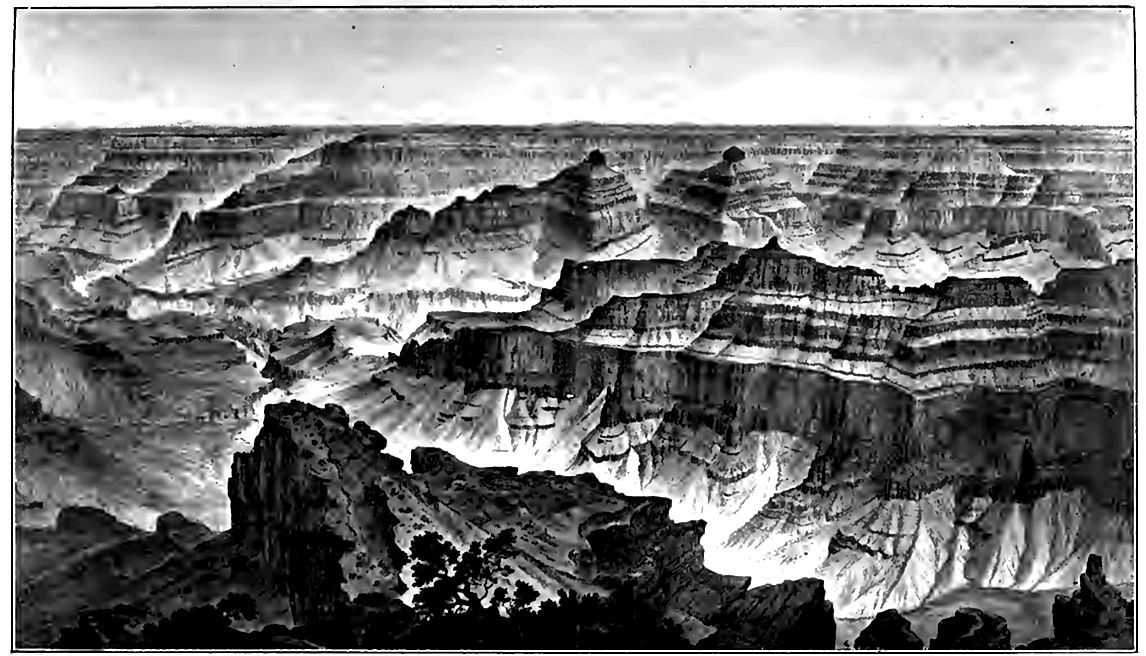
While all canyons are valleys, most valleys are not canyons. In popular usage, the rule seems to be that if a valley is sufficiently deep, narrow, and steep-sided to be distinctly striking, it is called a canyon in regions where that term is in use. Whether a valley is deep, narrow, and steep-sided enough to be striking, clearly depends on the observer. The Colorado Canyon (Figs. 101 and 102) is the greatest canyon known, but it is rarely more than a mile deep, and where its depth approaches this figure it is often 8, 10, or even 12 miles wide from rim to rim. Its width at bottom is little more than the width of the stream; that is, a few hundred feet. Its cross-profile throughout much of its course is therefore not in keeping with the conventional idea of a canyon. With a depth of one mile and a width of eight, the slope, if uniform, would have an angle of less than 15°. Such a valley is represented in Fig. 103. As a matter of fact the slopes of a canyon are not commonly uniform, but more like those of Fig. 104. The step-like slopes are due to inequalities of hardness. It is perhaps needless to say that to an observer on the rim of the canyon, the slopes seem several times as steep as those shown in the diagrams.
Like all valleys which are narrow relative to their depth, the Colorado Canyon, great as it is, is a young valley, for it represents but a small part of the work which the stream must do to bring its drainage basin to base-level.
[p. 138]
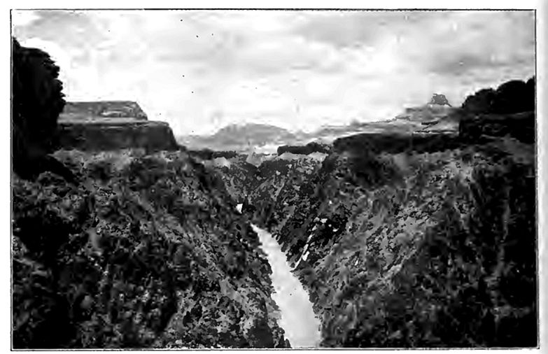
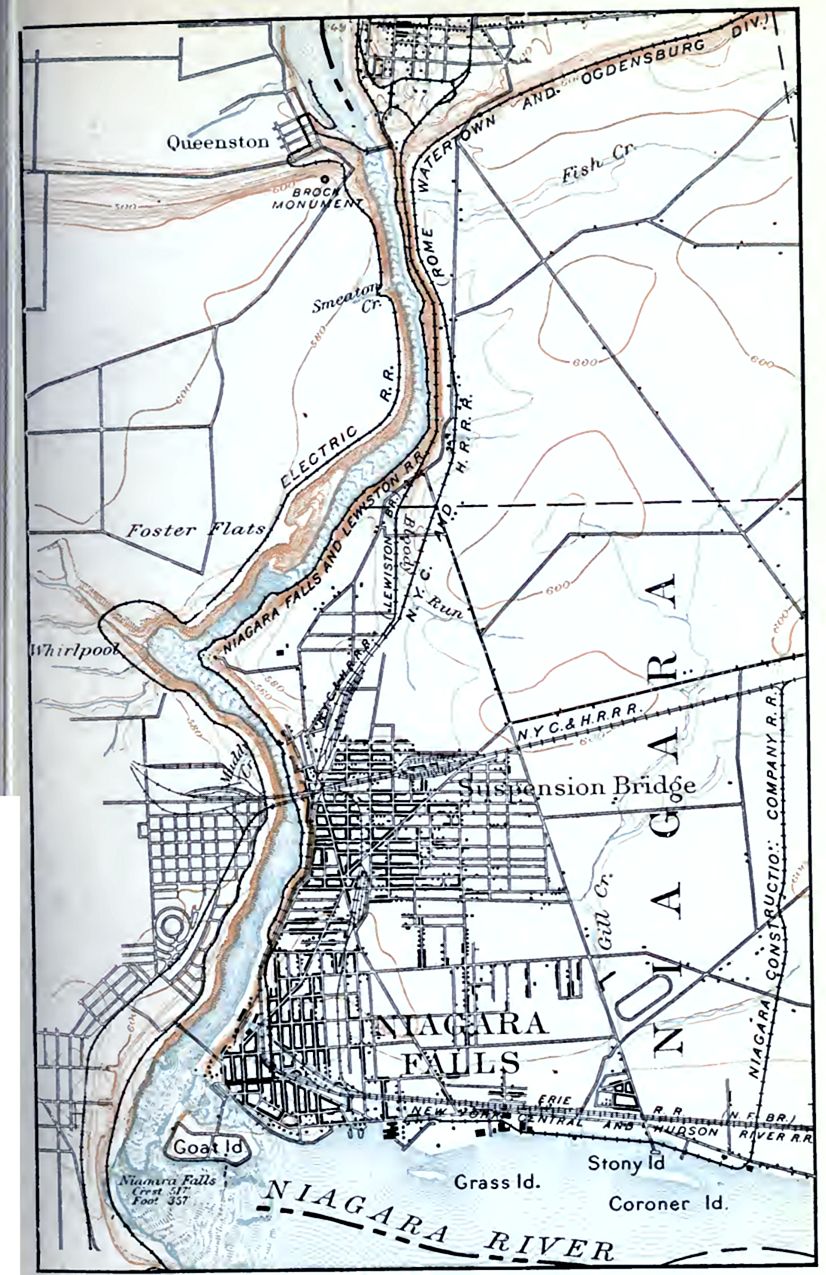
While aridity and altitude are conditions which favor the development of canyons, as shown by the fact that most canyons are in high and dry regions, they are not indispensable. Niagara River has a canyon below its falls (PL IX), and the surrounding region is neither high nor arid. The narrow- part of the valley is so young that side erosion has not yet widened the valley or lowered its angle of slope to such an extent as to destroy its canyon character. This canyon is often called a gorge, a term frequently applied to small valleys of the canyon type.
Rate of Degradation
The amount of mechanical sediment which the Mississippi River carries to the Gulf of Mexico is estimated to represent a rate of degradation for the Mississippi basin of about one foot in 5,000 years. But the mechanical sediment carried to the Gulf does not really represent the total degradation of the basin, for the water which sinks beneath the surface is dissolving more or less rock substance, especially lime carbonate. This material is carried to the sea in solution, and does not appear in the sediment on which the above estimate is based. Taking into account the matter dissolved by the water and carried to the sea in solution, the average rate of degradation for the Mississippi basin has been estimated at one foot in 3,000 to 4,000 years.[3]
The sediment carried to the Gulf by the Mississippi River is gathered from nearly all parts of the basin of this stream, but much more of it comes from some parts of the basin than from others. On the whole, the rate of erosion is probably greatest toward the margins of the basins, where the land is in its topographic youth or early maturity. It is notably less in the middle I courses of the valleys, and is exceeded by deposition in some places along the lower courses of the Mississippi and some of its main tributaries.
The average elevation of North America is probably not far from 2,000 feet. If the present rate of degradation, say one foot in 3,500 years, were to continue, it would take something like [p. 139] 7,000,000 years to bring the continent to sea-level. But this rate of degradation could not continue to the end, for as the continent became lower, streams would become sluggish and erosion less rapid. Long before the continent reached base-level, the rate of degradation, so far -as dependent on mechanical erosion, would I become so slow that the time necessary to bring the continent to sea-level would be indefinitely prolonged. Furthermore, it is quite possible that the land is suffering, or is liable to suffer, uplift, relative or absolute. If the rate of rise were equal to the rate of degradation, the average height of the continent would of course not be affected.
The following table [4] gives the percentage of material carried in suspension by various rivers :
| River | Drainage areas in square miles | Mean annual discharge (in cubic feet) per second | Total tons of sediment carried to sea annually | Ratio of sediment to water by weight | Height in feet of column of sediment with a base of one sq. mile | Thickness of sediment in inches if spread over drainage area |
|---|---|---|---|---|---|---|
| Potomac | 11,043 | 20,160 | 5,557,250 | 1: 3,575 | 4.0 | .00433 |
| Mississippi | 1,244,000 | 610,000 | 406,250,000 | 1:1,500 | 241.4 | .00223 |
| RioGrande | 30,000 | 1,700 | 3,830,000 | 1:291 | 2.8 | .00116 |
| Uruguay | 150,000 | 150,000 | 14,782,500 | 1:10,000 | 10.6 | .00085 |
| Rhone | 34,800 | 65,850 | 36,000,000 | 1,775 | 31.1 | .01075 |
| Po | 27,100 | 62,200 | 67,000,000 | 1:900 | 59.0 | .01139 |
| Danube | 320,300 | 315,200 | 108,000,000 | 1:2,880 | 93.2 | .00354 |
| Nile | 1,100,000 | 113,000 | 54,000,000 | 1:2,050 | 38.8 | .00042 |
| Irrawaddy | 125,000 | 475,000 | 291,430,000 | 1:1,610 | 209.0 | .02005 |
| Mean | 334,693 | 201,468 | 109,649,972 | 1:2,731 | 76.65 | .00614 |
The composition of rain-water falling near London, as determined by analysis, was as follows:2
| Organic carbon | .99 part in 1,000,000 of water |
| Organic nitrogen | .22 " " |
| Ammonia | .50 " " |
| Nitrogen as nitrates and nitrites | .07 " " |
| Chlorine | 6 .30 parts in " " |
| Total solids | 39 .50 " " |
[p. 140]
A comparison of the composition of rain-water with that of springs and rivers gives some idea of the solvent work of water. From a study of the water of 19 of the principal rivers of the world Murray has compiled the following table[5] showing the amount of mineral matter in average river water:
| Constituents | Tons in a Cubic Mile |
|---|---|
| Calcium carbonate (CaCO3) | 326,710 |
| Magnesium carbonate (MgCO3) | 112,870 |
| Calcium phosphate (Ca3P2O8) | 2,913 |
| Calcium sulphate (CaSO4) | 34,361 |
| Sodium sulphate (Na2SO4) | 31,805 |
| Potassium sulphate (K2SO4) | 20,358 |
| Sodium nitrate (NaNO3) | 26,800 |
| Sodium chloride (NaCl) | 16,657 |
| Lithium chloride (LiCl) | 2,462 |
| Ammonium chloride (NH4Cl) | 1,030 |
| Silica (SiO2) | 74,577 |
| Ferric, oxide (Fe2O3) | 13,008 |
| Alumina (Al2O3) | 14,315 |
| Manganese oxide (Mn2O3) | 5,703 |
| Organic matter | 79,020 |
| Total dissolved matter | 762,587 |
The 6,500 cubic miles of river water, which Murray estimate! flows to the sea annually, would carry about 4,975,000,000 tons of mineral matter in solution.
¶ Analysis of Erosion
Erosion is the term applied to all the processes by which earthy matter or rock is loosened or removed from one place to another. It consists of several sub-processes, namely, weathering, transportation, corrasion, and corrosion.
Weathering
Weathering is the term applied to nearly all those natural processes which tend to loosen or change the exposed surfaces of rock.
[p. 141]
The lettering of inscriptions on exposed marble becomes fainter and fainter as time goes by, and finally disappears, because the jrock in which the letters were cut has weathered away. In this case the weathering is effected partly by the atmosphere and partly by water, and these are the chief, though not the only agents concerned in weathering.
The rain which falls upon the surface of exposed rock, and that which sinks through the soil to the solid rock below, dissolves slowly some of the constituents of the ock. This tends to make the rock rumble, much as mortar does when ;he lime carbonate which cements the sand is dissolved. The chemical changes effected by ground-water and the gases lissolved in it, also help to disintegrate the rock, as we have seen.
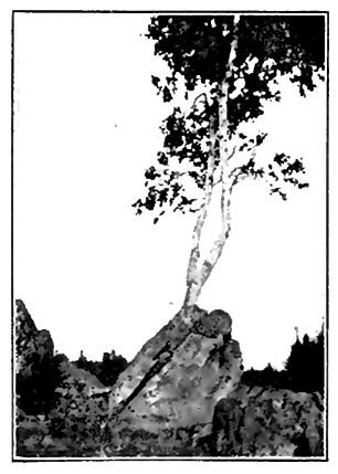
There are other processes of weathering not due directly either to the atmosphere or to water. Thus the roots of trees frequently grow into tracks of rocks (Fig. 105), and, increasing in size, act like wedges. Again, water freezing in cracks works in the same way.
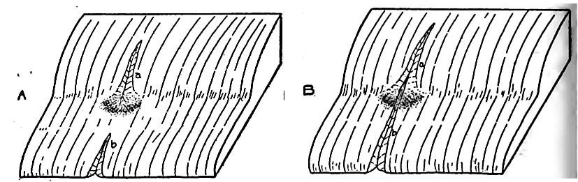
From the faces of steep cliffs masses of rock are frequently loosened, by the wedge-work of roots or ice, or by expansion and contraction due to changes of temperature. The quantities of debris at the bases of many cliffs, forming slopes of talus (Fig. 106), testify to the importance of the weathering of the rock, and o the action of gravity in getting loosened material down. Another phase of gravity work is shown in Fig. 107. Here, under the influence of gravity and expansion and contraction, due to freezing and thawing and wetting and drying, the surface material is creeping down slope. In the process the rock is being broken. The descent of rock detritus under the influence of gravity is hardly weathering, but it is often weathered material which is brought down.
[p. 142]
[p. 143]
The above are among the commoner processes of weathering, although they do not exhaust the list. The more active and tangible processes by which surface rocks are broken up, such as wave wear, river wear, and glacier wear, are processes of corrasion, and are not usually regarded as processes of weathering.
The importance of weathering in the general processes of erosion is shown in many ways. In regions where the mantle rock is the product of the decay of the solid rock beneath, and such regions constitute a large portion of the earth’s surface, the soil and jubsoil represent the excess of weathering over transportation. Since most of the earth’s surface is covered with soil and subsoil, it is clear that, on the whole, weathering keeps ahead of transportation. Again, it is clear that the loosening of rock by weathering greatly increases the erosion which a given amount of moving water can accomplish. Not only this, but weathering plays a much more important role in the development of valleys than is commonly realized. This is illustrated by the valleys of young swift streams. The valley whose top is not ten times as wide as its stream, is rare. The stream which has such a canyon has been jutting chiefly at its bottom. A swift stream would make a valley is wide as itself. This is illustrated by Fig. 108. Weathering in its broadest sense is largely responsible for the width of such a valley, in so far as it exceeds the width of the stream. Weathering, slope wash, etc., have widened the valley, especially in its upper part, and the stream has carried away the material which slope wash, gravity, etc., brought down to it. The above illustration would not apply to old and sluggish streams, for they widen their valleys by meandering, independently of weathering.
The central idea of the processes embraced under the term feathering is the loosening and the disrupting of rock, by which [p. 144] it is prepared tor transportation. Weathering is the first stcl in most erosion, but it is not the only one, and erosion may take place without it.
Transportation
A second element of erosion is transportation. The trans tation of sediment is to be distinguished from the transportation of materials in solution. In so far as mineral matter is dissolve! it becomes a part of the fluid of the stream. If the quantity dissolved were large, it might influence the mobility of the water; but the amount is usually too slight to influence flow sensibly.
The sediment transported by a stream is either rolled along its bottom, or carried in suspension above the bottom. The coarser materials (gravel and sand) are carried chiefly in the former position, and the finer (silt and mud) largely in the latter.
Transporting power and velocity. The transporting power of running water depends on its velocity. Swift streams have enormously greater power of transportation than sluggish ones, but transportation does not always keep pace with transporting power. The Niagara at its rapids is a stream of great transporting power, but it carries little sediment, because there is little to be had.
The velocity of a stream depends chiefly on three elements its gradient, its volume, and its load. The higher the gradient, the greater the volume, and the less the load, the greater the velocity. The relation between gradient and velocity is evident that between volume and velocity is illustrated by every stream in time of flood, when its flow is greatly accelerated. The relation between velocity and load is less obvious, but none the less definite. Every particle of sediment carried by a stream makes a draught on its energy, and energy expended in this way reduces the velocity. A muddy stream is never so swift as a clear stream of the samel size would be, flowing in the same channel.
How sediment is carried. Coarse materials, such as gravel stones, are rolled along the bottom of the swift streams which earn them. Their movement is by the impact of the water. The samd is true to a large extent of sand grains. So far as concerns tin material rolled along the bottom, it is to be noted that a stream’! transporting power is dependent on the velocity of the water at [p. 145] its bottom. This is much less than the surface velocity, or even the average velocity.
The particles of fine sediment, such as silt and mud, are frequently carried by streams quite above their bottoms, as shown by the muddiness of many streams. Most particles of mud are small bits of mineral matter, the specific gravity of which is between two and three times that of water. Why do they not sink through the water and come to rest at the bottom tof the stream?
A particle of sediment in running water is subject to two principal forces, that of the current which tends to move it nearly horizontally down stream, and that of gravity which tends to carry it to the bed of the stream. As a result of these two forces, the particle tends to move in the general direction which represents the resultant of these forces (Fig. 109) . If a river were the simple straightforward current which it is popularly thought to be, a particle in suspension would reach its bottom in the time it would take to sink through an equal depth of still water; for the descent would be none the less certain and scarcely less prompt because of the forward movement of the water. The current would simply be a factor in determining the position of the particle when it reached the bottom, not the time of reaching it. Very fine particles, like those of clay, sink less readily than coarser ones, like grains of sand, because the former expose larger surfaces, relative to their mass, to the water through which they sink. But even such particles, unless of extraordinary fineness, would presently reach the bottom if acted on only by a horizontal current and gravity. Since even sediment which is not of exceeding fineness is kept in suspension, it is clear that some other factor is involved. This is found, in part at least, in the subordinate upward currents in a stream.
[p. 146]
Where a bowlder occurs in the bed of a stream (Fig. 110) a part of the water which strikes it is forced up over it. If there are many bowlders, the process is frequently repeated, and the number of upward currents is great. Any roughness will serve the same purpose, and every stream’s bed is rough to a greater or less extent. Roughnesses at the sides of a channel start currents which flow toward the center, and the varying velocities of the different parts of a stream serve a similar purpose. A river is therefore to be looked upon as a multitude of currents, some rising from the bottom toward the top, some descending from top to bottom, some diverging from the center toward the sides, and some converging from the sides toward the center.
It is, of course, true that the sum of the upward currents is always less than the sum of the downward, so that the aggregate motion of the water is down slope. Sediment in suspension is held up chiefly by the upward currents, which, locally and temporarily, overcome the effect of gravity. The particles in suspension are constantly tending to fall, and frequently falling; but before they reach the bottom, many of them are seized and carried upward by the subordinate currents, only to sink and be carried up again. Even if they reach the bottom, as they frequently do, they may be picked up again. It is probable that every particle of sediment of such size that it would sink readily in still water is dropped and picked up many times in the course of any long river journey, and its periods of rest often exceed its periods of movement.
Corrasion
The mechanical wear effected by running water is corrasion. So long as the materials to be moved are incoherent, it is easy m understand how running water moves them. The water which [p. 147] flows over the surface of a cultivated field gathers earthy matter, and the process is continued all the way to the channel of the stream. Thus sediment is gathered at the very sources of the streams. It is also contributed by all slope wash from whatever part of the valley, and the stream gathers more load from its bed wherever it flows with sufficient velocity over loose material. 'Streams also undercut their banks, and receive new load from the fall of the overhanging material.
By far the larger part of the sediment of most streams is made jup of material loosened in advance by the processes of weathering. iThe stream, and the waters which get together to make the stream, find them ready-made; but rivers frequently wear rock which is not weathered, for the principal valleys of the earth are in solid rock, and many of them in rock of great hardness. How does the |stream wear the solid rock?
When a stream flows over a rock bed, the wear which it accomiplishes depends chiefly on the character of the rock, the velocity lof the stream, and the load it carries. If the rock is much divided by bedding planes and joint planes, the water of a clear stream of even moderate strength may dislodge bits of the rock. This condition of things is often seen where streams run on beds of shale or slate. If the rock is hard and without bedding-planes and joints, or if its layers are thick and its joints few, clear water will be much less effective. If massive hard rock presents a smooth surface to a clear stream, the mechanical effect of even a swift current is slight.
This general principle is illustrated by the Niagara River. Just above the falls the current is swift. When the river is essentially free from sediment, the surface of the limestone near the bank beneath it is sometimes distinctly green from the presence of the one-celled plants (fresh-water algae) which grow upon it. The whole force of the mighty torrent is not able to sweep them away. Were the stream supplied with a tithe of the sand which it is capable of carrying, it would not take many hours, and perhaps not many minutes, to remove the last trace of the vegetation. This illustration furnishes a clue to the method by which the erosion of solid rock in a stream’s bed is effected.
[p. 148]
The gravel rolled along the channel wears even solid rock, and as the moving stones wear the stream’s bed, they are themselves worn by impact both with the bed and with one another, and arc reduced to rounded, water-worn forms. The particles broken off may make grains of sand, or, if very fine, particles of silt or mud. In the course of time the pebbles and cobbles rolled along may be literally worn out.
The sediment carried in suspension, as well as that rolled along the bottom, wears the rock bed of a stream. The coarser the sediment and the stronger the current, the greater the wear. Contemporaneous processes are largely concerned in making valleys wide, but the depth of valleys cut in solid rock is chiefly the result of the impact and friction of the sediment in transportation. The gravel, sand, and mud carried by a stream are therefore the tools with which it works. Without them it is relatively impotent, so far as the abrasion of solid rock is concerned; with them, the stream may wear any rock over which it passes.
Swift and slow streams corrade their valleys differently. The erosion of a swift stream is chiefly at the bottom of its channel. The sluggish stream lowers its channel less rapidly, while lateral erosion is relatively more important. The result is that slow streams increase the width of their valleys more than the depth, while swift streams increase the depth more than the width. It follows that slow streams develop flats, while swift ones do not. Not only is a slow stream more likely to have a flat, and therefore a better chance to meander, but it is more likely to take advantage of opportunities in this line, for a slow stream gets out of the way for such obstacles as it may encounter, while a swift stream is much more likely to get obstacles out of its way.
Corrosion (Solution, etc.)
In most cases the solution (and other chemical changes) em by a stream is much less important than its mechanical work. Only when conditions are unfavorable for the latter is solution the chief factor in the excavation of a valley. This may be the case where a stream’s bed is over soluble rock, such as limestone, and where the stream is clear, or its gradient so low that its current is [p. 149] sluggish. The solvent power of water is not influenced by the presence of sediment, though the presence of sediment offers the water a greater surface on which to work.
¶ Conditions Affecting the Rate of Erosion
Declivity
In general the greater the slope the more rapid the rate of erosion by running water, whether in the stream’s channel or on the slopes above it. But high declivity does not favor every element of erosion. The effect of declivity on weathering is far from simple. Steep slopes favor some phases of weathering and hinder others, but they favor both transportation and corrasion.
Both corrasive power and transportive power increase rapidly with increase of velocity, and under these circumstances, corrasion will also be increased if the water has tools to work with, and transportation if there is material which can be carried. Since high declivity greatly increases both the transporting and the corrading power of running water, and favors certain elements of weathering, it is clear that the aggregate effect of high declivity is to favor erosion.
Rock
The physical constitution, the chemical composition, and the structure of a rock formation, influence the rate at which it may be broken up and carried away.
Physical constitution. Clastic rocks may be firmly cemented, or their constituents may be bound together loosely. The less the coherence the more ready the disintegration, and the finer the particles the more easily they are carried away. If the materials carried are harder than the bed over which they pass, corrasion of the latter is favored.
Chemical composition. Something also depends on the chemical composition of the rock, since this affects its solubility and its rate of decomposition. The more soluble the rock, the larger the proportion of it which will be taken away in solution; but it does not follow that the most soluble rock will be most rapidly eroded, since the rate of erosion depends on abrasion as well as solution, and [p. 150] a rock which is readily soluble, as rocks go, may be less easily abraded than a rock which is made of discrete and insoluble particles bound together by a soluble cement. In such rocks, for example a conglomerate in which the pebbles are cemented together by lime carbonate, the solution of the cement sets free a considerable quantity of gravel, so that a small amount of solution prepares a large amount of sediment for removal. A stream might cut its valley much more rapidly in such rock than in a compact limestone, though the latter is, as a whole, the more soluble.
Structure. The structure of the rock has much to do with the rate of its erosion. Other things being equal, stratified rock is more readily eroded than massive rock, since stratification planes are planes of cleavage, and therefore of weakness. Taking advantage of these planes, the water has less breaking to perform to reduce the material to a transportable condition. For the same reason, a thin-bedded formation is more easily eroded than a thickbedded one.
The beds of stratified rock may be horizontal, vertical, or inclined, and inclined strata may stand at any angle between horizontality and verticality. In indurated formations the rate of erosion is influenced both by the position of the strata and by the relation of the direction of the flowing water to their dip and strike. On the whole, the strata which are horizontal, or but slightly inclined, are probably less favorably situated for rapid erosion than those which are vertical or inclined at considerable angles. Tliis is at least true where the layers are of uniform hardness and the joints infrequent. In general, joints have somewhat the effect of bedding planes, so far as erosion is concerned.
The Influence of Climate
Climate has both a direct and an indirect effect on erosion. Its direct influence is chiefly through precipitation, changes of temperature, and wind; its indirect, through vegetation. Like declivity and rock structure, climate does not affect all elements of erosion equally.
Direct effects. The effects of variations in temperature on rock weathering have been discussed in Chapters II and III.
[p. 151]
High temperature favors chemical action, and the weathering of rock by decomposition is at its best in the presence of abundant moisture, in regions where the temperature is uniformly high. Furthermore, a warm, moist climate favors the growth of vegetation, the decay of which supplies the water with organic acids which greatly increase its solvent power. The climatic conditions favoring mechanical weathering are therefore different from those favoring chemical weathering. High temperature and abundant moisture and vegetation are found in many tropical regions, and here the rock is decomposed to greater depths, on the average, than in high latitudes. How far this is the result of rapid weathering, and how far of slow removal, due in part to the protective influence of the plants, cannot be affirmed.
So long as the water of the surface and that in the soil remains unfrozen, temperature affects neither corrasion nor transportation. But in middle and high latitudes the surface is frozen for some part of each year. During this time corrasion is at a minimum, for although the streams continue to flow, there is relatively little water running over the surface outside the drainage channels, and that little is relatively ineffective. Under some conditions, therefore, temperature affects both corrasion and transportation.
The humidity of the atmosphere has an influence even more important than that of temperature upon the rate of erosion, and its influence is exerted on each of the elements of that complex process. A moist atmosphere favors oxidation, carbonation, hydration, and the growth of vegetation, all of which promote certain phases of rock weathering. On the other hand, humidity tends to prevent sudden and considerable variations in temperature, thus checking the weathering effected by this means. Precipitation, the most important single factor in determining the rate of erosion, is dependent on atmospheric humidity. Its amount, its kind (rain or snow), and its distribution in time, are the elements which determine its effectiveness in any given place.
Other things being equal, the greater the amount of precipitation the more rapid the corrasion and transportation. Much, however, depends on its distribution in time. A given amount of rainfall may be distributed equally through the year, or it may fall [p. 152] during a wet season only. The maximum inequality of distribution would occur if all the rainfall of a given period were concentrated in a single shower. With such concentration the volume of water flowing off over the surface immediately after the down-pour would be greater than under any other conditions of precipitation, and since velocity is increased with volume, and erosive power with velocity, it follows that the erosive power of a given amount of water would be greatest under these circumstances. Furthermore a larger proportion of the precipitation would run off over the surface under these circumstances than under any other, for less of it would sink beneath the surface, and less would be evaporated.
If erosive power and rate of erosion were equal terms, the maximum concentration of rainfall would be the condition for greatest erosion; but erosive power and rate of erosion do not always correspond. If the water falling in this way could get all the material it could carry, erosion would be at a maximum; but if the amount of available material for transportation is slight, a large part of the force of the water could not be utilized in erosion. In this case, that distribution of precipitation which most favored weathering would lead to greatest erosion. Temperature favoring, the uniform distribution of moisture through the year would allow the growth of vegetation. This would favor some processes of weathering, but it would retard erosion in general. While, therefore, it is hardly possible to say what distribution of rainfall favors most rapid erosion without knowing the nature of the surface on which it is to fall, enough has been said to show that the problem is not a simple one. Some of the most striking phases of topography developed by erosion, such as those of the Bad Lands (Figs. 99 and 100), are developed where the rainfall is unequally distributed in time, and too slight or too infrequent to support abundant vegetation.
Except in dry regions, where wind-work sometimes exceeds water-work, the movements of the atmosphere are of less importance directly than precipitation in determining the rate of erosion. Hut even in regions which are not arid the winds have much to do with the rate of evaporation and the distribution of rainfall, so that their indirect effect is great.
[p. 153]
Erosion in arid regions differs from that in regions of abundant rainfall in several ways. It is obvious that the valleys will develop more slowly .in the former, that they will remain young longer, that the period necessary for the dissection of the surface is greater, that the water-courses will be less numerous, and that fewer of them will have permanent streams. There are certain other differences which are less obvious. If the arid region is high and composed of heterogeneous strata, the topography which erosion develops is more angular (Figs. 101 and 133) than that of the humid region. This is because there is less rock decay, and less vegetation to hold the products of decay. The more resistant beds of rock, therefore, come into greater prominence, especially on slopes, where they develop cliffs (Figs. 101 and 104). These general principles find abundant illustration in the plateaus of the western part of the United States,[7] where cliffs are by no means confined to the immediate valleys of the streams.
Indirect effects. Through vegetation, climate influences erosion in ways which are easily defined qualitatively, but not quantitatively. Both by its growth (wedge-work of roots) and by its decay (supplying CO2, etc., to descending waters) it favors certain phases of weathering; but, on the other hand, it retards corrasion and transportation both by wind and water. This is well shown along the banks of streams and on the faces of cliffs, in clay, sand, etc. Its aggregate effect is probably unfavorable to erosion by mechanical means, and favorable to that by chemical processes.
¶ Effects of Unequal Hardness
Irregularities of hardness give rise to many peculiarities of topography, and to many scenic features. To this category belong many rapids, falls, narrows, terraces, and many striking hills and ridges.
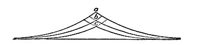
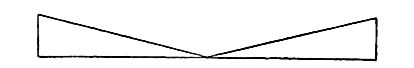
Falls and rapids. Falls and rapids are most commonly developed where streams pass from more resistant to less resistant rock. The greater wear of the latter gives origin to rapids. At first the [p. 154] rapids are slight (a, Fig. 111), but they become more considerable (b) as time and erosion go on. When the bed of the rapids becomes sufficiently steep, the rapids become falls[8] (cd). When the water falls rather than flows over the rock surface below the hard layer, erosion assumes a newphase. The hard layer is then undermined, and the undermining causes the falls to recede. This phase of erosion is sometimes called sapping (Fig. 113).
If the hard layer which occasions a fall dips up-stream (Fig. 111), its outcrop in the stream’s bed becomes lower as the fall recedes (e). When it has become so low that the water passing over it no longer reacts effectively against the less resistant material beneath (f), sapping ceases, and the fall is then transformed again into rapids. The history of rapids which succeed falls is the verse of the history which preceded. Tne later rapids are steepest at the beginning of their history, the earlier at their end. Stated in other terms, rapids are steepest when nearest falls in time. Slight differences in the resistance of successive layers often occasion successive falls or rapids (Fig. 114).
[p. 155]

If the layers of unequal hardness in a stream’s bed are vertical, and the course of the stream at right angles to the strike, rapids, and perhaps falls, will develop. Falls developed un ’ der these conditions would not recede.
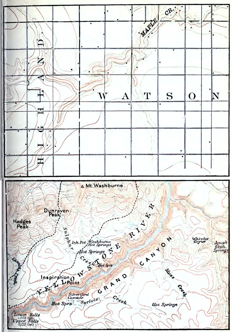
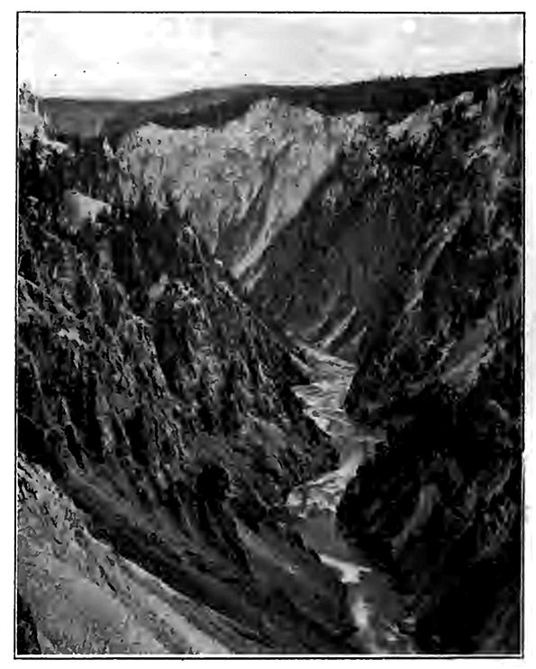
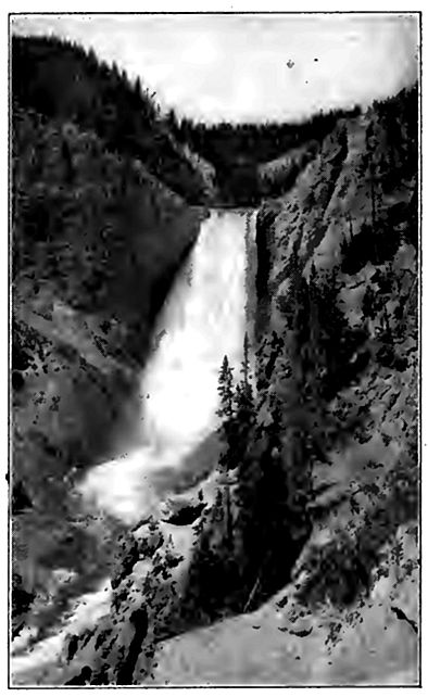
The inequality of resistance in the rock which occasions a fall may be original or secondary. In the case of Niagara Falls (Fig. 113) relatively resistant limestone overlies relatively weak shale. At the Falls of St. Anthony (Minneapolis) limestone overlies friable sandstone. The falls of the Yellowstone, and the Shoshone Falls of the Snake River (Idaho), are in igneous rock. In the former case the unequal resistance is occasioned by unequal decay of the rock, due perhaps to the rise of hot vapors which have decomposed the rock along the lines of their ascent; in the latter, a more resistant sort of igneous rock overlies a less resistant.
One waterfall often breeds others. Thus where a fall recedes beyond the mouth of a tributary stream, the tributary falls. The Fall of Minnehaha creek tributary to the Mississippi near Minneapolis, is an illustration. Once in existence, the fall of a tributary follows the same history as that of a main stream.
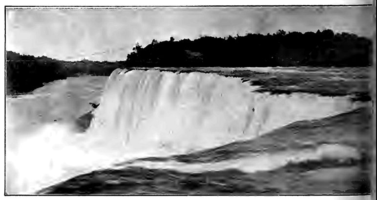
The fall of the Niagara[9] (PL IX) is one of the most remarkable known both because of its large volume of water and its great descent, between 160 and 170 feet. This fall is divided into two parts, separated by Goat Island, the Horseshoe fall (Fig. 115) on the west, and the American fall on the east. Between 1842 and 1905, the Horseshoe fall receded about five feet a year, while between 1827 and 1905, the American fall receded less than three riches a year.[10]
[p. 156]

[p. 157]
Rapids and falls sometimes occasion the development of potloles (Fig. 116), a peculiar rather than important feature of erosion. The holes are excavated in part by the falling and eddying of silttharged water, but chiefly by stones which the eddies move. Potholes which are not now in immediate association with rapids or alls often point to the former existence of rapids or falls.
Rock terraces. Where a hard layer outcrops in the side of a valley above its bottom, the side slopes of the valley become gentle ust above the hard layer, and steep, or even vertical, at and below its outcrop, as illustrated by Fig. 117. The hard layer then stands but as a rock terrace on either side of the valley. Such terraces ire not rare, and are popularly believed to be old “water-lines”; that is, to represent the height at which the water once stood. In one sense this interpretation is correct, since a river has stood at all levels between that of the surface in which its valley started, and its present channel; but the shelf of hard rock does not mean that the river was ever so large as to fill the valley from its present channel to the level of the terrace. Rock terraces may also result from changes of level.
[p. 158]
Narrows. If a stream crosses vertical or highly inclined strata of unequal hardness, its valley is usually constricted at the crossing of the hard layers. If such a constriction is notable it is called a narrows, or sometimes a water-gap (Fig. 118). The Appalachian Mountains afford numerous examples. The narrows develop because the processes which widen the valley are less effective on the hard layer than on the less resistant ones. Narrows sometimes arise in other ways also.
Narrows are much more conspicuous in certain stages of erosion than in others. While a valley is still so young as to be narrow at all points, there can be no pronounced “narrows”; but later, when the valley is otherwise wide, narrows are more pronounced. From what has preceded it is clear that rapids or falls are likely to occur at narrows, especially in the early part of their history.
[p. 159]
Other effects on topography. Inequalities in the hardness of rock develop certain peculiarities of topography outside of valleys. The less resistant portions of a land area more or less distant from streams are worn down more readily than those which are more resistant. If great areas of high land be capped with hard rock, they are likely to remain as plateaus after surrounding areas of less resistance are brought low. If the hard capping remains over a small area instead of a large one, the elevation is a butte, a hill, or a mountain, instead of a plateau (Fig. 119). Many buttes and small mesas are but remnants of former plateaus. A feature of buttes and mesas capped by hard rock is the steep slopes or cliffs corresponding to the edges of the hard beds (Figs. 101 and 119).
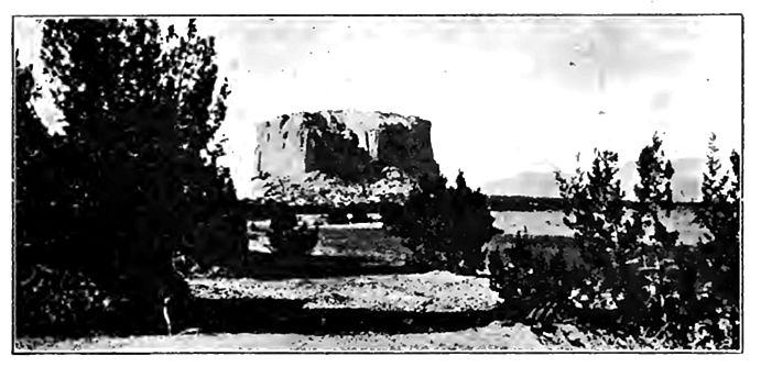
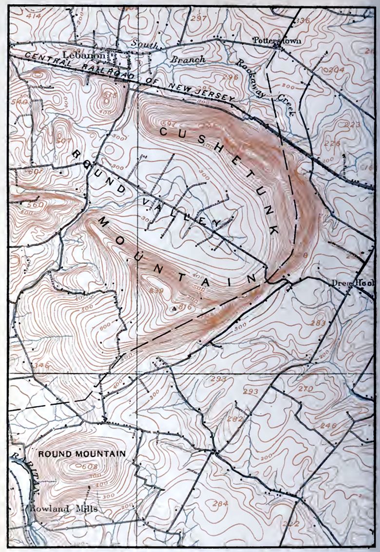
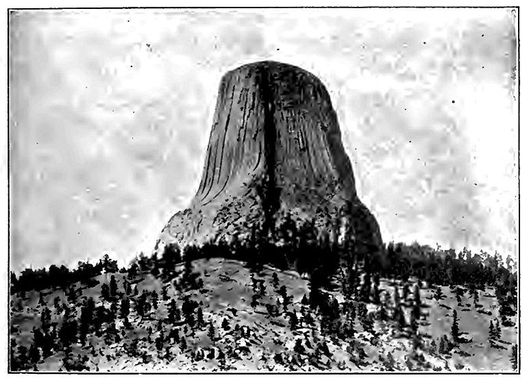
If the rock of a region is stratified and the layers tilted, the removal of the softer beds leaves the harder ones projecting above the general level in the form of ridges or “hog-backs” (Fig. 120). Dikes of igneous rock, harder than the beds which they intersect, likewise become ridges after the degradation of their surroundings. The plugs of old volcanic vents and other igneous intrusions of limited area often constitute conspicuous hills or mountains after [p. 160] erosion has removed their less resistant surroundings (Fig. 121). Round Valley, shown on PL X, is an example.
Ridges and hills resulting from the unequal degradation of unequally resistant strata are not equally prominent at all stages in an erosion cycle. In early youth the material surrounding the hard bodies of rock has not been removed; in early maturity considerable portions of their surroundings still remain about them; but in late maturity or early old age the outcropping masses of hard rock have been more perfectly isolated, and are most conspicuous. Most of the even-crested ridges of the Appalachian system, as well as many others which might be mentioned, became ridges in this way. In the final stages of an erosion cycle, the ridges of hard rock are themselves brought low. Isolated remnants of hard rock which remain distinctly above their surroundings in the late stages of an erosion cycle (Fig. 121) are known as monadnocks, the name being derived from Mount Monadnock, N. H., an elevation of this sort developed in a cycle antedating the present.
Adjustment of streams to rock structures. Valleys (gullies) are located at the outset without immediate regard to the hardness [p. 161] and softness of their beds. It is primarily the slope about the head of a gully which determines its line of growth, and, once established, streams tend to hold their courses. The streams on the weaker rock will deepen their valleys more rapidly than others, and those which flow across stronger and weaker rocks alternately, will deepen their valleys more rapidly than those which run on hard rock all the time.
The streams on the weaker rocks, therefore, have an advantage over the others. Being deeper, their tributaries may be lengthened until their heads reach the other valleys, with the results shown in Figs. 122-124. Even where several streams cross the same resistant bed, piracy is likely to take place among them, for some are sure to deepen their valleys faster than others, because of inequalities of volume, load, or hardness. This is illustrated by Figs. 125-127. An actual case is shown in Figs. 87 and 88. Though piracy may take place where streams do not flow over rock of unequal resistance, [p. 162] it is much more common where they do, for unequal resistance puts one stream at a disadvantage as compared with another.
Figs. 125-127. — Diagrams to illustrate piracy where the competing streams all cross a hard layer. The diagrams represent successive stages of development.
The changes in the courses of streams, by means of which they come to sustain definite and stable relations to the rock structure beneath, are known as processes of adjustment.[11] Since streams and valleys adjust themselves to other conditions as well, this [p. 163] phase of adjustment may be called structural adjustment. Structural adjustment is not uncommon among rivers flowing over strata which are vertical or highly inclined, since in these positions the hard and soft strata are most likely to come to the surface in frequent alternation.
The processes of adjustment go on until the streams flow as much as possible on the weaker beds, and as little as possible on the stronger, when adjustment is complete. This amounts to the same thing as saying that the outcrops of the hard layers tend to become divides. In many cases an area is so situated that there is no escape for its drainage except across resistant rock. In this case its drainage is completely adjusted when as few streams as possible cross the resistant rock, and these by the shortest routes.
Adjustment has been carried to a high degree of perfection in most parts of the Appalachian system. Here, as in all other mountains of similar structure, strata of unequal hardness were folded into ridges. The folds were then truncated by erosion, exposing the more and the less resistant beds (H and S,Fig. 128, respectively) in alternate belts along the flanks of the truncated folds (truncated at ab and cd). The streams, especially the lesser ones, now flow along the strike of the weaker beds much more commonly than elsewhere, and where they cross the hard layers it is usually at right angles to the strike. This is shown in Fig. 129, where the arrows indicate the direction of strike.
[p. 164]
As base-level is approached, the outcrops of hard rock are brought low. When they have been reduced to the level of their surroundings, the streams may flow without regard to the resistance of the rock beneath, for the downward cutting has ceased.
It sometimes happens that rocks of unequal resistance are covered by beds of uniform hardness. A consequent stream (p. 116) developed on the latter may find itself out of structural adjustment when it has cut its channel down to the level of the heterogeneous beds below. Such a stream is said to be superimposed (Fig. 130) on the underlying structure. Structural adjustment is likely to follow in time.
[p. 165]
Influence of joints. It has been pointed out that joint planes have somewhat the same influence upon erosion, that bedding planes have when beds are tilted at a high angle. Most rocks are affected by joints, and joints are often nearly vertical. Two sets are generally present, and sometimes more. When there are but two, they usually meet at a large angle (Fig. 2). These joints allow the ingress of water, roots, etc., which help to weather and disrupt rocks. Their effect on erosion may often be seen along a stream which flows in a rock gorge. In such situations, the outlines of the banks are sometimes angular, and sometimes crenate (Fig. 131), the re-entrants being located at the joints. By working into and widening joints, running water sometimes isolates masses of rock as islands (Fig. 132).
In a region free from mantle rock, or where the mantle rock is meagre, joints often determine the courses of valleys by directing the course of surface drainage. This is shown in many parts of the arid West. In regions where the rocks are notably faulted, the courses of the streams are in many cases controlled by the courses of the fault planes.
[p. 166]
The jointing of rocks often shows itself distinctly in the weathered faces of cliffs (Fig. 133), especially in arid and semi-arid regions, or where the slope is too steep for the accumulation of soil and rock-waste on its surface.
Joints in rocks may occasion the development of natural bridges.
[p. 167]
If above a waterfall, for example, there were an open joint in the bed of the stream (as at b,Fig. 134), some portion of the water would descend through it. After reaching a lower level it might find or make a passage through thej-ock to the river at the falls. If even a little water took such a course, the flow would enlarge the passageway through the joint to the valley at the falls (bcde,Fig. 134). This passageway might in time become large enough to accommodate all the water of the river. In this case, the entire fall would be transferred from the position which it previously occupied (f) to the position of the enlarged joint (b). The falls would then recede. The underground channel between the old falls and the new would then be bridged by rock (bf" and f",Fig. 135). The natural bridge near Lexington, Va., (Fig. 136), almost 200 feet above the stream which flows beneath it, is believed to have been developed in this way; but it is not to be understood that all natural bridges have had this history.
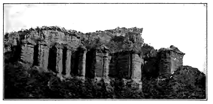
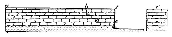
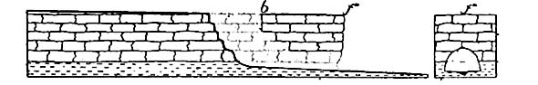
[p. 168]
Folds. The erosion of folded strata (anticlines and synclines) leads to the development of distinctive topographic features. So soon as a fold begins to be lifted, it is, by reason of its position, subject to more rapid erosion than its surroundings. For the same reason, the crest of the fold is likely to be degraded more rapidly than its lower slopes, and must suffer more degradation before it is brought to base-level. Folds are usually composed of beds of unequal resistance, and as the degradation of a fold proceeds, successive layers are worn from the top, and the alternating hard and soft layers composing it are exposed. When this is accomplished, adjustment of the streams is likely to begin, and the water-courses, and later the valley plains, come to be located on the outcrops of the less resistant layers, while the outcrops of the stronger beds become ridges.
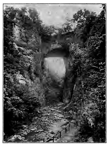
[p. 169]
If the axis of an eroded anticline were horizontal, a given hard layer, the arch of which has been cut off, would, after erosion, outcrop on both sides of the axis. When the topography had become mature, these outcrops would constitute parallel ridges, or parallel lines of hills; when the region had been base-leveled, the outcrops would be in parallel belts, though no longer ridges or hills. The lower the plane of truncation, the farther apart the outcrops would be in the anticline, and the nearer together in the syncline (compare outcrop of H, along ab and cd,Fig. 128).
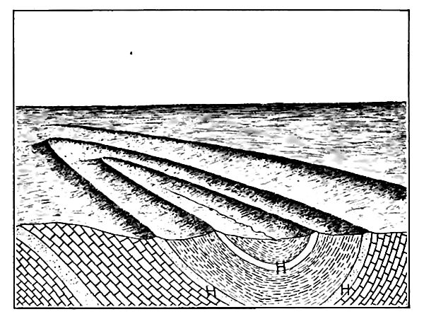
If, on the other hand, the axis of the anticline or syncline is not horizontal, that is, if it plunges (dips), the topographic result will be different. In this case the outcrops of a given layer on opposite sides of an anticline would converge in the direction of plunge, and come together at the end. At a stage of erosion antedating planation (say late maturity) there would be a ridge or a succession of hills, in the position corresponding to the outcrop of a hard layer, [p. 170] with a canoe-shaped valley within. If two hard layers were involved, instead of one, there would be two encircling ridges, with a curved valley between them, and a canoe-shaped valley within the innermost (Fig. 137). A succession of plunging anticlines and synclines might give rise to a very complex series of ridges and valleys. Illustrations of the above phenomena are found at various points in the Appalachian Mountains.[12]
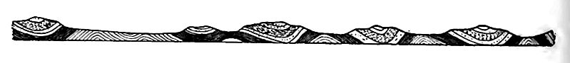
In the structural adjustment which goes with the erosion of folds, it often happens that the valleys come to be located on the anticlines, after they have been worn down, while the outcrops of the hard layers on the flanks of the anticlines, or even in the original synclines, become the mountains (Fig. 138).
¶ Effect of Changes of Level
Rise. If, after being base-leveled, or notably reduced by erosion, a region is uplifted so as to increase the gradients and velocities of its streams, they are said to be rejuvenated, and a new cycle of erosion is begun. The renewed youth differs from the first youth, in that the streams are already in existence in well defined channels. The rejuvenated streams erode their valleys after the manner of youthful streams. They excavate new valleys in the bottoms of older ones (Figs. 139 and 140), deepening them, or tending to, until they reach the new grade plane.
The new valley in the old one may be developing all along its course at the same time, or it may begin at the debouchure of a stream and work headward. In either case, the tributaries are rejuvenated when their main is lowered at the point of union.
Another evidence of rejuvenation is found in entrenched meanders. If an old winding stream is rejuvenated, the deepened channel follows the course of the stream before rejuvenation. The result is that a new winding gorge is cut; that is, the old meanders are entrenched. Entrenched meanders are rather common in the Appalachian Mountains (PL XI), and are known in other parts of the world.[13] Entrenched meanders and new valleys in the bottoms of old ones are among the commoner marks of rejuvenation. With rejuvenation of the drainage, a new cycle of erosion is begun, whether the preceding one was complete or not.
[p. 171]
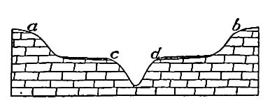
The recognition of different cycles of erosion, separated by uplifts, is often easy. The principles involved are illustrated by Fig. 141, which represents an ideal profile of considerable length (say 20 miles). The points a, a’, and a" have about the same elevation. Below them there are areas b, b’ , and b", which have a nearly common elevation, below which are the sharp valleys d, d’, and d" . The points a, a’, and a" represent the cross-sections of ridges formed by the outcrops of layers of hard rock. If the crests of the ridges are level, the points a, a’, and a" must represent remnants of an old base-level, since at no time after a ridge of hard rock becomes deeply notched does it acquire an even crest, until it is base-leveled.[14] After the cycle represented by the remnants a, a’, and a" was completed, the region suffered uplift. A new cycle represented by the plain b, b’, and b" was well advanced, though not completed, when the region was again elevated, and the rejuvenated streams began to cut their valleys d, d’, and d" in the plain of the previous incomplete cycle. The elevations, c and c’ (intermediate in elevation between a, a’, and a", and b, b’, and b"), may represent either remnants of the first base-level plain, lowered, but not obliterated, while the plain b, b’, b" was developing; or they may represent a cycle intermediate between that during which a, a’, a" and b, b’, b" were developed.
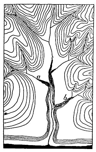
[p. 172]
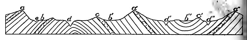
If the strata involved are horizontal, the determination of cycles is sometimes less easy. Thus in Fig. 142, it is not possible to say whether a and a’ represent remnants of an old base-lewl, or whether they represent the original surface from which degradation started. So, too, the various benches below a, such as b, b’ ', and b", may readily be the result of the superior hardness of beds at this level. For the determination of successive cycles in the field, it is necessary to consider areas of considerable size, and to eliminate the topographic effects of inequalities of hardness.
It is by the application of the preceding principles that it is known that the Appalachian Mountains, after being folded, were reduced to a peneplain (the Kittatinny peneplain) from the Hudson River to Alabama. The old peneplain surface is indicated by the level crests of the Appalachian ridges. The system was then warped (not folded) up, and in the cycle of erosion which followed, broad plains were developed at a new and lower level, corresponding in a general way to the plains b, b’, and b" of Fig. 141.
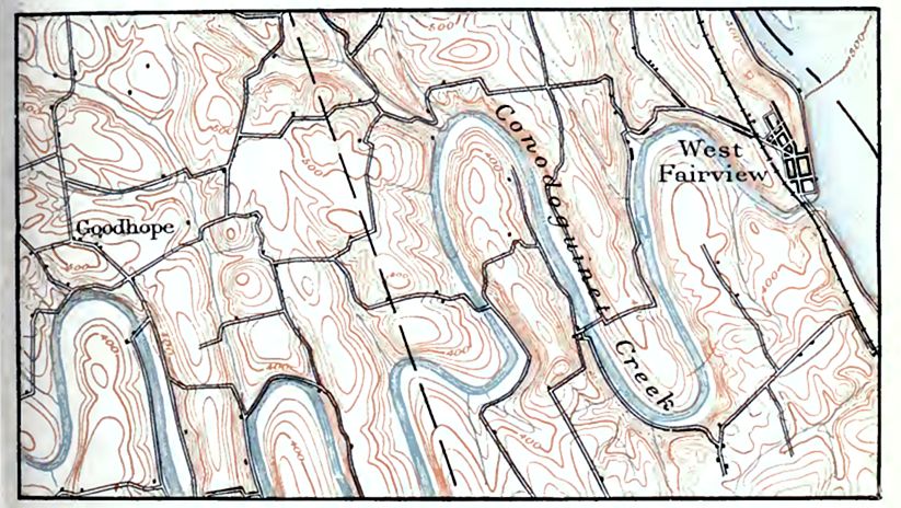
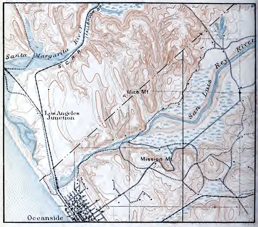
[p. 173]
The plains were located, for the most part, where the less resistant strata come to the surface. Above them rise evencrested ridges, the outcrops of the resistant layers, isolated by the degradation of the weaker beds between. It is the outcrops of these layers which constitute many of the present mountain ridges (the high points of Fig 141). The evenness of their crests testifies to the completeness of the first peneplanation. The evenness of the crests is, however, interrupted by (1) notches cut by the streams in later cycles, and (2) by occasional elevations (monadnocks) above the common level. The monadnocks are generally rather inconspicuous, but there is a notable group of them in North Carolina and Tennessee, of which Mount Mitchell and Roan Mountain are examples. When long distances are considered, the ridge crests depart somewhat from horizontality. This is believed to be due, in part at least, to deformation of the old peneplain during the uplift which inaugurated the second cycle of erosion.
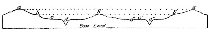
The extent to which the second cycle of erosion recorded in the present topography had proceeded before its interruption by upwarp, is indicated by the extent of the valley plains (Fig. 141) below the mountain ridges. While these plains were being developed on the weak rocks, narrow valleys only were cut in the resistant rocks which stood out as ridges. Deep narrows of this sort are often called water-gaps. Similar valleys, whether shallow or deep, from which drainage has been diverted, are sometimes called wind-gaps.
The second cycle of erosion, while still far from complete, was interrupted by uplift (relative or absolute), and a new cycle inaugurated. This event was so recent that the new (third) cycle has not yet advanced far.
Some of the features just described are illustrated by Fig. 118. The even mountain crest in the background is the Kittatinny [p. 174] Mountain of New Jersey and its continuation in Pennsylvania. In common with other corresponding crests, it is a remnant of the oldest recorded base-level (or peneplain) of the region. The great gap in the mountain is the Delaware Water-Gap. Below the mountain crest there is another plain, developed in a subsequent cycle of erosion, while the valley plain in the foreground represents the work of a still later cycle.
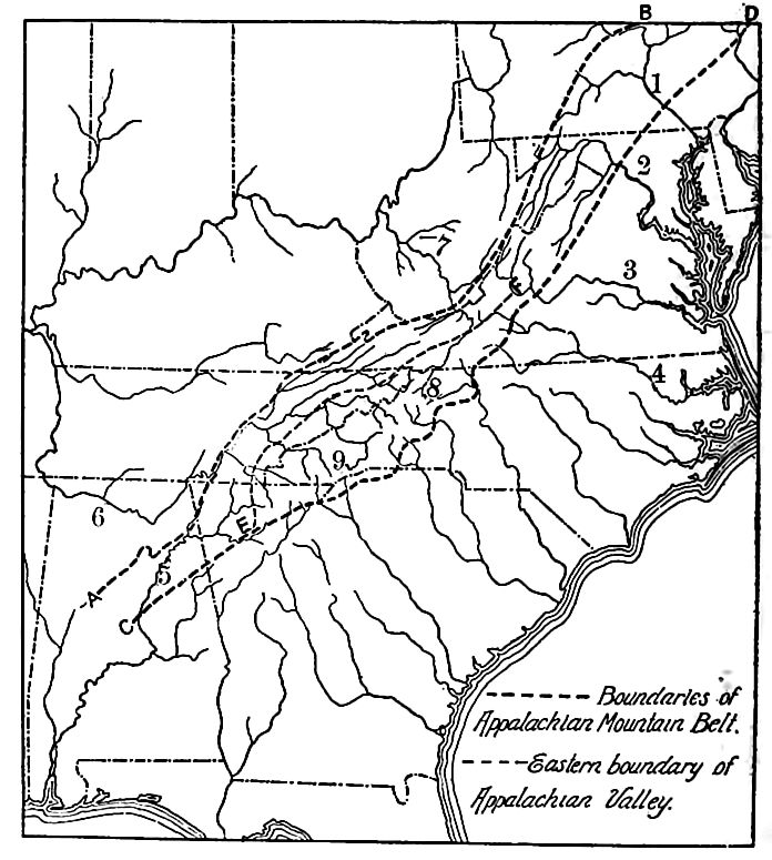
Many of the peculiarities of the drainage of the Appalachian [p. 175] Mountain system are intimately connected with the history just outlined. Thus three great rivers, the Delaware, the Susquehanna, and the Potomac, have their sources west of the Appalachians proper, cross the system in apparent disregard of the structure, and flow into the Atlantic. The James and Roanoke head far to the west, although not beyond the mountain system, and flow eastward, while the New River (leading to the Kanawha) farther south, heads east of the mountain-folds, and flows northwestward across the alternating hard and soft beds of the whole Appalachian system, to the Ohio (Fig. 143). The French Broad, a tributary to the Tennessee, has a similar course. Such streams are clearly not in structural adjustment, and afford good opportunities for piracy. Their courses were apparently assumed during the time of the Kittatinny base-level, when the streams had so low a gradient as not to be affected by the structure. Elevation rejuvenated them, and they have held their courses in succeeding cycles across beds of unequal resistance, though smaller streams have become somewhat thoroughly adjusted. Crustal deformations have also helped them to hold their courses, for the Cretaceous peneplain seems to have been tilted to the southeast at its northern end, and to the southwest at its southern, when the succeeding cycle began.
Streams which hold their early courses in spite of changes which have taken place since their courses were assumed are said to be antecedent. They antedate the crustal movements which, but for pre-existent streams, would have given origin to a different arrangement of river courses. As a result of crustal movements, therefore, a consequent stream may become antecedent. Master streams are more likely to hold their courses, and therefore to become antecedent, than subordinate ones.
The uplift of base-leveled beds, especially if the beds are tilted so as to bring layers of unequal resistance to the surface at frequent intervals, affords conditions favorable for extensive adjustment. The numerous wind-gaps in the mountain ridges, representing the abandoned courses of minor streams, and the less numerous watergaps, which indicate the resistance of large streams to structural adjustment, are instructive witnesses of the extent to which adjustment has gone. So extensive has been the adjustment among [p. 176] the streams of the Appalachian Mountains that there is probably no considerable stream in the whole system which has not gained or lost through its own or its neighbor’s piracy.
Sinking. The land on which a river system is developed may be depressed relative to sea-level. In this case the sea occupies the lower ends of valleys, converting them into bays and estuaries. A valley in this condition is said to be drowned. Of drowned valleys there are many examples along the Atlantic coast. Thus the St. Lawrence is drowned up to Montreal, and the Hudson up to Albany. If the drowned portion of the latter valley were not so narrow, it would be a bay. Delaware and Chesapeake bays, as well as many smaller ones, both north and south, are likewise the drowned ends of river valleys (Figs. 144 and 145).
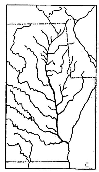
[p. 177]
Successive rising and sinking. Another peculiarity of valleys and streams resulting from changes of level is illustrated by PI. XII. The main valleys of this part of the coast were developed when the land stood higher than now. Later, the subsidence of the coast converted the lower ends of the valleys into bays or fiords. The bays were then transformed into lakes by deposition at their mouths. Subsequent rise of the land or depression of the sea allowed the drainage from the old lagoons to cut across the deposits which had converted the bays into lagoons. The result is an older, wider valley above, succeeded by a younger one near the debouchure.
Differential movement. Warping. A land surface on which a river system is established may suffer warping, some parts going up and others down. Above an upwarp which notably checks its flow, a stream is ponded. If a stream holds its course across a notable uplift athwart its valley, it becomes an antecedent stream. The Columbia River has been thought to hold its antecedent course across areas which have been uplifted (differentially) hundreds and even thousands of feet1. Some of the striking scenic features of this noble valley are the result of these changes in the country through which it flows. A lesser stream would have been diverted, as many of its tributaries have been. Even its course across the Cascade Range has been interpreted as antecedent.
¶ The Aggradational Work of Running Water
We have seen that rivers carry mud, sand, gravel, etc., from land to sea, and that their goal is the degradation of the land nearly to the level of the sea. We have also seen that rivers do not always carry the sediment derived from the land directly to the sea. It is often dropped for a time on the land, perhaps to be picked up and carried on again when the conditions for its transportation are more favorable. We have now to inquire more particularly into the causes and especially the results of deposition.
Causes of Deposition
When running water drops its load, or any part of it, it is generally because the current has lost something of its velocity. We 1 Russell. Rivers of North America, p. 279. [p. 178] have already seen that gradient and volume are the most important factors in determining the velocity of a small stream.
1. Loss of velocity. The commonest cause of loss of velocity is decrease of gradient. Running water may lose velocity (1) suddenly, as when it passes from a steep slope, whether of hill or mountain, to a gentle one, or to a body of standing water; or (2) slowly, as in descending a valley the gradient of which becomes gradually less. We therefore look to the places where these changes in velocity occur for the principal deposits of running water.
Streams also become slower wherever their channels become wider, even if volumes and gradients remain constant.
Decrease of volume is a less common cause of decrease of velocity. Streams generally increase in size with increasing distance from their sources, but to this general rule there are exceptions. (1) If a stream flows through a very dry region, it may receive few tributaries and few springs, while evaporation is great and the thirst y soil and rock through which it flows absorb some of the water. In a dry region, therefore, a stream may diminish as it flows, and may even disappear altogether (Pls. II and XIII). (2) A stream sometimes breaks up into several streams (Fig. 146). The volume of [p. 179] each is less than that of the original stream. (3) Still again, many streams, especially in arid regions, have much of their water withdrawn for purposes of irrigation. Many streams in the west are made smaller in this way. (4) Streams decrease in volume as their floods decline, and so deposit in their channels during low water, where they eroded during high water.
Location of Alluvial Deposits and their Topographic Forms
1. At the bases of steep slopes. Every shower washes fine sediment down the slopes of the hills, and much of it is left at their bases. Its lodgment is sometimes shown by the fact that fences in such situations are in places buried by the mud lodged against them. Temporary streams, bred of showers, sometimes flow down steep slopes, and are. suddenly checked at their bases. Such streams gather much debris from the steep slopes, but abandon it where their velocity is suddenly checked. Thus, at the lower end of the new-made gully on the hillside there is commonly a mass of debris which was washed out of the gully itself (Figs. 72 and 147). Material in such positions accumulates in the form of a partial cone, known as an alluvial cone. Alluvial cones have much in common with cones of talus; but in the latter, gravity brings the material down without the aid of water, or with but little help from it. Be tween talus cones and alluvial cones there are, however, all gradations.
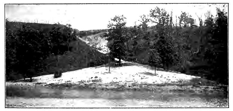
[p. 180]
Conspicuous alluvial cones are common at the bases of steep slopes in semi-arid regions; for in such regions the rainfall is fitful, and the occasional heavy showers, which give rise to temporary and powerful torrents, favor the development of cones of great size. At the bases of the mountain ranges in the Great Basin, the talus and alluvial cones from the mountains are sometimes 2,000 or 3,000 feet high.
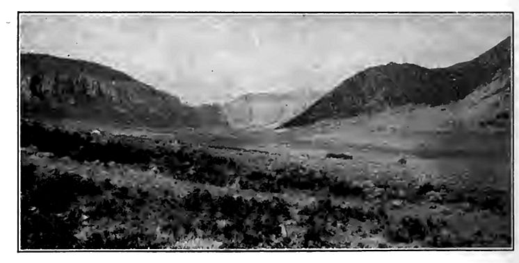
An alluvial fan is the same as an alluvial cone, except that it has a lower angle of slope. The term fan is indeed more appropriate than cone for most alluvial accumulations at the bases of slopes. The lower angle of the fan may be due to the less abrupt change of slope where it is developed, to the larger quantity of water concerned in its deposition, to the smaller amount of detritus, or to its greater fineness. Less change of slope, more water, and less and finer material, all favor the wider distribution of the sediment. and so the development of fans rather than cones. Nearly all young rivers descending from mountains build fans where they leave the mountains. Thus, the rivers descending from the Sierras to the great valley of California build great fans at the base of the [p. 181] range. Most of the rivers descending from the Rockies to the plains to the east have done the same thing. The fans of streams descending from the mountains are often many miles across. The fan of the Merced River in California, for example, has a radius of about 40 miles.
The fans made by neighboring streams may grow laterally until they merge. The union of several such fans makes a compound alluvial fan, or a piedmont alluvial plain (Pl. XIII). Such plains exist at the bases of most considerable mountain ranges, and sheet wash, as well as streams, contribute to them. The depth of alluvial material in such plains is often scores and sometimes hundreds of feet. One of the most remarkable features of these land deposits is their great spread. Thus east of the Rocky Mountains they extend out more than a hundred miles in some places. This wide spread appears to be the result of the long-continued action of running water. The alluvial cone or steep fan, as first built, is degraded later, and its materials spread more widely. As the gradient of the running water which makes the fan becomes lower, the higher parts of the fan are spread out farther and farther, with continually lower gradient, as suggested by Fig. 149.
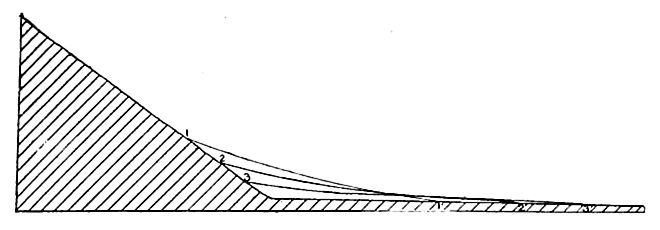
Deposits of this sort have probably been far more important in the past than has been generally recognized. Much of the material of the Coastal Plain of the Atlantic and Gulf slopes of the United [p. 182] States appears to have been deposited in this way. A large part of the Great Plains is covered with wash from the Rocky Mountains, and similar deposits are of great extent and depth east of the Andes and south of the Himalayas. They are, indeed, of significant extent and depth about almost every mountain range which has been carefully studied, especially where plains are adjacent to the mountains. It seems clear that similar deposits must have been made at all stages in the past history of the earth, whenever and wherever mountainous lands bordered plains.
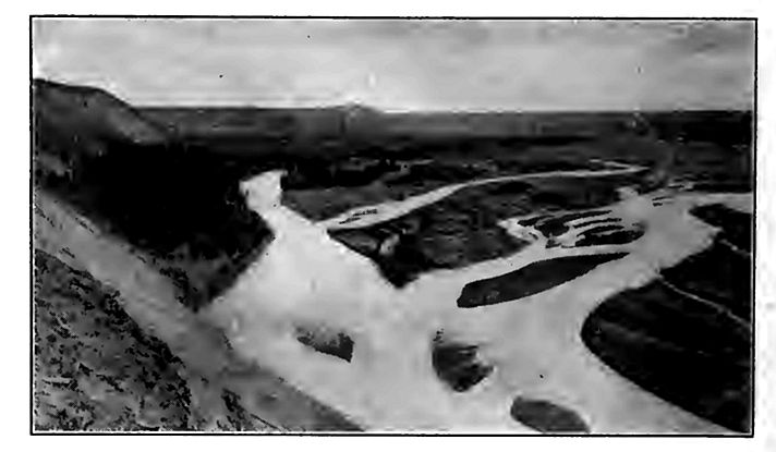
Formations of this general sort, made at the bases of high lands, have now been recognized among the ancient formations of the earth, as well as among the recent ones, and some of the ancient beds of sediment deposited in this way, attained thicknesses of hundreds and even thousands of feet. They probably attained their greatest thickness, as now, in basins.
2. In valley bottoms. A stream which makes deposits in its channel reduces the size of the channel. In time it may become too small to hold all the water. A part then breaks out, and follows a new course over the valley flat. This process may be repeated again and again (Fig. 150). Streams sometimes deposit bars in their channels, especially in low water. The bars maybe swept away in time of flood, but they sometimes become more or less permanent islands.
[p. 183]
The profiles of most valleys are curves, the curvature becoming less as the lower end of the stream is approached (Fig. 151). It therefore happens that as a stream descends its valley it generally reaches a point where its reduced gradient so diminishes its velocity that it must abandon some of its load. In this way sediment is distributed for long distances along valley bottoms. It is left in the channels of streams in low water, and spread over their flood plains in high water, aggrading them and making them alluvial plains. Deposition in a valley which has no flat tends to develop one (Fig. 152). Alluvial deposits on valley flats are usually but a few feet, or at most a few scores of feet thick; but in some cases they reach hundreds of feet.
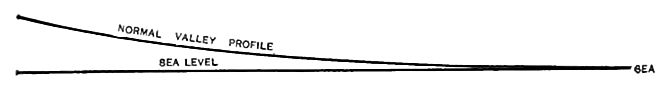
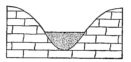
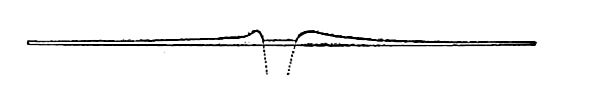
Natural levees (Fig. 153) are developed in flood plains aggraded by occasional floods. At such times the current in the main channel is swift; but as the water escapes its channel and spreads over [p. 184] the adjacent flat, its velocity is checked promptly, because its depth suddenly becomes less. It must therefore abandon much of its load then and there. Repeated deposition in this position, in excess of that over other parts of the flood plain, gives rise to the levees.
Scour-and-fill. Aggrading streams deepen their channels periodically to a notable extent, and the deepening of the channel takes place at the very time when the flood-plain is being aggraded. In other words, the stream in flood aggrades its plain, and degrades its channel. This follows from the fact that the current is slowin the former position, where the water is shallow, and rapid in the latter, where it is deep. After the flood subsides, the channel, deepened while the current was torrential, is filled up again by sediment from the feebler current. This alternate deepening and filling is known as scour-and-fill. It is well illustrated by the Missouri River. At Nebraska City, scour reaches depths of 70 to 90 feet occasionally.[15] At Blair, about 25 miles above Omaha, the same river is believed to cut to bed-rock (about 40 feet below the bottom of the channel in low water) during floods.[16] All streams similarly situated do a like work. The material thus eroded is shifted down stream, some of it for short distances only, and some of it to the sea. Even an aggrading stream therefore is not without erosive activity; it is a stream whose fill exceeds its scour, not one which has ceased to erode.
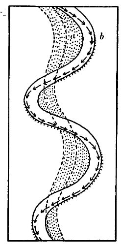
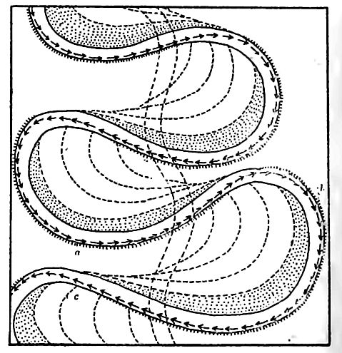
[p. 185]
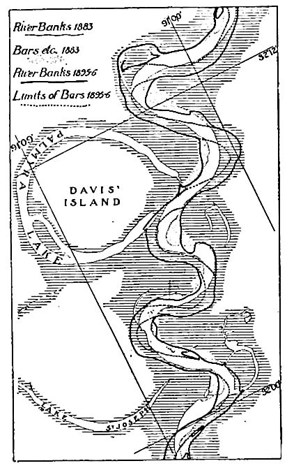
Materials of the flood-plain. As a result of its varying velocities in flood and low water, a stream may deposit coarse material at one time and fine at another. Flood-plain deposits are often, therefore, very heterogeneous, ranging from the finest mud, through sand, to gravel, and even bowlders. In general they become finer down-stream. In a given plain, they are usually coarser at the bottom, and finer toward the top.
[p. 186]
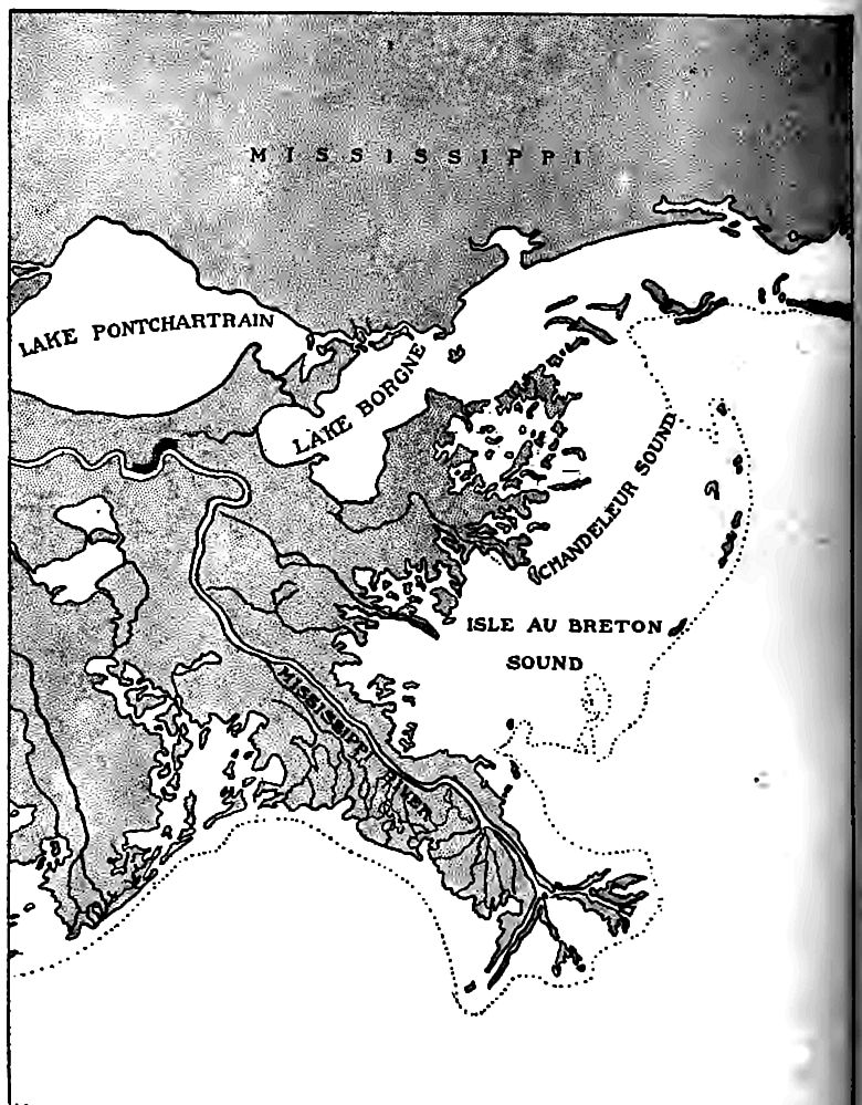
[p. 187]
Flood-plain meanders. A stream with an alluvial plain is likely to meander widely (Pis. XIV and VIII). In general terms this may be said to be the result of low velocity, which allows the stream to be turned aside easily. Were the course of such a stream made straight, it would soon become crooked again. The manner of change is illustrated by Figs. 154 and 155. If the banks are less resistant at some points than at others, as is always the case, the stream mil cut in at those points. If the configuration of the channel is such as to direct a current against a given point, b (Fig. 154), the result is the same, even without inequality of material. Once a curve in the bank is started, it is increased by the current which is directed into it. Furthermore, as the current issues from the curve, it impinges against the opposite bank and develops a curve at that point. The water issuing from this curve develops another, and so on.
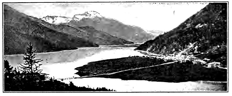
Once started, the curves or meanders tend to become more and more pronounced (Fig. 155). In the case represented by Fig. 1, PL VIII, the narrow neck of land between curves is almost [p. 188] cut through. A later stage in the process is shown in Fig. 2, PL VIII.
When the stream has cut off a meander, the abandoned part of the channel often remains unfilled with sediment. If it contains standing water, as it often does, it becomes the site of a lake (Fig. 156). Such lakes sometimes have the form of an ox-bow, and so are called ox-bow lakes (Pls. XIV and VIII).
3. At debouchures. Where a swift stream flows into the sea or a lake, its current is promptly checked and soon destroyed altogether. Its load is accordingly dropped. If not washed away by waves, etc., the deposits of river-borne sediment in such pla make deltas (Figs. 146 and 157 to 159).
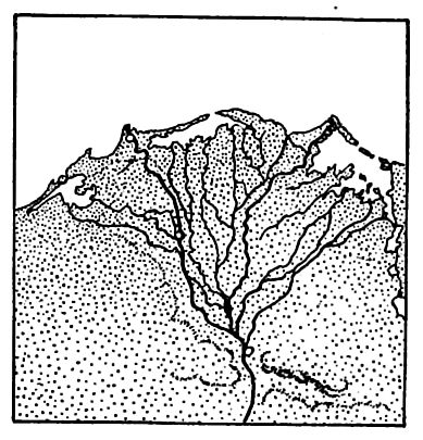
The delta has some points in common with the alluvial fan. In both cases the principal deposit is concentrated at the point where the velocity is suddenly checked. In the case of the delta, however, the current is checked more completely, and the debris accumulates (at the outset) below the surface of the standing water. In form, the delta differs from the alluvial fan in that its edge has a steep slope (compare Figs. 160 and 161).
Once a delta is started below water, deposition takes place upon its surface, which may be built up to, and even above, the water [p. 189] level. That part of the delta above the surface of the water in which it is built, is like a flat alluvial fan.
Much land has been made by delta-building. Thus the Colorado River has built a great delta many square miles (above water) in area at the head of the Gulf of California (Fig. 162). The delta has been built quite across the gulf near its upper end, shutting off the head. In the arid climate of the region, this shut-off head has become a nearly dry basin, the lowest part of which is about 300 feet below sea-level. The Skagit River, in Washington, has built out its delta so as to surround what were high islands in Puget Sound, thus joining them to the mainland. The deltas of the Mississippi (Fig. 157), the Nile and the Hoang-Ho Rivers are among the large and well-known deltas. The united delta of the Ganges and Brahmaputra is also a great one, having an area (above water) of some 50,000 square miles. The Po has built a delta 14 miles beyond the former port of Adria, which gave its name to the Adriatic Sea. The Rhone River (France) has advanced its delta some 15 miles in as many centuries.
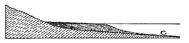
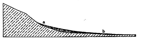
The effect of delta-building is to increase the area of the land; but it is to be noted that the processes which lead to delta-building reduce the volume of the land-masses, even though they increase their area.
[p. 190]
The outline of some deltas is determined by the surroundings in which they are built. When, for example, a delta is built into a bay, the form of the bay-head determines the shape of the delta.
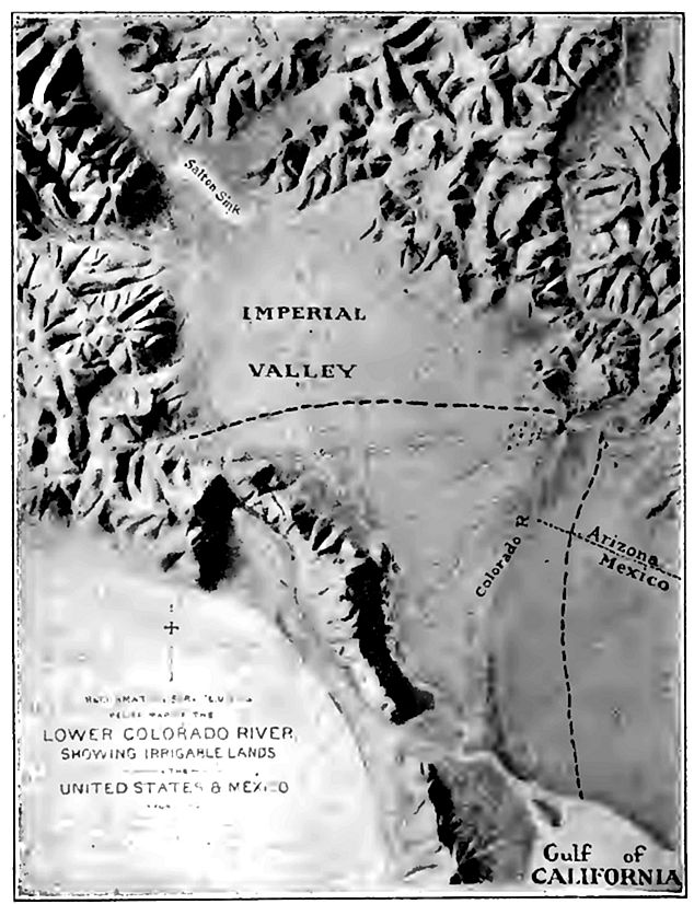
The normal form of a delta built on an open coast is somewhat semicircular, though there is often a fringe of delta fingers which together have some resemblance to the Greek letter Δ, which gave these terminal deposits of streams their names.
[p. 191]
¶ Stream Terraces
Stream terraces[17] are bench-like flats or narrow plains along the sides of valleys (Fig. 163-4) and above their bottoms. They are usually narrow, but sometimes have great length in the direction of the axis of the valley.
The commoner river terraces are remnants of former floodplains, below which the streams which made them have cut their channels. They originate in various ways. (1) Some are due to inequalities of hardness (Fig. 117). (2) If an alluvial flood plain has been built as the result of an excessive supply of sediment (p. 183), the exhaustion or withdrawal of the excessive supply would leave the stream again relatively clear, and free to erode where it had been depositing. It would forthwith set to work to carry away the material which it had temporarily unloaded on the plain. The plains built up in many valleys in the northern part of our continent during the glacial period, when the drainage from the ice coursed through them, have subsequently been partially destroyed by erosion, and their remnants have become terraces. (3) A notable increase in the volume of a stream, without corresponding increase in load, as when one stream captures another, may occasion the development of terraces by allowing the enlarged stream to deepen its channel. (4) The uplift of a region in which there are well developed river flats, would rejuvenate the streams, and parts of their old flood-plains would be left as terraces. Other occasional causes which need not be mentioned here, may give rise to terraces.
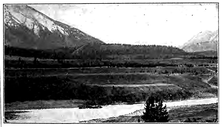
[p. 192]
Apart from the terraces due to the more or less occasional causes mentioned above, terraces are developed in the normal course of every stream’s history. The causes are as follows:
(1) The head of the valley-plain where the first notable deposition takes place, normally advances up-stream. After the advance has been considerable, the descending stream may, on reaching the head of its valley-plain, lose so much of its load as to be able to sink its channel into the flood-plain farther down the valley.
(2) Again, so long as a stream is actively eroding at its head. there is likely to be some aggradation below. At a later stage in the stream’s history, when erosion at the head has become less because of the reduction of the surface, less material will be carried from the upper part of the valley, and the stream on the floodplain below, formerly loaded with material from up the valley, is now free to take up and carry away material temporarily left on the flood-plain. The result is a deepening of the channel.
(3) A stream does not drop all its load at the head of its plain, but only its excess; but it will always drop coarse sediment to take fine, if fine is available. For a relatively small amount of coarse material dropped, a relatively large amount of fine may be taken up, both because fine sediment takes less of a stream’s energy, pound for pound, than coarse does, and because more of a stream’s energy may be utilized in carrying fine material. Other things being equal, it follows that when a stream drops material to take fine, its channel is degraded unless there is at the same time a great reduction in the stream’s energy. Such reduction [p. 193] is likely to go with the decreasing declivity down-stream; but this is partly, or sometimes wholly, counterbalanced by the increasing volume of water. By the exchange of load, therefore, a stream may ultimately sink its channel below the flood-plain which the earlier and perhaps smaller stream had developed.
(4) Any stream which has reached the flood-plain stage is likely to meander. After the flood-plain has become wide, the width of the belt within which the stream meanders is less than the width of its plain. In the Lower Mississippi, for example, the meander belt is often no more than a third to a tenth of the width of the flood-plain. The meanders migrate down the valley. In so doing they depress the meander belt, the tendency being to reduce it to the level of the channel, and, therefore, below the level of the flood-plain. As the meander belt widens, the depression which it develops becomes more and more capacious. Presently it may attain such dimensions as to hold the water of ordinary floods. At this stage, or even before, such parts of the earlier flood-plain as remain are terraces.
Terraces developed by the normal activities of a stream are always low, and it is improbable that they would ordinarily be conspicuous.
In conclusion, it may be stated that many river terraces, mostly very low, are normal features of valley development, coming into existence at definite stages in a valley’s history. They are generally composed, in large part, of river alluvium. Others result from more or less accidental causes, working singly or in conjunction, and to this class belong all of the more conspicuous terraces developed from flood-plains.
Discontinuity of terraces. Where a stream’s deepened channel is in the middle of its flood-plain, there is, temporarily, a terrace on either side; but wherever the deepened channel is at one margin of its flood-plain, a terrace remains on the other side only. Even where continuous at the outset, terraces soon become discontinuous, for all processes of sub aerial erosion conspire to destroy them. A stream is likely to meander on its second and later flood-plains, as on its first and highest one. Wherever the meanders on its second flood-plain undercut the first terrace, the terrace at that [p. 194] point may be destroyed, and since the meanders are continually migrating, terraces are continually disappearing. The same would be true of the second terrace, if a second is developed. Again, tributary streams cut through the terraces of their mains. New gullies develop on the faces of the terraces, and their heads work back across them, dissecting them still further. At the same time, sheet erosion and other phases of slope wash tend to drive the scarps of the terraces back toward the bluff beyond. By the time a second series of terraces is well developed, no more than meagre remnants of the first may remain.
From the foregoing considerations it is clear that the present extent of river terraces once developed, is dependent in part on the length of time which has elapsed since the river sank its channel below them. Other things being equal, the greater their age the more meagre their remnants.
Alluvial terraces, like rock shelves, are popularly thought to mark “old levels of the river.” In one sense this is true, but not in the sense in which the expression is commonly used. Every level, from the crest of the bounding bluffs to the bottom of a valley, is a level at which water ran for a longer or shorter time; but the terrace does not mean that the river was once so much larger than now as to fill the valley from its present channel to the level of the terraces.
Laboratory work. The study of topographic and geologic maps, and of photographs, slides, etc., illustrating river work should be taken up in connection with this chapter. Numerous sheets of the topographic maps and several of the folios published by the United States Geological Survey afford available illustrations of river work. Plates XXIII I, XXXIX of Professional Paper 60 of the United States Geological Survey also afford good illustrations. This work should not be left until the chapter has been completed, but may well be sub-divided. Illustrations of stream erosion under varying conditions and at various stages of development; the topographic effect of unequal hardness; structural adjustment and piracy; effects of cha of level; cycles of erosion; alluviation, etc., may best be taken up in connection with the discussion of these severai topics.
Great rivers, like the Mississippi, cut their channels somewhat below sea-level, for miles above their debouchures. ↩︎
Davis. Jour, of Geol., Vol. X, p. 87. ↩︎
Some recent unpublished data seems to indicate that this rate is, perhaps, too high. ↩︎
Babb. Science, Vol. XXI, p. 343. 1893. ↩︎
Scot. Geol. Mag., Vol. Ill, p. 76. 1887. ↩︎
An excellent discussion of this subject is given by Gilbert in The Henry Mountains, pp. 99 et seq., and more briefly in the Am. Jour. Sci., Vol. XII. p. 85, et seq., 1876. ↩︎
Dutton. Tertiary History of the Grand Canyon District, Mono. II, U. S. Geol. Surv. ↩︎
The terms rapids, falls, and cataracts are rather loosely used. Many moderate rapids are incorrectly called falls. The “Falls of the Ohio” is an example. The term cataract is often applied to very steep rapids or falls. ↩︎
For a brief account of this fall see Gilbert in Physiography of the United States. ↩︎
Gilbert. Bull. 306, U. S. Geol. Surv. ↩︎
See Campbell, Jour. Geol., Vol. IV, pp. 567, 657. ↩︎
See Willis, The Northern Appalachians, in Physiography of the United States. ↩︎
Davis. The Seine, the Meuse and the Moselle. Nat. Geog. Mag., Vol. vll, pp. 181-202, and 228-238; an article which throws much Jight on the behavior of rivers. ↩︎
Other views have been entertained. See Tarr, Am. Geol., Vol. XXI. pp. 351-370, and Daly, Jour, of Geol., Vol. XIII, pp. 105-125. ↩︎
Cooley. Rept. U. S. Engineers for 1879-80, Pt. II, pp. 1060 and 1071. ↩︎
Gerber. Cited by Todd. Bull. 158, U. S. Geol. Surv., pp. 150, 151. ↩︎
For discussions of terraces see Gilbert’s Henry Mountains, p. 126; Davis River Terraces in New England, Bull, of the Mus. of Comp. Zool. Geol. Series Vol IV, pp. 282-346; and Dodge, Proc. Boston Soc. of Nat. [Hist., Vol. XXVI, pp. 257-273. ↩︎